

Curated Itinerary
Rome Stratified: A Walk Through Two Thousand Years on the Same Square Mile
A 3 km walk from Palazzo Chigi to the Imperial Forums, threading Renaissance, Baroque, Risorgimento and Imperial Rome into one afternoon. Seven stops, mostly flat, best in spring or autumn.
Take this route into Google Maps
From Palazzo Chigi – Virtual Tour 360° to Imperial Forums – Virtual Tour 360°, in the order we curated them.
➤ Turn on the navigator in Google MapsIt opens in the Google Maps app with every stop already loaded, in the order we put them in. From there the route is yours: pick how you travel — on foot, by bike, by public transport or by car — change where you start and where you end, drag the stops into a different order, and add places of your own along the way.
Most visitors arrive in Rome wanting the Forum and leave without a thread that ties two thousand years of the same square mile into one walk. This route does that. It begins at the working seat of Italian government, drops south through a Renaissance palazzo Peruzzi curved against an ancient theatre wall, then turns east to where the Imperial city declared itself in marble and the unified Kingdom answered, fifteen centuries later, in white Brescian stone.
The walk is short — under three kilometres on the map, closer to four once you account for cobbles, level changes, and the inevitable detour around a film crew on Via dei Fori Imperiali. What it lacks in distance it earns in stratigraphy. Within ten minutes of leaving Palazzo Chigi you are looking at a 16th-century façade built on the curve of Domitian’s odeon. Forty minutes later you are climbing the staircase Michelangelo redesigned for a 1348 plague-vow basilica that sits on the foundations of Juno’s temple. Each stop is a layer the next one rests on.
The order matters. Going north-to-south lets the city open up: tight Baroque alleys around the Biscione, then the deliberate widening into Piazza Venezia, then the Imperial Forums unrolling east of Trajan’s Column like an opened ledger. Reverse it and the sequence reads as anticlimax — the Forum is a closer at this scale, not an opener.
Read the place cards before you go: each stop has its own essay with the architect, the dates, and the one detail worth pausing for. Use the GPX file in OsmAnd or Organic Maps if you prefer to walk it offline. The route is flat apart from the Aracoeli staircase (122 steps, no handrail on the right side). Best walked late morning in spring or autumn — Roman summer afternoons make the white travertine of the Vittoriano unreadable in the glare.
Useful to plan your visit
- Start: Palazzo Chigi (Piazza Colonna). Nearest metro: Barberini (Line A), 8 minutes on foot.
- End: Imperial Forums (Via dei Fori Imperiali). Nearest metro: Colosseo (Line B), 4 minutes on foot.
- Wear shoes with grip — sampietrini are slick when damp.
- The Vittoriano terraces are free; the panoramic lift is ticketed (separate entrance, right flank).
Get this route — explore at your own pace
The walk and the notes are open to everyone, right here. To take the route with you — the GPX and KML tracks for your phone — you need a CHO account, and a free one is enough. We do not sell these routes: we build them ourselves and give them to the people who read us.
Create a free accountAlready have one? Log in.
This route was built with the tools we give operators.
Guides, associations and cultural operators build their own routes here: pick the stops from the archive, add your notes, and the map, the GPX and the printable version come out on their own. Your programme gets a permanent page, your events go on the city pages people read while planning — and if you sell your route as a road-book or a virtual tour, you receive 80% of the price net of tax.
See how an operator account worksStep by step
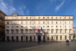
Palazzo Chigi – Virtual Tour 360°
Seat of the Italian Prime Minister; 16th-century façade by Maderno
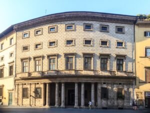
Palazzo Massimo alle Colonne – Virtual Tour 360°
Peruzzi's 1532 palazzo curved on the foundations of Domitian's odeon
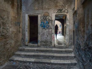
Passetto del Biscione – Virtual Tour 360°
A 17th-century covered alley with a faded Madonna frescoed mid-arch
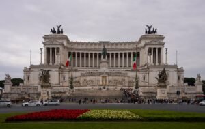
Vittoriano (Altar of the Fatherland) – Virtual Tour 360°
Sacconi's white travertine altar to unified Italy; terraces are free
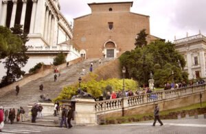
Basilica of Santa Maria in Ara Coeli – Virtual Tour 360°
Michelangelo redesigned the 122-step staircase; 1348 plague vow inside
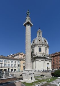
Trajan’s Column – Virtual Tour 360°
Apollodorus carved the Dacian Wars in 155 spiralled metres of relief
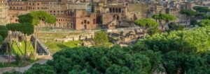
Imperial Forums – Virtual Tour 360°
Five imperial fora unrolled east; best viewed from the Via dei Fori parapet
Download for tour navigation
🔒 The walk and the notes are open to everyone on this page. The files to take with you — the stop list as a PDF, and the GPX and KML tracks for your phone — come with a CHO account, and the free one includes them.
Walk it with the navigator on
It opens in the Google Maps app with every stop already loaded, in the order we put them in. From there the route is yours: pick how you travel — on foot, by bike, by public transport or by car — change where you start and where you end, drag the stops into a different order, and add places of your own along the way.