Lithuania has five UNESCO World Heritage Sites, a compact but remarkably varied list that moves from medieval hill forts to modernist apartment blocks, from a shifting coastal dune to the invisible arc of nineteenth-century science stretched across a continent. These sites trace a small Baltic nation’s long entanglement with larger powers, its brief but formative independence, and the landscapes that have shaped it for millennia. From Cultural Heritage Online.
Why Lithuania’s list looks the way it does
Five inscriptions across three decades reflects both the rigour of the nomination process and Lithuania’s deliberate, selective approach to it. Every site on the list is cultural — Lithuania has no inscribed natural sites — yet the category covers an exceptionally wide range of significance: urban morphology, archaeological landscape, coastal ecology used as cultural criterion, geodetic science, and architectural urbanism all appear within the five.
The pattern also reflects Lithuania’s history of interruption. Centuries of shifting sovereignty, followed by Soviet occupation, meant that many historic environments were either neglected or frozen in place rather than redeveloped. That circumstance, painful in origin, preserved qualities that now underpin multiple nominations.
The first inscriptions
Lithuania joined the World Heritage Convention after the restoration of independence, and its first nomination was also its most prominent. The year 1994 brought the country’s inaugural inscription:
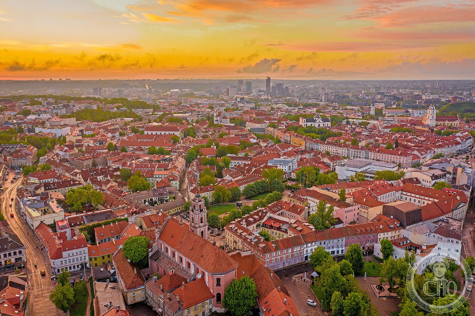
- Vilnius Historic Centre (1994) — the old city’s medieval street pattern, Gothic churches, Baroque campaniles, and layered civic architecture formed the opening entry and remains the most internationally recognised site on the list.
Six years later, a second site arrived with a very different character. The Curonian Spit, inscribed in 2000 jointly with Russia, shifted attention from the urban interior to the coast — and from built fabric to the dynamic relationship between human settlement and an extreme natural environment.
The most visited — and the alternatives
Vilnius draws the largest share of heritage visitors, and reasonably so: the historic centre contains the largest surviving medieval old town in northern Europe, and the visual density of the Baroque period alone rewards multiple days. The Curonian Spit, a 98-kilometre strip of sand dunes separating the Curonian Lagoon from the Baltic Sea, attracts considerable summer tourism for its scenery and as one of Europe’s significant bird-migration corridors.
The remaining three sites offer a quieter encounter with Lithuanian heritage. Kernavė, inscribed in 2004, preserves five earthen hill forts rising from the Neris River valley — the remnants of a medieval town destroyed by the Teutonic Order in the late fourteenth century and never rebuilt, leaving the topography intact for archaeology to read. The Struve Geodetic Arc, added in 2005 as a transnational serial inscription shared across ten countries, includes three measurement stations in Lithuania established by the astronomer Friedrich Georg Wilhelm von Struve as part of his 2,820-kilometre triangulation chain; the stations are modest in appearance but their scientific significance in determining the shape of the Earth is considerable. Most recently, Modernist Kaunas, inscribed in 2023, documents the interwar architecture built during Lithuania’s first period of independence between 1919 and 1939 — a coherent body of work that makes Kaunas one of the more concentrated examples of interwar modernism in Europe.
Natural and shared sites
Lithuania’s list contains no purely natural inscriptions, but two sites involve natural or transnational dimensions. The Curonian Spit was inscribed partly under cultural criteria for the fishing villages and cultural landscape sustained on an inherently unstable landform — generations of inhabitants have replanted and managed the dunes to prevent them from advancing over settlements. The spit is shared with Russia, making it one of the relatively rare World Heritage properties that straddles a state boundary.
The Struve Geodetic Arc is the other shared inscription, involving Belarus, Estonia, Finland, Latvia, Moldova, Norway, Russia, Sweden, and Ukraine alongside Lithuania. It is a site without conventional monuments: the “stations” are often a single chiselled mark on a rock face or a buried iron sphere. What it inscribes is an idea — the collaborative scientific effort to measure the meridian — rather than a building or a landscape, which makes it unusual within the World Heritage framework and largely unvisited by general tourism.
How to find them
Lithuania’s five sites are spread across the country’s geography: Vilnius in the southeast, Kaunas in the centre, Kernavė between them along the Neris valley, and the Curonian Spit on the western coast accessible via the port city of Klaipėda. The Struve stations in Lithuania are located at Blinstrubiškiai, Paliepiukai, and Medeikiai — rural points that require deliberate navigation but are reachable by road.
Lithuania’s World Heritage sites sit alongside thousands of other places on CHO’s interactive map, with GPS and sourced editorial history for each. See also our guides to Italy’s and France’s UNESCO sites, and our piece on cultural travel beyond mass tourism.
Frequently Asked Questions
How many UNESCO World Heritage Sites does Lithuania have?
Lithuania has five UNESCO World Heritage Sites as of 2023. All five are inscribed under cultural criteria; the country has no natural or mixed-category inscriptions. The most recent addition, Modernist Kaunas, was inscribed in 2023.
What was Lithuania’s first UNESCO World Heritage Site?
The Vilnius Historic Centre was Lithuania’s first inscription, added to the World Heritage List in 1994 shortly after the country restored its independence. It remains the largest surviving medieval old town in northern Europe and the most visited of Lithuania’s five sites.
Is the Curonian Spit shared between countries?
Yes. The Curonian Spit is a transnational World Heritage Site shared between Lithuania and Russia, inscribed in 2000. The 98-kilometre dune spit stretches along both countries’ coastlines, and the inscription recognises the cultural landscape maintained by fishing communities alongside the fragile natural environment.
What is the Struve Geodetic Arc and why is it a World Heritage Site?
The Struve Geodetic Arc is a chain of survey triangulations stretching 2,820 kilometres across ten countries, established in the nineteenth century to measure the exact size and shape of the Earth. It was inscribed in 2005 as a transnational serial site covering Norway to the Black Sea, with three measurement stations located in Lithuania. Its significance lies in the scientific achievement rather than in any monument or landscape.
Sources used in this article
- UNESCO — State Party Lithuania — World Heritage list.
- UNESCO — Lithuania: World Heritage Sites.
- CHO magazine — What is a World Heritage Site?
- CHO — Interactive map of heritage sites.