
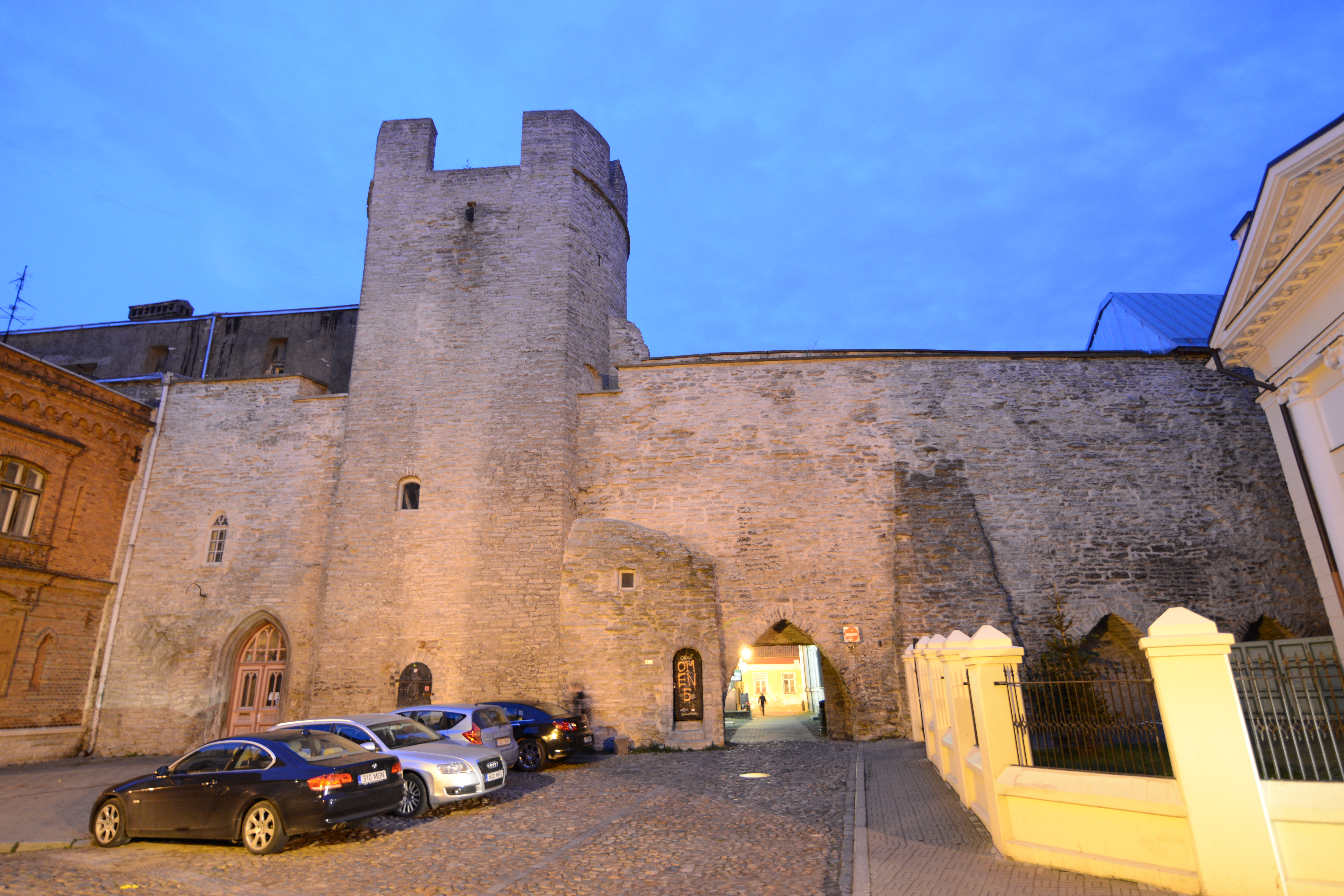
Estonia holds two UNESCO World Heritage Sites: the medieval city of Tallinn, one of the best-preserved Gothic urban cores in northern Europe, and the Struve Geodetic Arc, a transnational chain of 19th-century survey points that gave science its first precise measurement of the Earth. From Cultural Heritage Online.
Historic Centre (Old Town) of Tallinn Within the city — on foot
Tallinn’s Old Town divides into two distinct urban zones that have coexisted since the 13th century. Toompea — the limestone hill — was the seat of episcopal and later secular power. The Dome Church (Toomkirik) stands there today as the oldest church in Estonia, its white-plastered nave dating to the 13th century. Toompea Castle, now home to the Estonian parliament (Riigikogu), occupies ground fortified by Danish, Swedish, and Russian overlords in succession; three of its original towers survive, including the round Tall Hermann (Pikk Hermann), from whose summit the Estonian flag has flown since 1989.
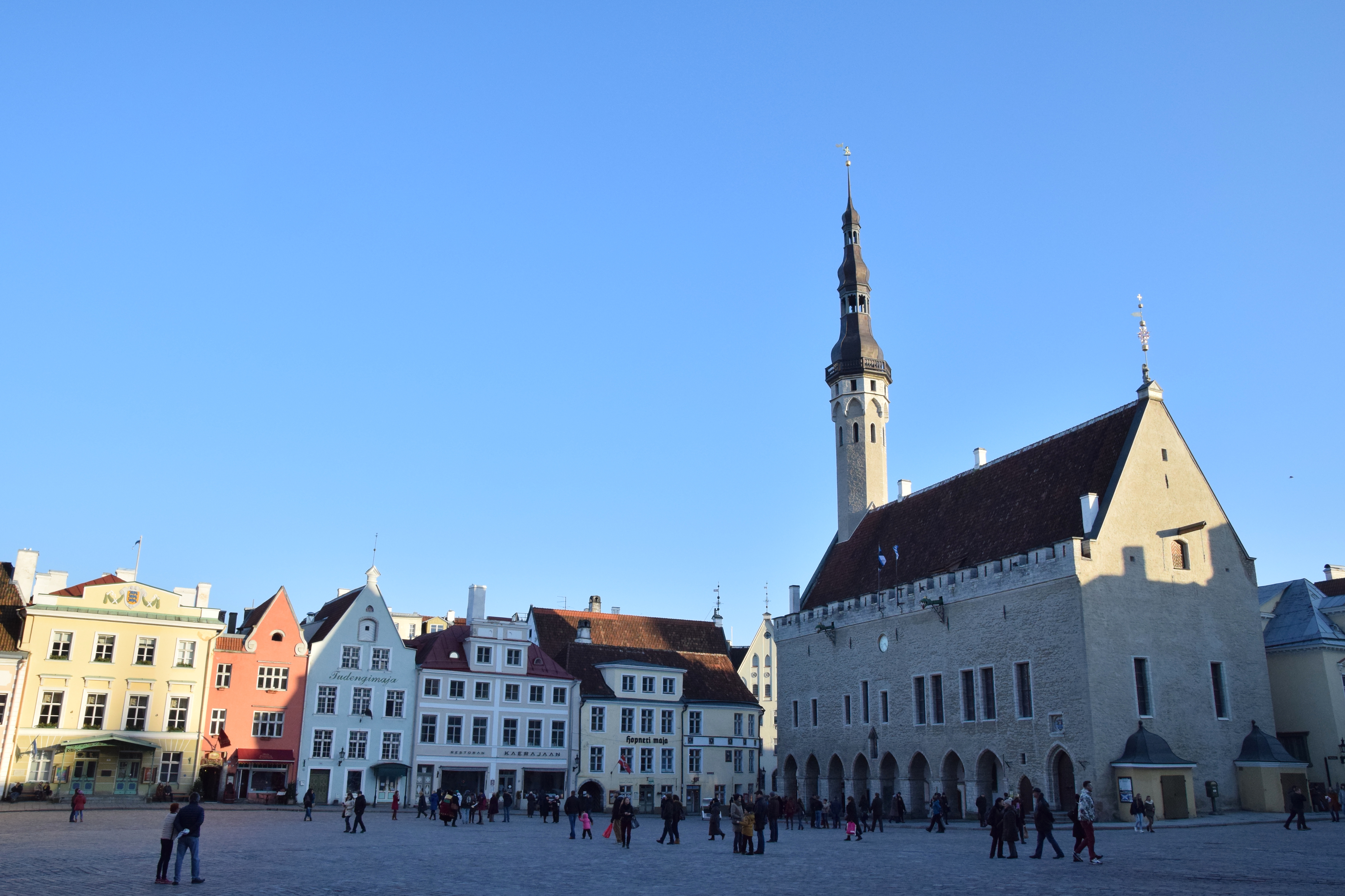
Below the hill, the Lower Town was a merchant city governed by German-speaking patricians under the Hanseatic League. Raekoja Plats, the central square, is flanked by the Gothic town hall — one of the oldest secular Gothic buildings in northern Europe, with a slender spire topped by the city’s copper weather vane Old Thomas (Vana Toomas). A short walk north on Pikk Street, the Church of St Olaf (Oleviste kirik) rises to a 124-metre spire; between 1549 and 1625 it was, by contemporary records, the tallest structure in the world. The Great Guild Hall on the same street dates to the early 15th century and now houses the Estonian History Museum. On the square itself, the Town Hall Pharmacy has operated continuously since 1422, making it one of the longest-running apothecaries in Europe.
The city wall is among the most intact medieval fortification systems in the Baltic. Of the original 46 towers, 26 survive along with substantial stretches of limestone curtain wall. The section between Kiek in de Kök (a 15th-century artillery tower, now a museum) and the Maiden Tower offers an unbroken walk along the ramparts. Narrow limestone streets, merchant warehouses, and guild houses fill the Lower Town; the scale is intimate and navigable without a map, which is part of why the site was inscribed by UNESCO in 1997 as the most complete medieval city in the Baltic region.
Getting there: The Old Town is the historical core of Tallinn and reachable on foot from the central railway station (Balti jaam) in 10 minutes, or by tram lines 1 and 2 (stop: Hobujaama). Allow: Half a day for the main circuit; a full day if you visit interiors. Best for: History-focused travellers, architecture enthusiasts, and anyone combining a Baltic cruise or ferry crossing from Helsinki (2.5 hours by fast ferry).
Struve Geodetic Arc ~100 km southeast — approx. 1.5 hours by car
The Struve Geodetic Arc is a chain of 265 survey triangulation stations stretching 2,820 kilometres from Hammerfest in Norway to Izmail on the Black Sea coast, crossing ten countries. Between 1816 and 1855, the Baltic German astronomer Friedrich Georg Wilhelm von Struve used these fixed points to measure a precise arc of the Earth’s meridian — the first such measurement accurate enough to determine the true shape of the planet (an oblate spheroid flattened at the poles). The data Struve produced underpinned geodetic science and cartography for the rest of the 19th century, and the stations were among the few fixed reference points available for large-scale European mapping before satellite positioning.
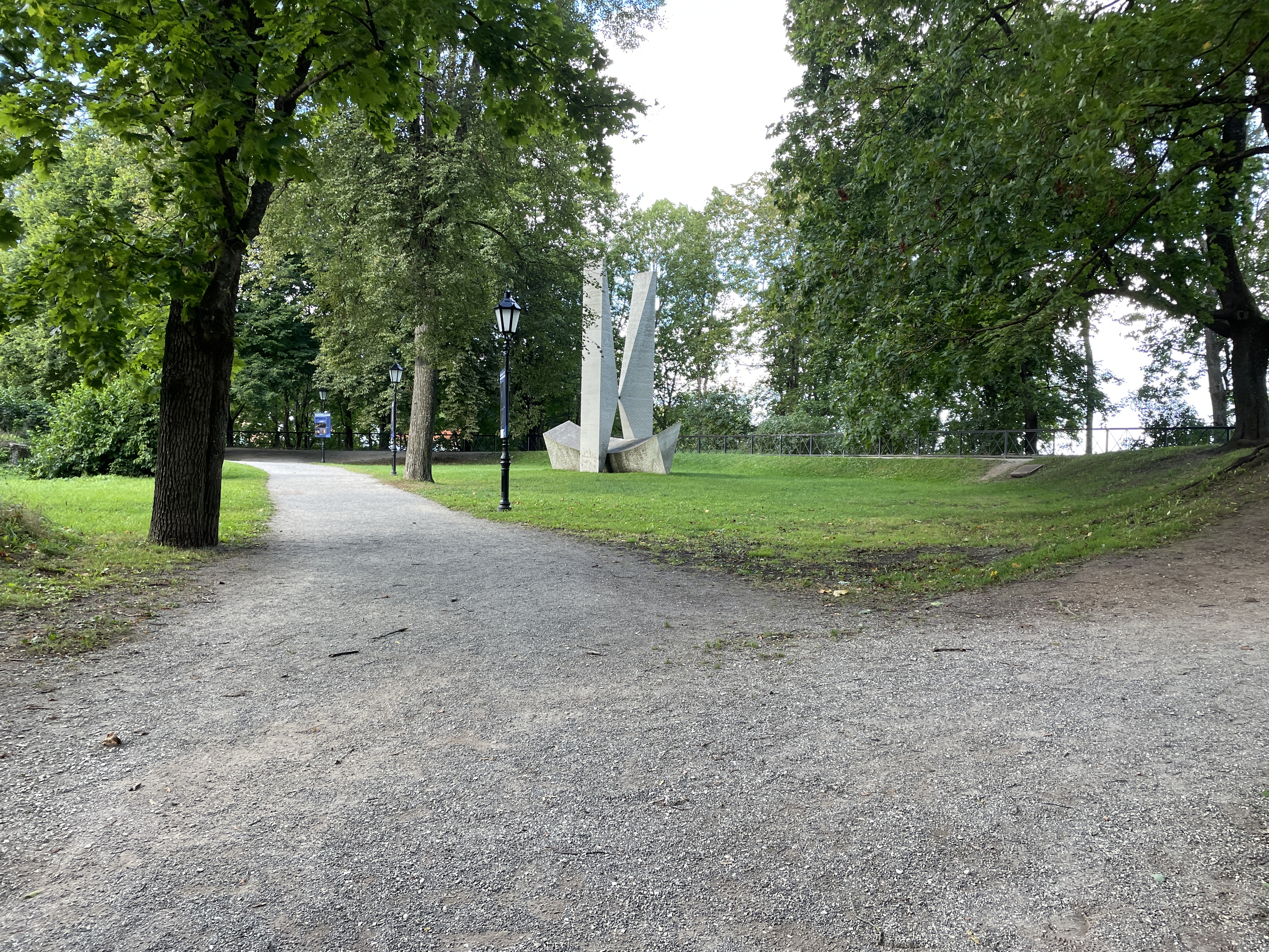
Estonia has several accessible points on the Arc. The most visited is in Tartu, where a commemorative stone stands on Toomemägi (Toome Hill) in the grounds of the old astronomical observatory — the very institution where Struve worked and from which the project was coordinated. The observatory itself (1810) is a neoclassical structure that has been restored and is open to visitors. Tartu is Estonia’s second city and a university town; the Struve monument sits within a pleasant park that also contains a 19th-century angel bridge and the ruins of a medieval cathedral. The Simuna point, one of the original triangulation stations, lies roughly 100 kilometres southeast of Tallinn in Lääne-Virumaa county and requires a short detour off the main Tallinn–Tartu highway.
The Arc was inscribed as a transboundary UNESCO World Heritage Site in 2005. It is notable as a site of scientific rather than architectural heritage: what is preserved is the logic of a measurement, materialised in stone markers set into the landscape. Visiting the Estonian points works best as part of a trip combining Tallinn and Tartu, Estonia’s two main cities connected by a direct two-hour bus or train journey.
Getting there: Tartu is 186 km from Tallinn by road (E263); direct buses run every 30–60 minutes (journey time approx. 2 hours 15 minutes). The Toomemägi monument is a 10-minute walk from Tartu bus station. For the Simuna triangulation point, a car is necessary. Allow: A half-day in Tartu to combine the Struve monument with the old observatory and the university quarter. Best for: Travellers with an interest in the history of science, cartography, or 19th-century European intellectual history.
Frequently Asked Questions
How many UNESCO World Heritage Sites are near Tallinn?
Estonia has two UNESCO World Heritage Sites. The Historic Centre (Old Town) of Tallinn was inscribed in 1997 and is located within the city itself. The Struve Geodetic Arc, inscribed in 2005 as a transboundary site spanning ten countries, has several accessible Estonian points, the most visited being in Tartu, approximately 186 kilometres southeast of Tallinn.
How do I visit Tallinn’s Old Town — is it easy to reach from the city centre?
The Old Town is Tallinn’s city centre. It sits immediately east of the main railway station (Balti jaam) and is best explored on foot; the entire walled area covers roughly one square kilometre. Tram lines 1 and 2 stop at Hobujaama, a two-minute walk from the medieval gates. No admission is charged to enter the Old Town itself, though individual museums and towers have their own ticketing.
When is the best time to visit Tallinn for heritage tourism?
May through September offers the longest daylight hours and the most temperate weather for walking the Old Town’s cobbled streets and open ramparts. July sees the Old Town Days medieval festival on Raekoja Plats, an annual event that brings period craft demonstrations and markets to the square. Winter visits have their own character — the Christmas market on Town Hall Square operates through late December, and the absence of summer crowds makes interior visits to the Guild Hall and Kiek in de Kök more comfortable. The Tartu Struve sites are accessible year-round, though the Toomemägi park is particularly pleasant in spring and autumn.
What made the Church of St Olaf the tallest building in the world in the 16th century?
The Church of St Olaf (Oleviste kirik) in Tallinn’s Lower Town stood at approximately 159 metres after a rebuilding in the early 16th century, according to records of the period. At that height, between roughly 1549 and 1625, it exceeded any other known structure in the world. Lightning strikes repeatedly damaged and finally destroyed the original spire; the present 124-metre spire dates to a 19th-century reconstruction. The church tower is open to visitors, with a narrow staircase leading to a viewing platform over the Old Town roofscape.

.jpg)
.jpg)
