Xinjiang Tianshan (sito naturale): le quattro montagne sacre dello Xinjiang
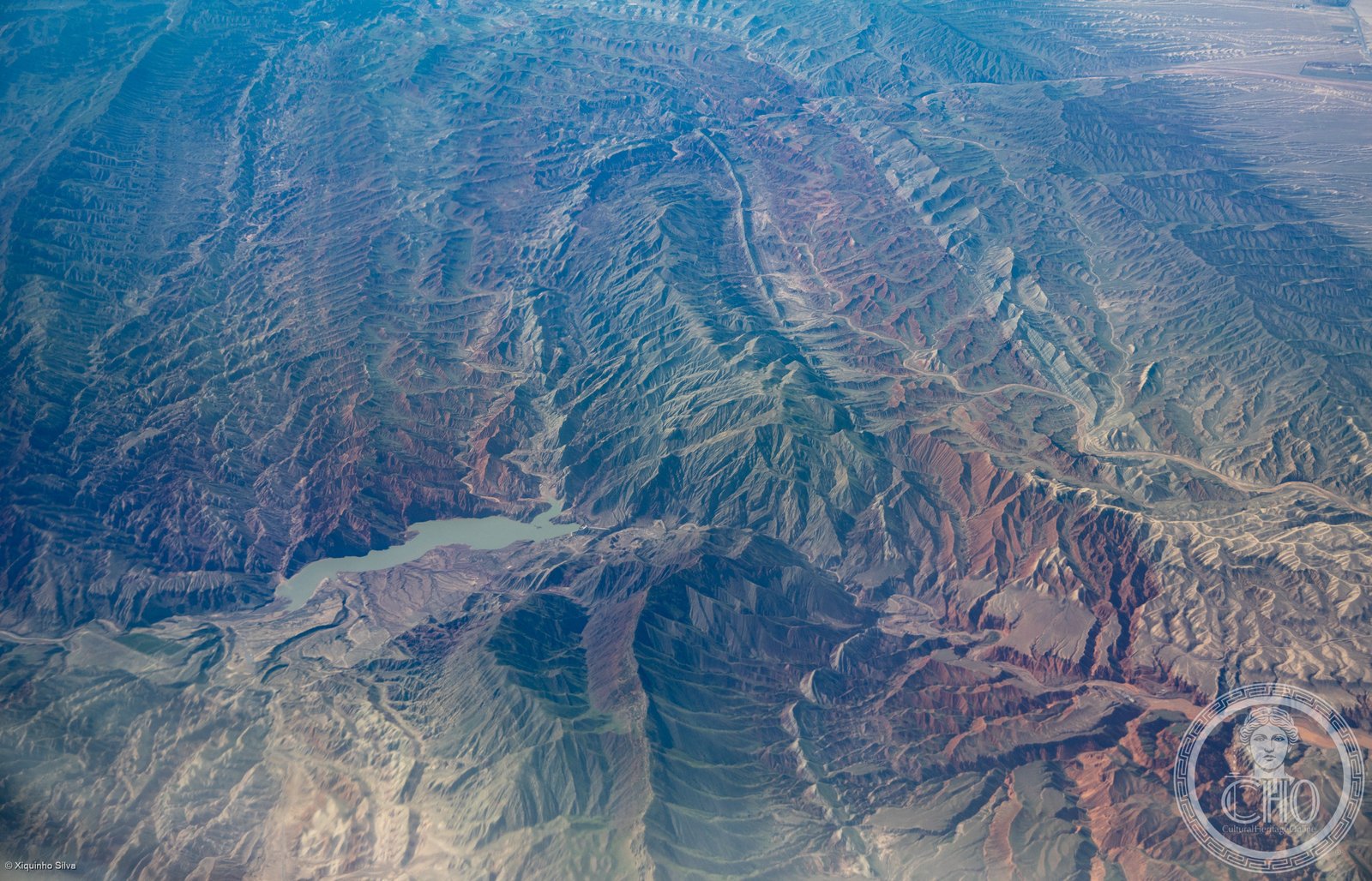
Il Tian Shan — letteralmente “Montagne Celesti” in cinese — è uno dei grandi sistemi montuosi dell’Asia Centrale, con vette che superano i 7.400 metri. La porzione cinese nello Xinjiang comprende quattro aree protette di straordinaria bellezza: ghiacciai, prati alpini, foreste di abeti e laghi turchesi incastonati tra picchi eterni. Patrimonio UNESCO dal 2013, è uno dei più importanti corridoi di biodiversità tra la Cina e l’Asia Centrale.
At a glance
Xinjiang Tianshan is a UNESCO World Heritage serial site (2013, ref. 1414) comprising four components of the Tian Shan (Heavenly Mountains) in China’s Xinjiang Uyghur Autonomous Region: Tomur (bordering Kyrgyzstan), Kalajun-Kuerdening, Bayinbuluke and Bogda. Together they cover 606,833 hectares and represent the full range of Tian Shan landscapes — from glaciers and high-altitude tundra to subalpine meadows, coniferous forests and wetlands. The inscription recognised the site’s exceptional natural beauty and its importance as a temperate arid biodiversity hotspot.
Key facts
- UNESCO: World Heritage since 2013 (Xinjiang Tianshan, ref. 1414)
- Four components: Tomur, Kalajun-Kuerdening, Bayinbuluke, Bogda
- Area: 606,833 hectares total across the four components
- Highest peak in China’s Tian Shan: Tomur Peak, 7,443 m
- Bayinbuluke: the world’s second-largest natural swan reserve, critical for migratory waterfowl
- Wildlife: snow leopard, Siberian ibex, Tian Shan brown bear, argali sheep
History
The Tian Shan has been inhabited and crossed by Turkic and Kazakh nomads for millennia and was a critical zone on the ancient Silk Road routes between China and Central Asia. The mountains are sacred in Uyghur, Kazakh and Han Chinese tradition alike. Chinese explorer and geographer Xu Xiake wrote about the Tianshan in the 17th century; Russian explorer Pyotr Semyonov explored the range in 1856–1857, bringing it to European scientific attention. The name “Tian Shan” (Heavenly Mountains) reflects the range’s spiritual significance across multiple cultures.
The four components were designated as nature reserves under Chinese law between 1980 and 2007. China submitted the Xinjiang Tianshan nomination in 2013, emphasising the exceptional natural beauty and biodiversity of the four areas. The site was inscribed under criteria vii (exceptional natural beauty) and ix (geological and biological processes), becoming one of China’s natural UNESCO sites with specific representation of the Tian Shan ecosystem.
What you see
Each of the four components offers a distinct landscape. Bogda, near Ürümqi, combines an eternal snow peak (5,445 m) with Tianchi (Heavenly Lake) at 1,910 m — one of the most scenic and accessible lakes in the region. Bayinbuluke features vast alpine wetlands filled with nesting whooper swans and black-necked cranes. Kalajun-Kuerdening shows glacier-draped ridges above rolling grasslands used by Kazakh herders. Tomur, the wildest component, is dominated by China’s highest peak in the Tian Shan and extensive glaciation.
Wildlife encounters — particularly ibex, argali and occasional snow leopard tracks — are possible on trekking routes from all four bases.
Practical information
- Most accessible: Bogda component — Tianchi Lake, 110 km from Ürümqi (bus available in summer)
- Bayinbuluke: 4-hr drive from Kuqa; seasonal guesthouses; prime swan season May–September
- Tomur: remote; access via Akesu prefecture; guides and permits required for trekking
- Best time: June–September for all components
Getting there
The gateway city for most of Xinjiang Tianshan is Ürümqi (Dihua), with domestic flights from Beijing, Shanghai and Xi’an. Tianchi Lake (Bogda component) is 110 km from Ürümqi by bus or taxi. High-speed rail now connects Ürümqi to Lanzhou and eastern China. GPS (centre): 43.00° N, 82.30° E.
Nearby
- Ürümqi — Xinjiang’s capital, with the Xinjiang Regional Museum (outstanding Silk Road collection)
- Turpan — ancient Silk Road oasis city in the Turfan Depression, with Jiaohe and Gaochang ruins
- Kashgar — the historic Uyghur city at the western end of the Silk Road, 1,500 km south-west
Sources
- UNESCO World Heritage Centre — “Xinjiang Tianshan” (ref. 1414)
- Encyclopaedia Britannica — Tian Shan mountains
- China National Tourism Administration — Xinjiang Tianshan documentation
Find it on the map
See this place and what’s around it →📷 Diventa un fotografo di Cultural Heritage Online
Condividi le tue foto dei luoghi: restano pubblicate con la tua firma come autore. Più vengono viste, più ti fai conoscere — e presto un concorso premierà le foto più apprezzate.
Accedi o registrati gratis per aggiungere una foto