

Three separate bridges converging on Randall’s Island solved what a single crossing never could: linking Manhattan, the Bronx, and Queens at once. Robert Moses opened the Triborough in July 1936 as the centrepiece of a parkway network that would define New York for decades.
At a glance
The Triborough Bridge is not one bridge but three — a suspension span across the East River to Astoria in Queens, a lift bridge across the Harlem River to Manhattan, and a series of viaducts reaching south through the Bronx — all meeting at Randall’s Island. Conceived to close the last gap in a metropolitan parkway system and to put the unemployed to work, it was built under the authority of Robert Moses and opened in the summer of 1936. The Art Deco toll plazas, bridgehouses, and approach structures that mark its landward ends still carry the geometric ornament and masonry detail of the New Deal construction era. In 2008 the bridge was renamed the Robert F. Kennedy Memorial Bridge, though the original name remains in everyday use.
Key facts
- Opened: July 1936
- Developer: Robert Moses, chairman of the Triborough Bridge Authority
- Three spans: East River suspension span (Randall’s Island to Astoria, Queens); Harlem River lift span (Randall’s Island to Manhattan); Bronx viaduct system (Randall’s Island to the South Bronx)
- Art Deco elements: Toll plazas, bridgehouses, and masonry approach structures at each landward terminus
- Renamed: Robert F. Kennedy Memorial Bridge, 2008
- Hub: Randall’s Island — meeting point of all three spans, now a public park
History
Planning for a bridge to connect the three boroughs had begun before the Depression, but the project came alive under Robert Moses, the Parks Commissioner who had already transformed the Long Island shoreline with parkways and beaches built for automobile access. Moses took control of the Triborough Bridge Authority in the early 1930s, used federal New Deal relief funds to finance construction, and drove the project to completion with a speed that became his trademark. Work began in the mid-1930s; the bridge opened to traffic on July 11, 1936.
The bridge was the linchpin of Moses’s vision for a motorway-era New York. Its three spans — the East River suspension bridge carrying the Queens approach, the Harlem River lift bridge carrying the Manhattan connection, and the Bronx viaduct system to the north — turned Randall’s Island into a traffic hub linking the New Deal’s infrastructure to the city’s commercial core. The toll revenues Moses collected became an independent financial base for his authority, enabling him to expand bridge and parkway construction for the next two decades with little need for legislative approval.
The Triborough Bridge was renamed the Robert F. Kennedy Memorial Bridge in 2008. The tolled crossing remains one of the busiest in the New York metropolitan area, and Randall’s Island — once occupied almost entirely by institutions — has been progressively converted to athletic fields and public parkland accessible from the bridge’s pedestrian connections.
What you see
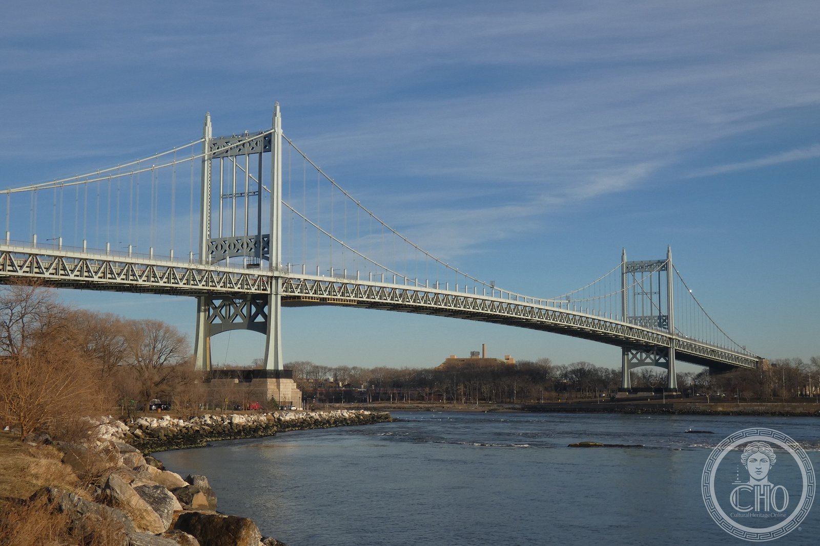
The East River span — the most visually prominent of the three — carries a suspension bridge between Randall’s Island and Astoria Park in Queens. The towers rise in pairs above the river, their steel structure rendered in a utilitarian Art Deco profile: squared tops, slightly tapered from base to crown, carrying the main cables across the channel. Below and around the towers, Astoria Park’s stone retaining walls and promenade — also built under the Triborough project — carry the same masonry vocabulary as the bridgehouses and approach ramps.
The Art Deco toll plazas and bridgehouses at each landward terminus are the bridge’s most elaborated architectural moments. Built in brick and limestone with geometric ornamental panels, they were designed to announce the toll collection points as civic gateways rather than purely functional structures — a standard of finish that characterised federally funded New Deal public works throughout the 1930s.
Practical information
- Pedestrian access to Randall’s Island via the footbridge from East 103rd Street, Manhattan, or the Queens approach path from Astoria Park
- Astoria Park on the Queens shore offers the best ground-level views of the East River span
- Vehicle toll applies at the main Queens-Randall’s Island toll plaza; pedestrians and cyclists free
- Randall’s Island Park is open daily and accessible without payment; athletic facilities available for hire
- No ferry or NYCT subway service stops directly at Randall’s Island — arrival is on foot, by bicycle, or by car
Getting there
From midtown Manhattan, the M15 or M15-SBS bus along First and Second Avenues reaches the East 103rd Street footbridge in approximately 20–30 minutes from 42nd Street. The N and W subway lines stop at Astoria–Ditmars Boulevard in Queens, from which Astoria Park and the bridge viewpoint are a 10-minute walk south. From the Bronx, the 4, 5, or 6 trains reach the bridge approaches via 138th Street–Grand Concourse station.
Nearby
- Astoria Park — Queens shoreline park directly beneath the bridge approach; swimming pool, running paths, and wide views of Manhattan
- Randall’s Island Park — athletic fields, wetland restoration areas, and the Icahn Stadium, accessible from the footbridge or bridge ramps
- Gracie Mansion — official residence of New York City’s mayor, East End Avenue and 88th Street, Manhattan, 15 minutes south by foot along the East River promenade
- Hell Gate Bridge (1916) — railroad arch bridge visible from Astoria Park, the steel arch that preceded the Triborough and influenced Ammann’s later work
Sources
- Robert Caro, The Power Broker: Robert Moses and the Fall of New York (Knopf, 1974)
- New York City Parks Department, Triborough Bridge and Randall’s Island Park history
- Metropolitan Transportation Authority bridge and tunnel historical records
- National Register of Historic Places — Triborough Bridge listing
- Hilary Ballon, Robert Moses and the Modern City (Norton, 2007)
Find it on the map
See this place and what’s around it →Record researched and written by Luigi De Marchi for Cultural Heritage Online, 2026.
📷 Become a Cultural Heritage Online photographer
Share your photos of places: they stay published under your name as the author. The more they're seen, the more you get noticed — and soon a contest will reward the most appreciated photos.
Log in or sign up free to add a photoIs this page about you?
This page is read by travellers and heritage enthusiasts who find it on Google. Tell us how you are connected to this place and we will take it from there.