
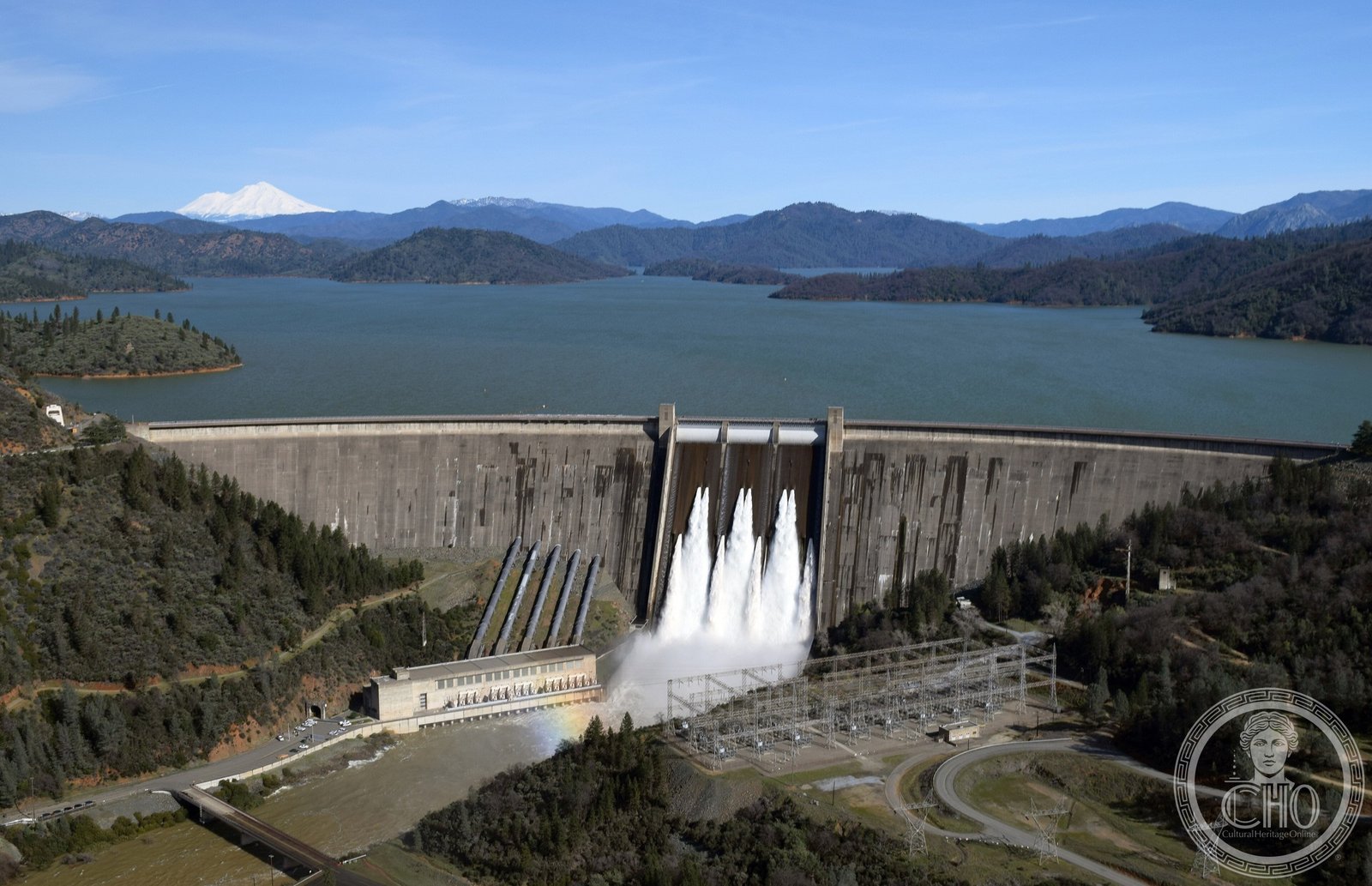
The New Deal’s great gamble on California’s future, Shasta Dam transformed the Sacramento Valley from a place of droughts and floods into the agricultural engine of the American West — its PWA Moderne powerhouse as precisely turned as any building on the continent.
At a glance
Shasta Dam spans the Sacramento River in the canyon north of Redding, California, creating Shasta Lake — the largest reservoir in the state. Built by the Bureau of Reclamation under the Central Valley Project beginning in 1938 and completed in 1945, the dam stands over six hundred feet above the river bed and is one of the tallest concrete structures in the Western Hemisphere. The dam’s powerhouse and public buildings are detailed in the PWA Moderne idiom: limestone-coloured concrete walls, streamlined massing, and the clean planar geometry that the federal government brought to its major public works throughout the 1930s and 1940s.
Key facts
- Location: Sacramento River, near Redding, Shasta County, California
- Construction: 1938–1945
- Agency: Bureau of Reclamation, Central Valley Project
- Height: Over 600 feet above the river (one of the tallest dams in the US)
- Reservoir: Lake Shasta — largest reservoir in California
- Purpose: Hydroelectric power, flood control, irrigation
- Status: National Register of Historic Places; active facility
History
The Sacramento Valley had been plagued for a century by alternating droughts and catastrophic floods when Congress authorised the Central Valley Project in 1935. Shasta Dam was to be its keystone: a structure large enough to regulate the full Sacramento River system, provide irrigation water to the broad valley below, and generate electricity for the farms and towns that would spread across the reclaimed land. Ground was broken in 1938, and construction proceeded through the late Depression years with a workforce that at its height numbered several thousand workers living in government-built camps in the canyon.
The rising of Lake Shasta required the relocation of several communities and submerged portions of the Sacramento River canyon that had been occupied since the California Gold Rush era. The town of Kennett, once a copper smelting centre in the canyon, was among those inundated when the reservoir filled in the early 1940s.
The dam was completed in 1945 as the Second World War was ending — the power it produced had supported defence industries in the Sacramento Valley throughout the conflict. In the postwar decades, the irrigation water delivered by Shasta and its associated works helped transform the Central Valley into one of the most productive agricultural regions on earth, producing a significant fraction of the nation’s vegetables, fruit, and nuts.
What you see
From the visitor centre on the canyon rim, the dam presents itself as a sweeping arc of concrete angling across the gorge — its face divided by the curving spillway opening that empties water in a white cascade hundreds of feet to the river below. The crest road runs across the top of the dam and offers views downstream into the narrow canyon and upstream across the vast blue expanse of Lake Shasta, with Mount Shasta visible on clear days many miles to the north.
The powerhouse at the base of the dam is the composition’s most architecturally considered element: a long low block of smooth concrete whose window bays march in precise rhythm along the river bank, detailed with the broad flat pilasters and restrained geometric mouldings that characterise PWA Moderne at its most composed. A visitor gallery runs through the powerhouse, connecting observation decks over the turbine floor where the generators turn in cavernous stillness behind glass.
Practical information
- Visitor centre: Free admission; open daily (hours vary seasonally); Bureau of Reclamation operated
- Tours: Guided powerhouse tours available on a seasonal schedule; free admission
- Recreation: Lake Shasta offers houseboating, swimming, and fishing; numerous private marinas
- Drive time: Approximately 3.5 hours from San Francisco, 1 hour from Redding city centre
Getting there
Shasta Dam is on Shasta Dam Boulevard off Interstate 5, approximately 9 miles north of Redding, California. The nearest major airport is Redding Municipal Airport (RDD), with connecting flights from San Francisco and Los Angeles. From I-5 northbound, take the Shasta Dam Boulevard exit; the visitor centre is signed from the freeway. There is no public transit to the dam; a private vehicle is required.
Nearby
- Cascade Theatre (1935) — Art Deco cinema in downtown Redding, on Market Street
- Lassen Volcanic National Park — approximately 50 miles east; active volcanic landscape
- Grand Coulee Dam (1942) — Bureau of Reclamation counterpart in Washington State; the largest of the New Deal dams
Sources
- US Bureau of Reclamation — Shasta Dam and Powerplant official history, usbr.gov
- National Register of Historic Places — nomination, Shasta Dam
- US Army Corps of Engineers — Central Valley Project documentation
- Wikipedia — Shasta Dam (cross-checked against Bureau of Reclamation sources)
Find it on the map
See this place and what’s around it →Record researched and written by Luigi De Marchi for Cultural Heritage Online, 2026.
📷 Become a Cultural Heritage Online photographer
Share your photos of places: they stay published under your name as the author. The more they're seen, the more you get noticed — and soon a contest will reward the most appreciated photos.
Log in or sign up free to add a photoIs this page about you?
This page is read by travellers and heritage enthusiasts who find it on Google. Tell us how you are connected to this place and we will take it from there.