Prosecco Hills of Conegliano and Valdobbiadene
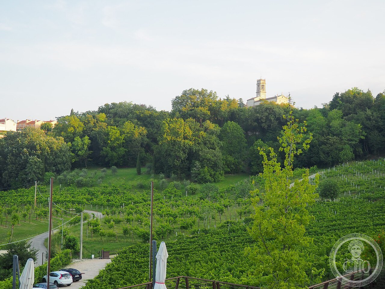
The Prosecco Hills (UNESCO 2019) between Conegliano and Valdobbiadene contain the most complex small-plot wine landscape in northern Italy — a 15th-century terrace system built on 45-degree clay slopes where every millimetre of cultivable ground is planted with Glera vines and maintained by hand-labour systems that have not changed in substance since the Middle Ages.
At a glance
Prosecco Hills (the most precisely ProseccoHills serial Treviso Province Veneto Italy 45.9070 N 12.2400 E UNESCO WHS 2019 reference 1571 15 municipalities 8853 ha: the geography of the UNESCO inscription: 15 municipalities from Conegliano (east) to Valdobbiadene (west); the protected area has 3 zones: the Core Zone (719 ha of the most distinctive terraced steep-slope vineyards; the areas of San Pietro di Barbozza, Guia, and Saccol — immediately south of Valdobbiadene; and the Cartizze hillside (107 ha; the premium Prosecco sub-zone and the most expensive single agricultural real estate in Italy by area per hectare, at approximately €600,000–800,000 per hectare vs. the DOCG average of €150,000–300,000)); the Buffer Zone (1,619 ha surrounding the core zone; moderately steep terrain with mixed forest, orchard, and vineyard); the Transition Zone (the remaining 15 municipalities’ agricultural area); the wine type: Prosecco DOCG (Denominazione di Origine Controllata e Garantita; the specific sub-zone of the UNESCO hills is the Conegliano Valdobbiadene Prosecco Superiore DOCG (since 2009); the still-higher-quality sub-zone within this is the Cartizze Superiore DOCG; the single-vineyard designations are called Rive (from the local Venetian dialect word for steep slope; a Rive must name a specific municipality and vintage year and be made from Glera grapes from a single harvest on those specific slopes)).
Key facts
- The Col Fondo method and why it is the opposite of what Prosecco became: the original traditional Prosecco production method is called Col Fondo (literally “with the bottom” — a reference to the sediment that remains in the bottle from the secondary fermentation); the Col Fondo method (also called Rifermentato in Bottiglia or Sui Lieviti): the still wine is bottled before the secondary fermentation is complete; the fermentation continues in the sealed bottle; the carbon dioxide produced creates the bubbles; the yeast cells that produced the CO₂ remain in the bottle as a sediment (the “fondo”); the wine is cloudy (the yeast impart flavor to the wine and cloud the appearance); the bottles are typically laid horizontally for 1–3 months; the Col Fondo wine is meant to be opened and consumed relatively soon (within 1–3 years); this method was the standard in the Valdobbiadene hills until the 1950s; the large-scale Charmat method (Metodo Martinotti; the large tank secondary fermentation that produces consistent, clear Prosecco at industrial volumes) replaced Col Fondo in the 1960s–1980s; the revival: Col Fondo has been revived since approximately 2010 CE by small producers in the Valdobbiadene area (the movement has been called “ancestral Prosecco” or “natural Prosecco”); approximately 20 producers now make Col Fondo; the most-visited tasting rooms include Malibràn, Bele Casel, and Casa Coste Piane; the Col Fondo wines taste significantly different from the standard Charmat Prosecco: earthier, more yeasty, less sweet, with a slight cloudiness and a more complex finish; they are the best-kept secret of the Prosecco hills for serious wine visitors
- GPS Cartizze (premium sub-zone): 45.8940° N, 12.0010° E (San Pietro di Barbozza)
- GPS Conegliano (eastern gate): 45.8874° N, 12.2983° E
History
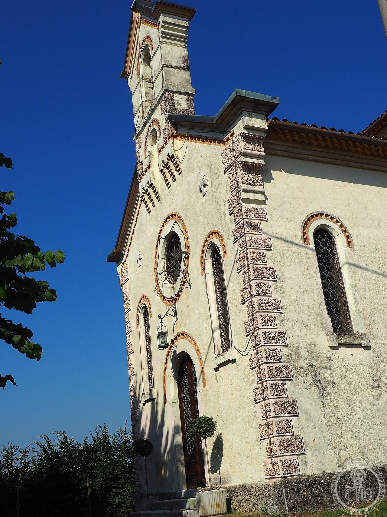
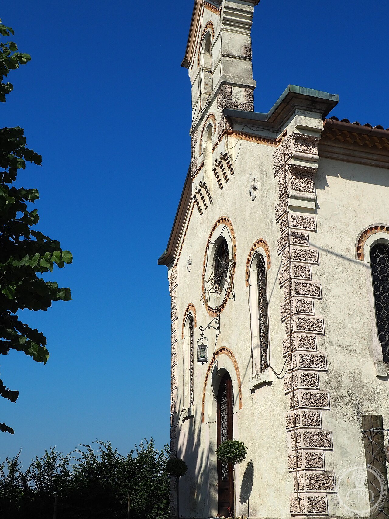
From medieval terrace agriculture to global sparkling wine to UNESCO recognition (the most precisely ProseccoHills single 10th century CE first documentary evidence: the hills between Conegliano and Valdobbiadene are documented as wine-producing territory in a Treviso episcopal charter of 982 CE; the Glera grape (then called Prosecco after the village of Prosecco near Trieste where it may have originated (the etymology is contested: Prosecco may derive from the Slovenian word “prosek” (path through the forest) or from the ancient Illyrian name “Pucinum” for the wine produced in the Carso region; the wine is documented in Pliny the Elder’s Naturalis Historia as the wine favourite of the Roman Empress Livia Augusta)) is documented in Venetian agricultural records of the 15th century CE; the terrace system: the construction of the steep-slope terraces is documented in the Venetian period (15th–18th CE century); the terraces were built by hand using a system of earth-banking (the ciglioni) rather than stone-walling (unlike the Cinque Terre terraces or the Amalfi terraces, which use dry-stone walls; the Prosecco hills terraces use earth-and-grass banks stabilized by the vine root systems — a more fragile but more flexible system); 1868 CE the Conegliano school: the Scuola Enologica di Conegliano (1868 CE; the oldest wine school in Italy; established by the agronomist Giovanni Battista Cerletti; the school trained the viticulturalists and oenologists who standardized Prosecco production methods throughout the 20th century); 1969 CE DOC: Prosecco di Conegliano e Valdobbiadene received Denominazione di Origine Controllata status; 2009 CE the DOCG upgrade; 2019 CE UNESCO inscription reference 1571.
What you see
The landscape, the ciglioni, and the Strada del Prosecco circuit (the most precisely ProseccoHills single the Strada del Prosecco e Vini dei Colli Conegliano Valdobbiadene (the wine route; established 1966 CE — one of the oldest wine routes in Italy; 120 km route from Conegliano to Valdobbiadene via the hill municipalities; the Strada del Prosecco follows provincial roads through all 15 UNESCO municipalities and passes the main winery access roads; a self-guided 2-day circuit at moderate pace; the recommended sequence Conegliano (east start): 1) Conegliano town (the old centre on the hill; the Duomo (14th CE century; the Chapel of the Battuti has the largest late-Gothic fresco cycle in the Veneto after the Scrovegni in Padua; by Giovanni da Treviso (attributed); the Sala dei Battuti, painted 1384 CE); the birthplace of the painter Giovanni Battista Cima da Conegliano (c.1459–1517 CE; “Cima da Conegliano”; his landscape backgrounds, visible in the Bellini room at the Accademia in Venice, are the earliest landscape paintings in Venetian art that are recognizably based on an actual place — the Prosecco hills appear in his Madonnas as the background topography; you can compare his painted hills with the actual hills from the Conegliano castle (Castello di San Salvatore; free; the view of the Piave plain and the vine hills to the west is the landscape of Cima’s paintings; he grew up looking at it); 2) Valdobbiadene (west end; the main visit: the Cartizze hill (Sant’Ambrogio di Valdobbiadene; 107 ha; the finest single-parcel wine area in all of Italy by price and reputation; the specific landscape: a single hill visible from the SP1 provincial road south of Valdobbiadene; the Glera vines here are planted at up to 45-degree slope; the south-facing exposure and the specific drainage created by the hill’s moraine soil are the two factors that differentiate Cartizze from other Prosecco; the Cartizze view from the SP1 is the iconic Prosecco image: a perfectly rounded dome-shaped hill covered in green vine rows)); the Col Fondo trail: the 6 or 7 Col Fondo producers who receive visitors are concentrated in the San Pietro di Barbozza / Guia area (immediately south of Valdobbiadene); the best-organized for visitors are Malibràn (Crevada di Refrontolo) and Casa Coste Piane (Santo Stefano di Valdobbiadene)).
Practical information
- 2-day Prosecco Hills itinerary by car (the detailed driving route and tasting stops): best season: September (harvest; September is called “la vendemmia” in the Prosecco hills; the harvest usually runs 3rd–4th week of September; the Rive di Molinetto di Cison festival (the “Mostra degli Spumanti” at the Molinetto della Croda water mill near Cison di Valmarino; September; free entry to the village; ticketed tastings) is one of the most picturesque wine harvest events in Italy); renting a car in Treviso (45 min from Venice by train; car rental from €45/day at Treviso airport) allows the full Strada del Prosecco circuit; Day 1: Conegliano (lunch at the Antica Osteria al Fabbri; the Cima da Conegliano museum (Casa di Cima; Via XX Settembre 124; free; the artist’s birth house with documentation of his paintings); afternoon drive west via SP15 through Refrontolo and Follina (the Cistercian Abbey of Santa Maria di Follina; 12th century; free; the cloister is the finest Romanesque cloister in the Veneto outside Torcello and Murano); overnight in Valdobbiadene; Day 2: morning Cartizze vineyard walk (park at the Cantina Bisol or Nino Franco cantina; free self-guided walk among the Cartizze vines; the winery receptions open from 9 AM); Col Fondo tasting at Casa Coste Piane (Santo Stefano di Valdobbiadene; book ahead; the tasting includes all 3 Col Fondo wines; €15); afternoon drive back to Conegliano via SP1 and the Valmareno road; the SP1 passes through the most dramatic Prosecco hill scenery (the road cuts through the vine terraces; the ciglioni banks are 1–2m high on the uphill side and create a series of visual frames as the road bends))
Getting there
Train to Conegliano from Venice (30 min, €5.50; hourly). Car essential for the Strada del Prosecco circuit (Treviso airport car rental). Best access points: Conegliano (east, train) or Valdobbiadene (west, car). Cartizze sub-zone: 5 km south of Valdobbiadene via SP1. GPS Cartizze: 45.8940, 12.0010.
Nearby
- Dolomiti — 60 km north (UNESCO WHS 2009; the southern Dolomite massifs (Pale di San Martino; Civetta; Marmolada glacier) are visible from the Prosecco hills on clear days; Cortina d’Ampezzo and the Tre Cime di Lavaredo are 1h30min by car)
- Memoriale Brion, Altivole — 20 km south (Carlo Scarpa’s 1969–1978 masterwork; see the Memoriale Brion card for the full Carlo Scarpa 3-day Veneto circuit)
Gallery

Sources
- Wikipedia, Prosecco Hills of Conegliano and Valdobbiadene; Prosecco; Cartizze; Strada del Prosecco e dei Vini dei Colli Conegliano Valdobbiadene, accessed June 2026
- UNESCO, Prosecco Hills of Conegliano and Valdobbiadene, WHS reference 1571, inscribed 2019
- Consorzio di Tutela del Prosecco Superiore DOCG. Annual Report 2023. Conegliano, 2023
Find it on the map
See this place and what’s around it →📷 Diventa un fotografo di Cultural Heritage Online
Condividi le tue foto dei luoghi: restano pubblicate con la tua firma come autore. Più vengono viste, più ti fai conoscere — e presto un concorso premierà le foto più apprezzate.
Accedi o registrati gratis per aggiungere una foto