
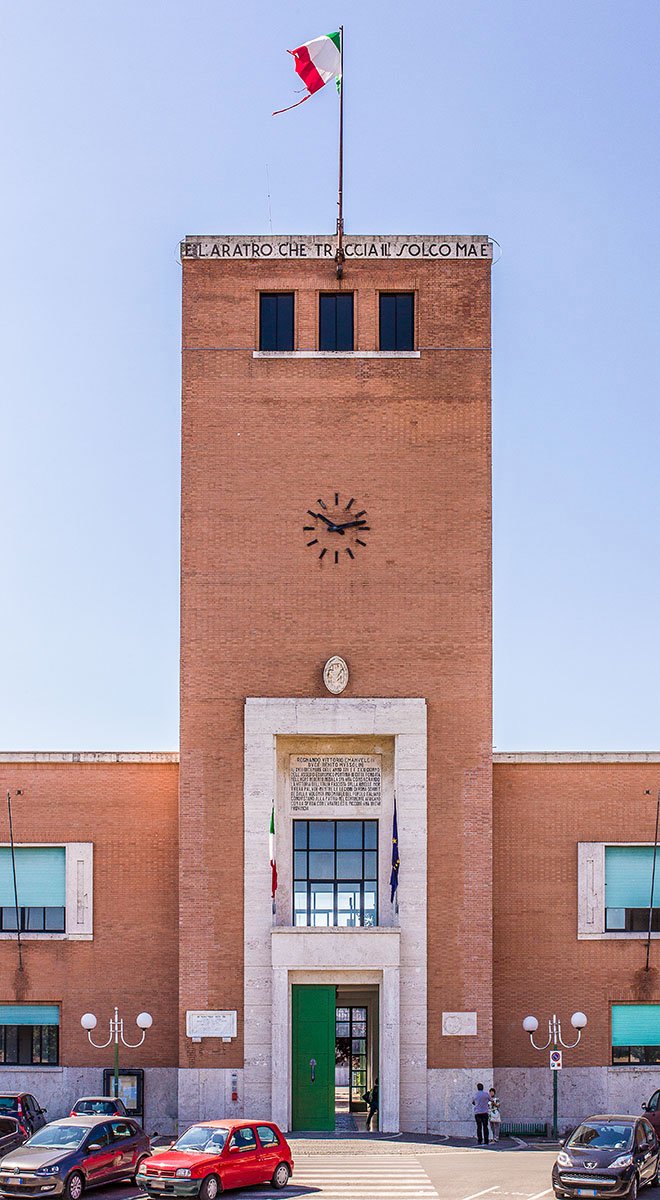
Pontinia is the third of the five new towns founded on the drained Pontine Marshes between 1932 and 1939. Inaugurated on 18 December 1935 to a design by engineer Alfredo Pappalardo with the artistic consultancy of Oriolo Frezzotti, it was conceived as the service centre for the agricultural colonists settled around the Sisto canal.
At a glance
Pontinia sits at four metres above sea level, on land that until the early 1930s belonged to the Pontine Marshes — a sweep of malarial wetland southeast of Rome that had defeated every reclamation attempt since antiquity. The town was inaugurated on 18 December 1935 as the third citta di fondazione of the Agro Pontino reclamation programme, following Littoria (today Latina, 1932) and Sabaudia (1934). It is the most modest of the five new towns in scale and ornament, designed as a working centre for the colonist families distributed across the surrounding farmland rather than as a representative capital.
Key facts
- Founded: 18 December 1935, third of five Pontine new towns
- Urbanist: engineer Alfredo Pappalardo (Opera Nazionale Combattenti), with artistic consultancy of Oriolo Frezzotti
- Commissioning body: Opera Nazionale Combattenti (ONC), the agency that ran the Pontine reclamation
- Plan: orthogonal grid rotating around two squares, with Piazza Indipendenza at its civic centre
- Population: roughly 15,000 residents
- Patron saint: Saint Anne, feast day 26 July
- Coordinates: 41.4019° N, 13.0431° E
History
The Pontine Marshes (Agro Pontino) cover roughly seventy-five thousand hectares between the Lepini hills and the Tyrrhenian coast. Drained intermittently from the late eighteenth century onward, they were finally reclaimed under the integrated programme launched in 1928 and pursued through the 1930s by the Opera Nazionale Combattenti, an agency originally created to resettle veterans of the First World War. As the network of canals advanced and the malarial water receded, the ONC laid out new agricultural lots and built five new towns to serve them: Littoria (1932), Sabaudia (1934), Pontinia (1935), Aprilia (1937) and Pomezia (1939).
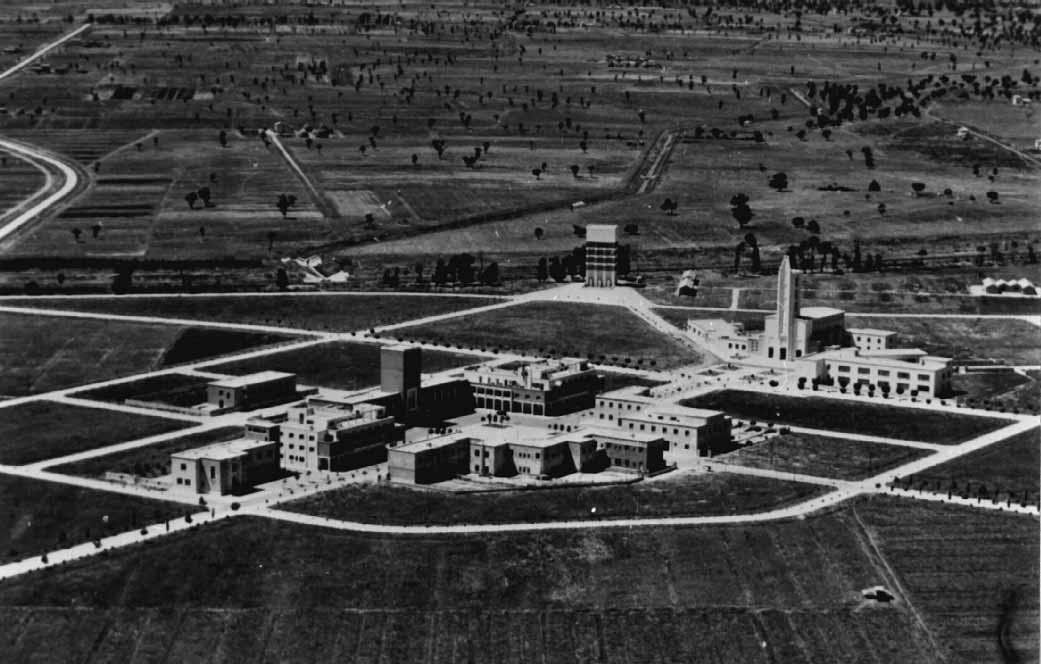
Pontinia was inaugurated on 18 December 1935, after a construction campaign of less than nine months. The site was chosen at the centre of the reclaimed land south of the Sisto canal, far enough from Littoria and Sabaudia to serve a distinct agricultural district. The town plan, drawn up by engineer Alfredo Pappalardo of the ONC technical office, organised the settlement as an orthogonal grid pivoting on two open spaces, Piazza Indipendenza and a secondary square reserved for the parish church. Oriolo Frezzotti — the Roman architect already responsible for the urban plan of Littoria — provided artistic consultancy on the principal buildings.
Unlike Sabaudia, where the rationalist designers of the Cancellotti-Montuori-Piccinato-Scalpelli group produced an internationally celebrated experiment, Pontinia received a deliberately modest treatment. Its buildings keep to a stripped, austere idiom common to the smaller ONC settlements: rendered walls, simple cornices, restrained signage. The town has since grown well beyond its 1935 perimeter, but the original civic core around Piazza Indipendenza remains legible as a coherent rationalist ensemble.
What you see
Piazza Indipendenza is the symbolic and functional heart of the foundation town. The Palazzo Comunale closes one side of the square with a long horizontal volume and a tower set off-axis on its eastern flank — the kind of asymmetrical composition typical of mid-1930s Italian municipal architecture, where the tower carries the civic clock and the building below carries the administrative offices. The facade is rendered in pale plaster against a simple stone base, with rectangular openings and no applied ornament; the only emphasis is the entrance loggia, slightly recessed.
A short walk from the square stands the parish church of Sant’Anna, dedicated to the town’s patron saint and designed in the same restrained register as the municipal buildings. The original water tower, no longer in operation, survives on the edge of the historic core as a vertical landmark visible across the surrounding farmland. The former Casa del Fascio, repurposed after 1945 as a cultural centre, completes the rationalist ensemble of the founding core and today houses the Museo della Bonifica e dell’Agro Pontino, which documents the reclamation campaign through photographs, instruments and oral testimony.
Practical information
- Best time: spring and early autumn for comfortable walking weather; the patronal feast of Sant’Anna falls on 26 July
- Time needed: 1.5 to 2 hours for the historic centre and museum
- Footwear: any comfortable shoes — the town is flat and the centre is paved
- Accessibility: the main square and municipal buildings are step-free
- Combine with: a visit to Sabaudia (20 km west) or to the archaeological park of Ninfa nearby
Getting there
Pontinia lies roughly 90 km southeast of Rome and 22 km southeast of Latina. The most convenient approach is by car along the Strada Regionale 148 Pontina from Rome or the SS 156 from Latina. Public transport options include COTRAL regional buses from Latina station, which is itself reached in about 35 minutes by direct train from Roma Termini. Fiumicino and Ciampino airports are within a 90-minute drive.
Nearby
- Pontinia Founded Town Walk — the curated itinerary, with map and GPX.
- Pontinia, 1935 — the dedicated magazine article by Stefano Vigolo.
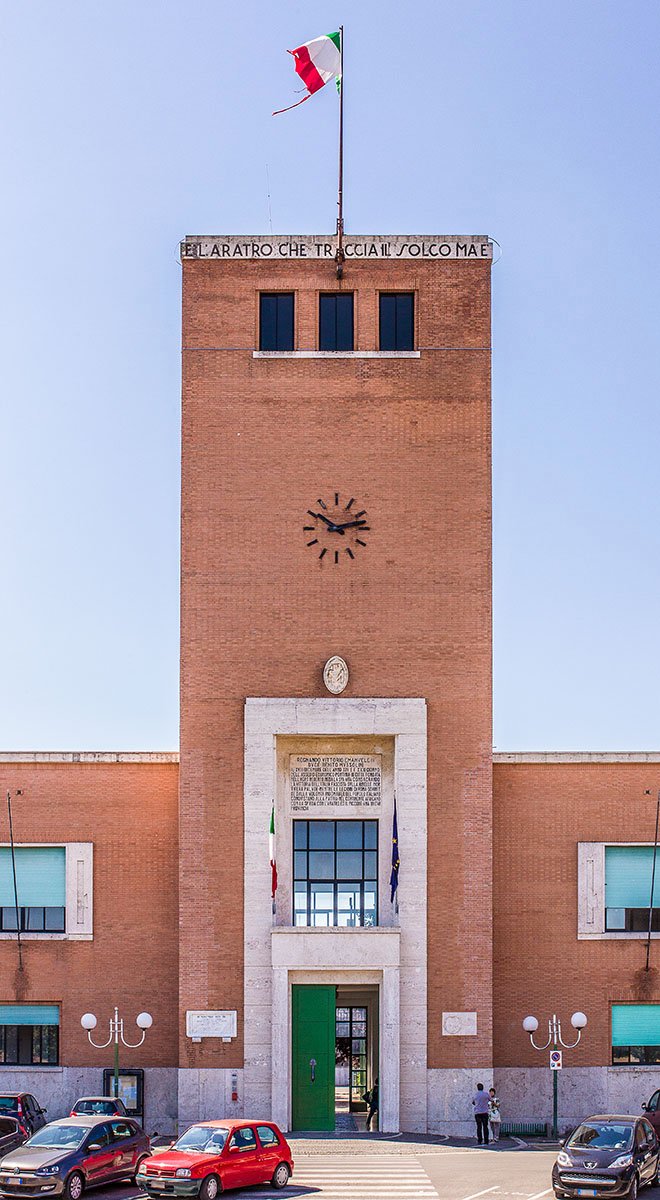
- Palazzo Comunale and civic tower — the brick-and-travertine town hall of 1935, with the inscribed reclamation motto.
- Sabaudia — the rationalist masterwork of the Pontine reclamation, 20 km west
- Latina — Littoria, the first city of foundation, 22 km northwest
- Ninfa — the medieval ruins and romantic garden of the Caetani family, 35 km north
- Circeo National Park — coastal dunes, lakes and the Tyrrhenian promontory, 25 km southwest
Image gallery
Sources
Find it on the map
See this place and what’s around it →Record researched and written by Stefano Vigolo for Cultural Heritage Online, 2026.

📷 Become a Cultural Heritage Online photographer
Share your photos of places: they stay published under your name as the author. The more they're seen, the more you get noticed — and soon a contest will reward the most appreciated photos.
Log in or sign up free to add a photo