Gunung Mulu National Park
The most cavernous landscape on Earth — Gunung Mulu National Park in Sarawak, Borneo, contains the world’s largest natural underground space (Sarawak Chamber), the longest cave in Southeast Asia (Clearwater Cave, 227 km), and the world’s largest single cave passage (Deer Cave); each evening approximately 3 million bats stream out of the Deer Cave mouth in the most dramatic wildlife spectacle in Asia.
At a glance
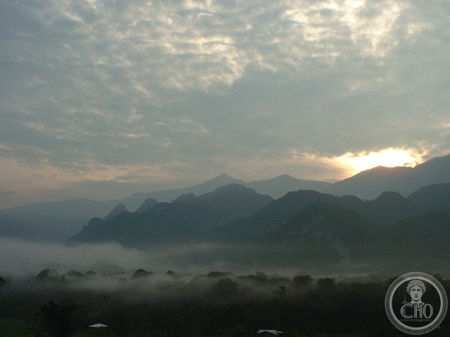
Gunung Mulu National Park (52,865 hectares; established 1974; UNESCO WHS 2000) is located in the Miri Division of Sarawak, on the island of Borneo, approximately 90 km south-east of the city of Miri (reachable by a 30-minute flight from Miri Airport on MASWings to the park airstrip at Mulu village); the park encompasses three distinct geological zones: the limestone karst terrain of the Melinau Limestone Formation (the primary zone for caves; the world’s most extensively explored cave system; more than 300 km of surveyed cave passages in a system still being explored and extended by expeditions); the sandstone massif of Gunung Mulu itself (2,376 m; the highest peak in Sarawak; a 4-day summit trek from the park headquarters); and the surrounding tropical rainforest (mostly undisturbed lowland and montane dipterocarp forest; exceptional biodiversity; approximately 4,000 plant species, 109 mammal species, 262 bird species, and 75 amphibian species); the park headquarters and most visitor infrastructure (show caves, chalets, restaurants) are at the Mulu village airstrip; all cave visits are guided (mandatory).
Key facts
- Sarawak Chamber: the world’s largest natural underground space by area and volume — the Sarawak Chamber (discovered by a British cave expedition in 1981; located in the Good Luck Cave system, the same system as Deer Cave; accessible from Deer Cave on a non-commercial expedition route) has dimensions of approximately 700 metres in length, 396 metres in width, and a height varying from approximately 70 to 100 metres; the floor area is approximately 170,000 m² (the equivalent of approximately 40 Boeing 747s parked side by side); the volume is approximately 600 million cubic metres (larger than the air volume of St. Peter’s Basilica in Rome by a factor of approximately 4,000); the Sarawak Chamber is not accessible on regular guided tours (access requires an expedition permit, full caving equipment, and physical fitness — the route involves wading, crawling, and climbing in absolute darkness); the regular show cave circuit visits Deer Cave and Lang Cave (accessible adjacent to Deer Cave, with spectacular speleothem formations), Wind Cave, and Clearwater Cave on a day or multi-day circuit
- The Deer Cave bat exodus: the most spectacular animal movement in Asia — the Deer Cave (Gua Rusa; the largest single cave passage in the world; 2.16 km long; up to 174 m wide and 122 m high; the entrance opening is 174 × 122 metres, the largest cave entrance in the world) is home to approximately 3 million Wrinkle-lipped free-tailed bats (Chaerephon plicata) and 2.7 million Horseshoe bats (Rhinolophus species); each evening at approximately 5:00–5:30pm (sunset in Sarawak varies little from the equatorial mean of 6pm throughout the year; the bats emerge approximately 45–90 minutes before dark), the bats begin to stream out of the cave mouth; the emergence starts slowly (a few thousand bats per minute), builds to a river of millions of bats (the sound is a continuous rushing hiss; the column of bats can be 5–10 metres wide and 30–40 metres long), and continues for 30–90 minutes; the column spirals and twists to confuse predators (the Bat Hawk and the Peregrine Falcon both hunt the exodus); the total weight of the bats emerging from Deer Cave each evening is estimated at 30–40 tonnes; the bat guano deposit on the cave floor supports an entire ecosystem of cave crickets, cockroaches, and cave centipedes
- The Mulu Pinnacles: the most dramatic limestone formation in Malaysia — the Pinnacles (Gunung Api Pinnacles; approximately 45 km from park headquarters; accessible by longboat up the Melinau River and then a 2-day climb; the final 1.2 km to the viewpoint involves vertical iron ropes and ladders fixed in the limestone; a strenuous multi-day trip requiring physical fitness) are a field of sharp limestone needles (50–70 cm wide at the base; 45 metres tall; approximately 1,200 in number) growing from the forested top of Gunung Api (1,750 m); they were formed by the dissolution of a flat limestone plateau by intense tropical rainfall over millions of years, leaving the hardest rock as razor-sharp spires; the limestone is sharp enough to cut through heavy canvas; the Pinnacles viewpoint (reached after a 2-day round trip from park HQ) gives a view of the needles emerging from the forest canopy
- Heritage: UNESCO World Heritage Site, Gunung Mulu National Park, inscribed 2000
- GPS: 4.0536° N, 114.9280° E
History
The Penan and Berawan peoples of Sarawak have lived in the Mulu region for centuries; the Melinau River was mapped by colonial administrators in the early 20th century; the first major cave exploration was by a British Royal Geographical Society expedition in 1961–1962 (which discovered and surveyed the Clearwater Cave and several others); the Sarawak Chamber was discovered in 1981 by a team from the Royal Geographical Society; the park was gazetted in 1974 under the Sarawak National Parks Ordinance; UNESCO WHS 2000; caves continue to be discovered and surveyed (the total surveyed length has grown from approximately 200 km in 2000 to 327+ km by 2020).
What you see
The show caves circuit (all guided; Deer Cave + Lang Cave as one circuit, Wind Cave + Clearwater Cave as another circuit): Deer Cave (the bat exodus; the cave mouth; the interior cave passage; the guano ecosystem — vast heaps of guano on the cave floor with cave cockroaches and cricket species visible); Lang Cave (small adjacent cave with excellent stalactite and stalagmite formations; immediately after exiting Deer Cave; the bat exodus viewing platform is outside the Deer Cave mouth); Wind Cave and Clearwater Cave (a longboat ride upstream on the Melinau River — 40 min; Wind Cave has exceptional cave formations including massive flowstone deposits; Clearwater Cave has an underground river and a surface entrance pool for swimming); the elevated walkway through the rainforest from park HQ to Deer Cave (2 km; the forest canopy walk passes hornbill, orangutan, and proboscis monkey habitat).
Practical information
- Access and permits: the park is accessible only by MASWings flight from Miri (30 min; daily; book in advance in high season; approximately MYR 120–200 one-way); all cave visits are guided (tours sold at park HQ; the Deer Cave + Lang Cave tour, approximately 2h, is approximately MYR 20; the Wind Cave + Clearwater Cave tour, approximately 3h, is approximately MYR 25; both tours should be done for a complete experience); the bat exodus is best viewed from the exterior observation platform outside the Deer Cave entrance at 5pm–6pm daily (no additional fee; the most magical moment in Mulu); accommodation at the Mulu Marriott Resort (the only resort-standard property; room prices approximately MYR 400–800/night; book in advance) or the park authority chalets (basic; approximately MYR 60/night)
- Getting there: fly to Miri (MYY; 1h 30 min from Kuala Lumpur; daily AirAsia and Malaysia Airlines flights; or 1h from Kuching on MASWings); then MASWings to Mulu (30 min; book online or through the park); Miri Airport to Mulu Airport is the only practical access route (there is a river route by speedboat from Marudi, approximately 8h, very rarely used by visitors; the road from Miri to Mulu does not exist)
- What to budget: the combination of Deer Cave (bat exodus) + Lang Cave + Wind Cave + Clearwater Cave covers 2 days; the Mulu Pinnacles (3 days return from park HQ; longboat + 2-day climb; approximately MYR 500–700 per person for guide, boat, and accommodation on the mountain) is for fit visitors who want to add the most dramatic landscape view; total for a 3-day Mulu visit: approximately USD $300–500 per person including flights from Kuala Lumpur, accommodation, and cave permits; the Mulu Marriott adds significantly to the cost
Getting there
Fly Miri to Mulu Airport on MASWings (30 min). Miri: 1h 30 min from Kuala Lumpur. GPS: 4.0536, 114.9280.
Nearby
- Gunung Kinabalu Park (Sabah, Malaysia) — 400 km north-east of Mulu (accessible by flight from Miri to Kota Kinabalu; 1h; then 2h road from Kota Kinabalu to the Kinabalu park); the highest peak in Malaysia and one of the most biodiverse parks in Southeast Asia — see separate CHO place card
- Bako National Park (Sarawak) — 500 km south-west of Mulu (accessible by flight from Miri to Kuching, then 45 min by road + 30 min by boat to Bako); the best proboscis monkey and pitcher plant viewing in the world — Bako National Park (2,728 hectares; the oldest national park in Sarawak; 37 km from Kuching) is the most accessible wild place in Sarawak for observing the proboscis monkey (Nasalis larvatus; the large-nosed endemic primate of Borneo; approximately 275 individuals in Bako; reliably seen at dawn and dusk near the mangrove edge), the pitcher plants (Nepenthes species; Sarawak has more pitcher plant species than any other region; several species are visible on the Bako heathland — peat swamp forest — without any trekking), the silvered langur, and the Bearded Pig
- Niah National Park (Sarawak) — 150 km south-west of Mulu (accessible by road from Miri; 3h); Niah Caves: one of the most important archaeological sites in Southeast Asia — the Niah Caves (Sarawak; the Great Cave of Niah is the site of the oldest modern human skull found in Southeast Asia, dated to approximately 40,000 BP; the find was made by Tom Harrisson in 1958 and transformed understanding of the early settlement of Southeast Asia and the Pacific; the cave is also famous for its edible bird nests, Aerodramus fuciphagus; the nests are harvested twice a year by local people who climb bamboo poles 30 metres to the cave ceiling using only a loop of rattan for support; the bird’s nest soup trade is one of the most valuable per-kilo food products in Asia)
Sources
- Wikipedia, Gunung Mulu National Park; Deer Cave; Sarawak Chamber; Clearwater Cave, accessed June 2026
- UNESCO, Gunung Mulu National Park, WHS reference 1013, inscribed 2000
- Andy Eavis et al., Mulu: The World’s Most Cavernous Place, Cave Studies, 2011
Find it on the map
See this place and what’s around it →📷 Diventa un fotografo di Cultural Heritage Online
Condividi le tue foto dei luoghi: restano pubblicate con la tua firma come autore. Più vengono viste, più ti fai conoscere — e presto un concorso premierà le foto più apprezzate.
Accedi o registrati gratis per aggiungere una foto