
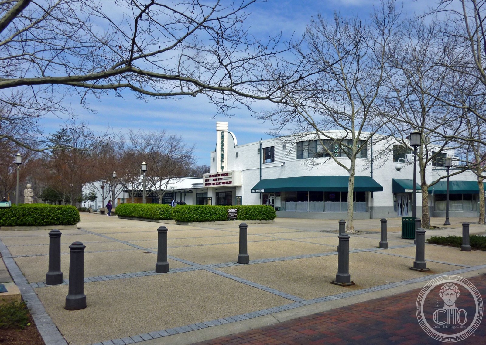
The most intact of three New Deal greenbelt towns built by the Roosevelt administration in 1937, Greenbelt, Maryland is a Streamline Moderne planned community — curved shopfronts, pedestrian underpasses, and superblock housing — that proposed a complete alternative model for American urban life at the depth of the Depression.
At a glance
Greenbelt, Maryland was designed and built in 1937 by the Resettlement Administration — a New Deal agency created by executive order in 1935 — as a demonstration of cooperative community planning. One of three federally constructed “greenbelt towns” (alongside Greendale, Wisconsin and Greenhills, Ohio), Greenbelt is the best-preserved example: its curved Streamline Moderne commercial buildings, cooperative civic institutions, pedestrian path network, and superblock residential layout remain substantially intact. The community has been designated a National Historic Landmark in recognition of its significance as an experiment in American planning, architecture, and social policy.
Key facts
- Location: Greenbelt, Prince George’s County, Maryland 20770
- Completed: 1937; first residents arrived November 1937
- Built by: Resettlement Administration (later Farm Security Administration), a New Deal federal agency
- Style: Streamline Moderne / Art Deco Moderne — curved facades, horizontal banding, cooperative planning
- Status: National Historic Landmark; living community
- Population: approximately 23,000 (contemporary municipality)
- Theme: Art Deco USA
History
The greenbelt town program emerged from a confluence of ideas in the 1930s: the Garden City movement of Ebenezer Howard (and its American realization by Clarence Stein and Henry Wright at Radburn, New Jersey in 1929), the cooperative housing experiments of Scandinavian welfare states, and the emergency programs of the New Deal’s first years. Rexford Tugwell, head of the Resettlement Administration, conceived of the greenbelt towns as a practical demonstration that planned communities could provide healthier, more affordable living conditions than the American private real estate market had delivered during the 1920s boom.
The Maryland site — then open farmland in Prince George’s County, 12 miles northeast of Washington, D.C. — was selected for its accessibility to federal employment and its proximity to the capital’s expanding workforce. The Resettlement Administration’s architectural division designed the Roosevelt Center commercial area, the community center, and the surrounding residential superblocks as an integrated composition: curved Streamline Moderne shopfronts organized around a pedestrian court, with housing arranged to eliminate through traffic and create protected interior green spaces. The pedestrian underpasses connecting the residential areas to the commercial center were a signature element — derived from the Radburn model — designed to allow children to move through the community without crossing automobile traffic.
The community became a cooperative in 1952 when the federal government sold it to the residents, who organized as Greenbelt Homes, Inc. — a cooperative housing corporation that continues to manage the original 1937 dwellings. The municipality of Greenbelt grew dramatically in the postwar decades as surrounding development transformed the Prince George’s County landscape, but the original planned community core has been maintained as a distinct historic district within the larger city. The National Historic Landmark designation recognized both the architectural integrity of the 1937 buildings and the continuing social experiment of cooperative community governance.
What you see
The Roosevelt Center commercial buildings are the community’s most distinctive architectural set pieces: curved facades in buff brick with horizontal windows and Streamline Moderne banding, arranged around an open pedestrian court accessible by a flight of steps from the surrounding residential areas. The curved geometry is both practical — it responds to the topography of the site — and aesthetic, giving the center a dynamic visual character that is at once welcoming and architecturally distinctive.
The Greenbelt Community Center (1937), adjacent to the Roosevelt Center, is a larger civic building housing the community theater, gymnasium, and meeting rooms. Its exterior continues the Streamline Moderne vocabulary of the commercial area, with horizontal banding and recessed windows that emphasize the building’s mass rather than its openings. The community center facade carries decorative relief panels in a Streamline Moderne register consistent with the surrounding commercial buildings.
The residential superblocks surrounding the center are organized around continuous interior greenways, with the houses grouped in curved rows that define shared outdoor spaces rather than individual backyards. The superblock layout, borrowed from Radburn, was designed to create a pedestrian environment that counteracted the social isolation of conventional subdivision planning.
Practical information
- Access: Crescent Road and Center Way, Greenbelt, MD 20770; Roosevelt Center is the commercial and geographic core of the original planned community
- Community Center: 15 Crescent Road, Greenbelt; open to the public; community events and theater programming
- Time needed: 2–3 hours to walk the full 1937 community, including Roosevelt Center, community center, residential superblocks, and pedestrian underpass network
- Best season: spring through fall; the interior greenways are especially visible in non-summer months when foliage is lower
Getting there
Washington Dulles International (IAD) is approximately 22 miles west; Ronald Reagan Washington National (DCA) approximately 15 miles south. The WMATA Green Line Greenbelt station (end of line) is approximately 1.5 miles from the Roosevelt Center, with local bus connections. Amtrak’s northeast corridor stops at New Carrollton station approximately 5 miles west. By road, Greenbelt is accessible from I-495 (Capital Beltway) via Exit 23.
Nearby
- NASA Goddard Space Flight Center — the principal NASA science research center, adjacent to the municipality of Greenbelt; the Visitor Center is open to the public on weekends
- Greenbelt Park (National Park Service) — the forested park that surrounds three sides of the original planned community, preserving the “greenbelt” buffer that gave the town its name; hiking and camping within minutes of the Roosevelt Center
- University of Maryland, College Park — the flagship state university campus approximately 4 miles south on US Route 1; one of the largest research universities in the eastern United States
Sources
- National Park Service — Greenbelt, Maryland National Historic Landmark documentation
- Greenbelt Museum — community history and architectural documentation, 10-B Crescent Road
- Library of Congress — Farm Security Administration photographs of Greenbelt construction, 1936–1937
- Wikimedia Commons — Roosevelt Center (5575827493).jpg, CC BY 2.0
Find it on the map
See this place and what’s around it →Record researched and written by Luigi De Marchi for Cultural Heritage Online, 2026.
📷 Become a Cultural Heritage Online photographer
Share your photos of places: they stay published under your name as the author. The more they're seen, the more you get noticed — and soon a contest will reward the most appreciated photos.
Log in or sign up free to add a photoIs this page about you?
This page is read by travellers and heritage enthusiasts who find it on Google. Tell us how you are connected to this place and we will take it from there.