Dolomiti
Le Dolomiti (UNESCO 2009 patrimonio naturale) sono le montagne dolomitiche più fotografate del mondo — una catena di guglie e torri calcaree nelle Alpi orientali italiane, inscritta dall’UNESCO per i loro “valori eccezionali di paesaggio” e per il fenomeno del’enrosadira (il rosseggiare della roccia al tramonto), con 9 sistemi alpini distinti distribuiti tra Trentino-Alto Adige, Veneto e Friuli Venezia Giulia su 141.902 ettari.
At a glance
Dolomiti UNESCO 2009 (the most precisely Dolomiti zone Dolomiti Trentino-Alto Adige Veneto Italy 46.6146 N 12.3011 E UNESCO WHS 2009 natural reference 1237: the 9 systems (the Dolomiti UNESCO inscription covers 9 distinct mountain systems grouped into 3 geographic zones: (1) the central and eastern zone: Pelmo-Croda da Lago; Marmolada; Pale di San Martino, San Lucano, Dolomiti Bellunesi, Vette Feltrine; Dolomiti Friulane e d’Oltre Piave; Dolomiti Settentrionali; (2) the north zone: Sesto-Dolomiti; (3) the west zone: Bletterbach; Dolomiti di Brenta; the total area: 141,902 ha (surface of 9 systems) + 89,267 ha (buffer zone); the total combined area is about twice the size of Luxembourg); the Marmolada (the highest Dolomiti summit: 3,343 m (the Punta Penia); the Marmolada glacier (the “Queen of the Dolomites”: the largest glacier in the Dolomites: 1900 CE: 7 km2; 2020 CE: 1.5 km2; projected disappearance: by 2040 CE at current melting rates; the specific collapse event: 3 July 2022 CE: a serac (an ice tower) on the southeast face of the Marmolada summit collapsed, triggering an ice-rock avalanche that killed 11 climbers on the normal route and injured 8; the collapse was attributed to unusually high temperatures (the summit temperature on July 3, 2022 CE was +10.5°C (a record for the Marmolada summit: the previous July record was +3°C)); the collapse covered 4 km2 of the summit face)); the Tre Cime di Lavaredo (the most photographed spot in the Dolomites: the 3 towers (Cima Grande 2999 m; Cima Ovest 2973 m; Cima Piccola 2857 m): the walk (the Rifugio Auronzo road (toll road in summer: €30 per car one-way (the toll is used to fund the road maintenance and limit traffic; approximately 1,500 cars per day in peak season)); the Rifugio Auronzo at 2320 m is the starting point of the classic 2.5-hour circuit hike (10 km; 400 m ascent; the circuit goes around the base of all 3 towers; the north face of the Cima Grande is visible at midpoint; the enrosadira is best seen at the east side of the circuit 1 hour after the start)): the enrosadira (the phenomenon: a specific optical and atmospheric condition that occurs at sunrise and sunset when the angle of incidence of the sun’s rays on the dolomite rock causes the feldspar minerals in the dolomite (calcium magnesium carbonate: CaMg(CO3)2) to fluoresce red-orange; the effect lasts 15–30 minutes at dawn and 15–30 minutes at dusk; it is not visible at all angles: the observer must face approximately east at dawn or west at dusk to see the full effect)).
Key facts
- Il ghiacciaio della Marmolada: storia, misurazioni, e quando sarà scomparso: the Marmolada glacier documentation (the glacier has been measured annually since 1902 CE by the Comitato Glaciologico Italiano: (1) 1902 CE: area 7.0 km2, thickness up to 80 m; (2) 1950 CE: area 5.3 km2 (a loss of 1.7 km2 or 24% in 48 years); (3) 1990 CE: area 3.0 km2 (a further loss of 2.3 km2; the melting rate was accelerating); (4) 2010 CE: area 2.1 km2; (5) 2020 CE: area 1.5 km2; (6) 2022 CE (after the July 3 collapse): area 1.3 km2; the specific projection (the Italian National Research Council (CNR) projection: at the current melting rate (0.1 km2/year) the Marmolada glacier will cease to exist as a glaciological object (< 0.1 km2 remnant) by 2040 CE; the “death year” projections from Italian meteorological agencies range 2035–2045 CE depending on the emission scenario)); the WWI history (the Marmolada was the site of the most dramatic mountain warfare of World War I: (1) in 1916–17 CE Austrian troops tunneled 12 km of galleries through the interior of the Marmolada glacier, creating an underground city for 800 soldiers (the “Città di Ghiaccio”: ice city); the tunnels were lit by electricity, had dormitories, kitchens, command posts, and a field hospital; (2) the Italian troops held the summit and the Austrian troops held the glacier below; the distance between the lines at some points was 50 m; (3) on 13 December 1916 CE a snow avalanche triggered by artillery killed 300 Italian soldiers at Marmolada in a single day (the deadliest single military avalanche event in history))
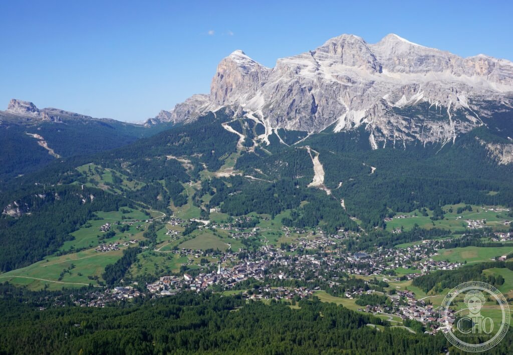
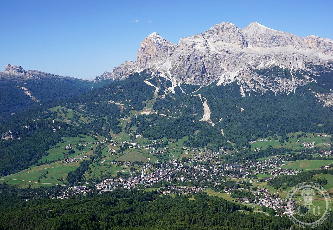
- GPS (Cortina d’Ampezzo, capoluogo Dolomiti): 46.5404° N, 12.1357° E
History
Da De Dolomieu alla scoperta della dolomia alle Olimpiadi al UNESCO 2009 (the most precisely Dolomiti zone history: the geological formation (the Dolomites were formed 250 million years ago (the Late Triassic period: 252–201 million years ago; the specific formation process: (1) the Triassic atolls: the area now occupied by the Dolomites was a tropical shallow sea (the Tethys Ocean: the Mesozoic sea that separated Laurasia from Gondwana; located at approximately 25° N latitude, similar to the modern Bahamas; mean water depth 20–50 m); (2) the coral atolls: carbonate platforms (reefs of corals, sponges, and calcareous algae) grew to 1,000+ m thickness in the Triassic sea; the specific organisms: Dachsteinkalk limestone (shallow-water facies) + Hauptdolomit (the platform dolomite: originally deposited as limestone and subsequently transformed into dolomite by magnesium-rich groundwater percolation during burial — the process of “dolomitization”)); (3) the uplift: the Tethys Ocean closed as Africa moved north into Europe (40–5 million years ago); the Alpine orogeny (mountain building) compressed and uplifted the Triassic carbonate platforms; the current altitude of the Dolomites (2,000–3,343 m) is the result of 40 million years of uplift (at an average rate of 0.1 mm/year)); the scientific discovery (Déodat de Dolomieu (1750–1801 CE): the French geologist who first identified the specific rock: the visit to the Dolomiti in 1789–91 CE; the paper (1791 CE: “Sur un genre de pierre calcaire très-peu effervescente avec les acides, et phosphorescente par la collision” (On a type of limestone that effervesces very little with acids and phosphoresces by collision); the specific observation: normal limestone (CaCO3) dissolves easily in hydrochloric acid; the Dolomiti rock (CaMg(CO3)2) effervesces only weakly; the mineral was named “dolomite” after De Dolomieu by Nicolas de Saussure in 1792 CE)); the mountaineering history (the first ascent of the highest Dolomiti summit: the Marmolada summit (Punta Penia 3,343 m) was first reached on 28 September 1864 CE by Paul Grohmann (Austrian mountaineer) and guides Angelo and Fulgenzio Dimai; 2009 CE UNESCO natural heritage inscription reference 1237).
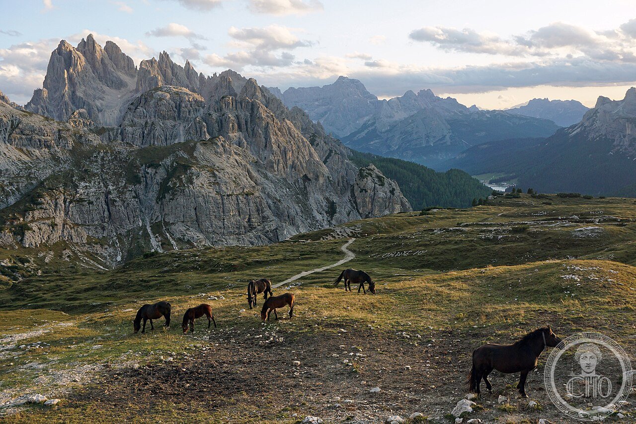
What you see
Le Tre Cime di Lavaredo, Cortina d’Ampezzo, le Pale di San Martino, il sentiero Messner, e la via ferrata (the most precisely Dolomiti zone visit (minimum 3–5 days for the main highlights): the seasonal strategies (summer (June–October): best for hiking (the high-altitude trails are snow-free July–September); the Alte Vie (the “High Routes”): 7 numbered long-distance trails crossing the entire Dolomiti WHS area: the most famous: Alta Via 1 (120 km; Lago di Braies to Belluno; 12–14 days)); winter (December–April): ski resorts: the Dolomiti Superski (the largest ski area in the world by number of connected lifts: 1,200 km of pisted runs + 450 lifts + 12 resorts; the “Giro delle Dolomiti” ski itinerary: Arabba → Corvara → Alta Badia → Val Gardena → Alpe di Siusi → Fiemme: 7 resorts, 500 km of runs; the Sellaronda: the 4-resort ring (Arabba, Corvara, Colfosco, Canazei) that can be skied in 1 day (26 km; 14 lifts; 50 km total run distance))); the Tre Cime access (summer: the Rifugio Auronzo road (€30 toll + €6 parking; open mid-June to mid-October); the circuit (10 km; 2.5 hours; level: intermediate; the Rifugio Lavaredo (2344 m; open June–October; meals + beds; booking essential in July–August at rifugiolavaredo.it)); winter (December–April): the access road is closed but the Tre Cime can be reached on snowshoes from Dobbiaco (12 km each way: a full-day hike)); the Lagazuoi and the Great War galleries (Passo Falzarego, 2105 m; gondola from Falzarego base to Lagazuoi summit (2752 m); the WWI tunnel circuit from the summit: 800 m of original Austrian military tunnels with 8 mine craters; the Museo delle Grande Guerra at Lagazuoi summit (open summer; the “Fiat Topolino found in 1984 CE in a snow cave near the summit” — a 1942 CE Fiat 500 used by the German Wehrmacht as an alpine supply vehicle; abandoned in a crevasse in 1945 CE; found intact in 1984 and now on display).
Practical information
- La Dolomiti Card: come risparmiare su piste, bus, e rifugi con un unico pass: il Guest Card sistema (ogni comune delle Dolomiti ha il proprio sistema di guest card attivabile presentando la ricevuta dell’alloggio (l’attivazione è automatica dal primo giorno di soggiorno): (1) Cortina d’Ampezzo Guest Card (estate: bus gratuiti + navetta Tre Cime gratuita nei giorni in cui la strada Auronzo è chiusa alle auto (domenica + festivi luglio-agosto) + riduzione €5 su musei e impianti); (2) Val Gardena Card (inverno: alcuni impianti di risalita gratuiti in settimana; estate: hiking bus gratuito su 15 linee); (3) Südtirol/AltoAdige Guest Card (se alloggiate in strutture iscritte al sistema): bus BLS gratuito in Alto Adige + riduzione impianti; il momento migliore per evitare la folla (le Tre Cime sono le più affollate delle Dolomiti: luglio-agosto weekend 3.000–5.000 visitatori/giorno; andare in settimana, o arrivare al Rifugio Auronzo prima delle 8 AM per il parcheggio gratuito (i primi 200 posti sono liberi prima che il pedaggio scatti); il tramonto (17–20 in estate): spesso il turno pomeridiano è meno affollato del mattino))
Getting there
Trenitalia da Venezia a Calalzo di Cadore (3h, €15.90), poi bus SAD/Dolomiti Bus a Cortina (1h, €5). In auto: A27 Venezia–Belluno, poi SS51 fino a Cortina (190 km da Venezia; 2h30). GPS Cortina d’Ampezzo: 46.5404, 12.1357.
Nearby
- Cortina d’Ampezzo 2026: Sede delle Olimpiadi Invernali Milano-Cortina — le piste della discesa + slalom gigante; Olimpiadi 6–22 febbraio 2026; i nuovi impianti di Olimpia delle Tofane (inaugurazione 2025)
- Bolzano / Bozen: Museo Ötzi e Castel Roncolo — 110 km ovest (Trenitalia da Verona 1h10 €12.90; l’Uomo del Similaun (Ötzi; 3300 BCE; il più antico essere umano conservato in Europa; Museo Archeologico dell’Alto Adige Via Museo 43; €13))
Gallery
Sources
- Wikipedia, Dolomites; Tre Cime di Lavaredo; Marmolada; Dolomieu, accessed June 2026
- UNESCO, The Dolomites, WHS natural reference 1237, inscribed 2009
- Comitato Glaciologico Italiano, Catasto dei Ghiacciai Italiani 2019 (the glacier area measurements used here)
Find it on the map
See this place and what’s around it →📷 Diventa un fotografo di Cultural Heritage Online
Condividi le tue foto dei luoghi: restano pubblicate con la tua firma come autore. Più vengono viste, più ti fai conoscere — e presto un concorso premierà le foto più apprezzate.
Accedi o registrati gratis per aggiungere una foto