

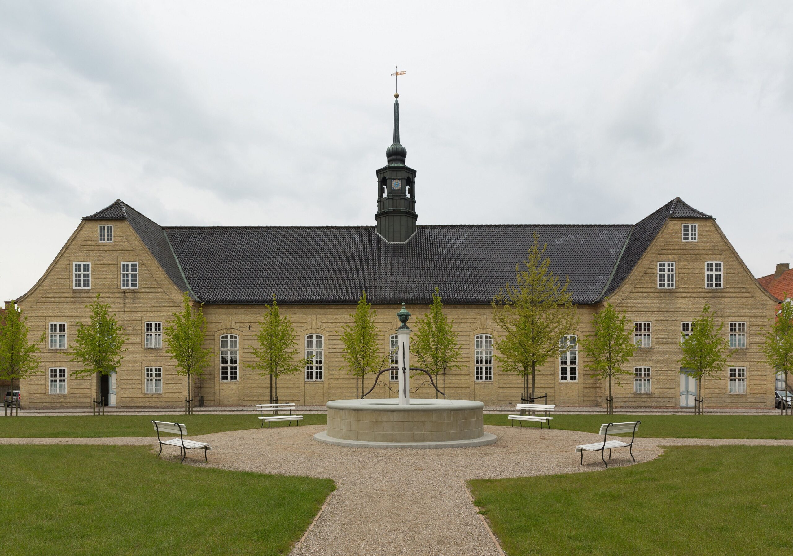
In 1773, the Moravian Brethren built a model town in rural Denmark embodying their vision of Christian equality. Identical houses, identical grave markers, a community where rank dissolved at the threshold of the church. Two and a half centuries later, it remains almost entirely unchanged.
At a glance
Christiansfeld is a planned town in South Jutland founded by the Herrnhuter Brudergemeine (Moravian Brethren) with the express permission of the Danish Crown. Laid out on a strict grid around a central Brotherhood Square, every element of the town reflects the theological convictions of one of Protestantism oldest denominations: equality before God, communal life organised by gender and marital status, and the subordination of individual expression to congregation. UNESCO inscribed it in 2015 as an outstanding example of a planned religious community.
Key facts
- UNESCO inscription: 2015, Cultural — criteria (iii)(iv)
- Location: Christiansfeld, South Denmark Region, Denmark
- Founded: 1773 by the Herrnhuter Brudergemeine (Moravian Brethren)
- Denomination: Moravian Church, founded 1722 in Herrnhut, Saxony
- Urban plan: Grid with central Brotherhood Square (Brodremenighedspladsen)
- Church: Completed 1776; identical yellow-brick residential rows, 18th century
- Cemetery: God Acre (Gudsager) with identical flat grave markers in rows
- Status: Active Moravian congregation; Choir Houses still in use
History
The Moravian Brethren trace their spiritual origins to the Czech reformer Jan Hus (executed 1415). Reconstituted in 1722 by Count Nikolaus Ludwig von Zinzendorf on his Saxony estate, the renewed Brethren developed a distinctive piety centred on communal singing, missionary work, and a communal life structured by the Choir system.
By the mid-18th century the Brethren had planted settlements across Europe and North America: Herrnhut (1722), Niesky (1742), Zeist (1746), Gracehill in Ireland (1759), and Bethlehem, Pennsylvania (1741). Christiansfeld was founded in 1773 when the Danish Crown offered land in South Jutland as part of an economic development initiative. The town plan was drawn up in Herrnhut and built in local yellow brick. It quickly became a prosperous craft centre, noted especially for its honey cakes (honningkager).
After Danish-Prussian territorial shifts in 1864 and 1920, Christiansfeld passed in and out of German administration. Its survival intact owes to isolation from industrialisation and to the community steady conservatism in maintaining its built fabric as an expression of faith.
What you see
The central space is Brodremenighedspladsen (Brotherhood Square), a long rectangular open area flanked by the Congregation Church (1776), the Widows House, and rows of identical two-storey yellow brick buildings. Facades are uniformly plain, windows proportioned identically, rooflines level. Architectural ornament was deliberately excluded.
The Choir Houses for Single Sisters, Single Brothers, Married Couples, and Widows each have their own entrance and cemetery section. The Single Sisters House is the best-preserved and open to visitors.
The God Acre (Gudsager) is the most arresting sight: hundreds of identical flat white sandstone markers in precise rows on a lawn, each bearing only name and dates. Bishops and servants receive the same stone. The visual egalitarianism is striking.
The community bakery on Lindegade sells honningkager to an unchanged 18th-century recipe.
The Moravian network
Christiansfeld is one node in a network of Moravian settlements from Herrnhut (Germany) to Gracehill (Northern Ireland) to Bethlehem (Pennsylvania). The UNESCO inscription recognised this network dimension: Outstanding Universal Value lies in what the settlement demonstrates about the Brethren capacity to translate theological conviction into a consistent built environment across continents. Christiansfeld is considered the best-preserved node because it never underwent significant alteration.
Practical information
- Address: Lindegade 26, 6070 Christiansfeld, Denmark
- Visitor centre: Christiansfeld Center on Lindegade
- Church: Open daily in summer; guided tours in Danish, German, and English
- God Acre: Open at all times, no admission
- Honey cakes: Community bakery on Lindegade
- Best season: April-October
Getting there
- By car: Route 170 between Kolding and Haderslev; 20 km northeast of Haderslev, 25 km south of Kolding
- By rail: Kolding station (Copenhagen IC, 2.5 hrs) then local bus to Christiansfeld
- From Germany: Flensburg 60 km south, Schleswig 70 km south via E45 motorway
- Nearest airport: Billund (BLL) 45 km northwest; Copenhagen (CPH) 250 km north
Nearby
- Hedeby and the Danevirke UNESCO WHS — 70 km south in Germany, the Viking Age trading town and frontier earthwork
- Haderslev Cathedral — 20 km west, a red-brick Gothic cathedral, finest medieval church in South Jutland
- Koldinghus Castle — 25 km north, medieval royal castle, now museum of applied arts and Danish royal history
- Jelling UNESCO WHS — 55 km north, 10th-century runic stones and burial mounds of the Danish royal dynasty
Sources
- UNESCO World Heritage List — Christiansfeld, a Moravian Church Settlement (2015)
- Christiansfeld Center official site, christiansfeldcenter.dk
- Unitatsarchiv der Evangelischen Bruder-Unitat (Herrnhut), Moravian Church archives
- Vogt, P. (2007). Everywhere at Home. Journal of Moravian History 2.
- Hamilton, J.T. and Hamilton, K.G. (1967). History of the Moravian Church. Moravian Church in America.
Find it on the map
See this place and what’s around it →📷 Become a Cultural Heritage Online photographer
Share your photos of places: they stay published under your name as the author. The more they're seen, the more you get noticed — and soon a contest will reward the most appreciated photos.
Log in or sign up free to add a photo