

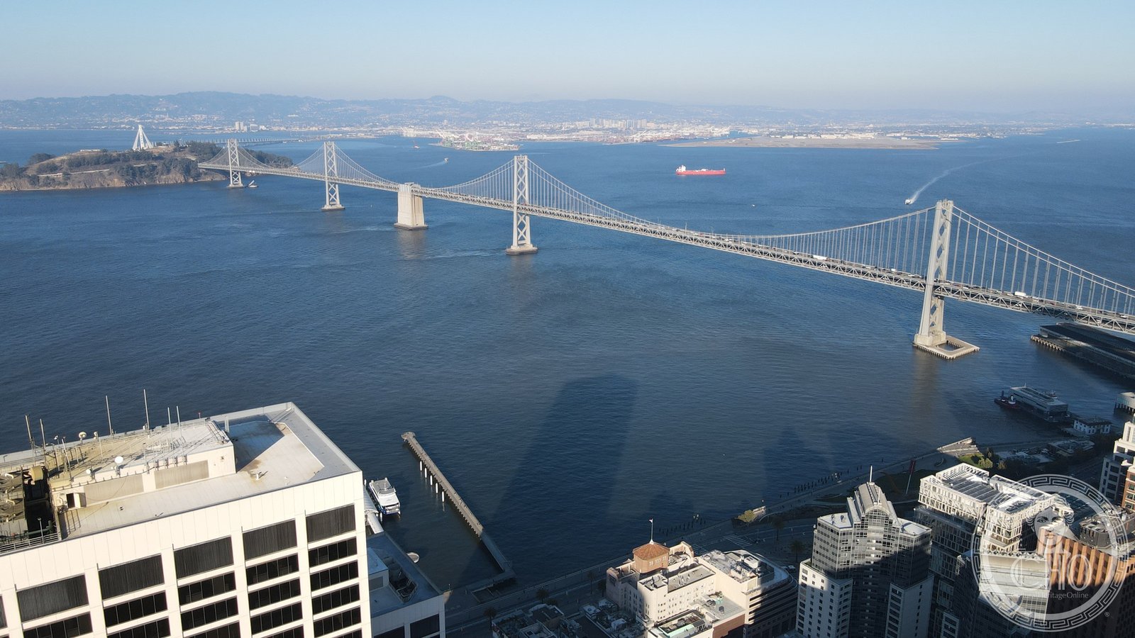
When it opened in November 1936 — six months before the Golden Gate — the Bay Bridge was one of the longest bridges in the world, its Art Deco towers framing the principal crossing of San Francisco Bay.
At a glance
The western span of the Bay Bridge, the double-suspension structure that runs from San Francisco to Yerba Buena Island, is the original 1936 engineering and remains among the most recognisable pieces of American civic infrastructure of the Art Deco era. Its twin towers — rising 474 feet above water — carry the design language of streamlined modernism into civil engineering at a scale that few contemporaries matched. The bridge was the work of the California Division of Highways under Chief Engineer Charles H. Purcell; construction involved thousands of workers and consumed more steel than the Golden Gate.
Key facts
- Opened: 12 November 1936
- Type: Double-deck suspension bridge (western span)
- Chief Engineer: Charles H. Purcell, California Division of Highways
- Tower height: 474 feet (144 m) above water
- Total length: 4.5 miles (7.2 km) including approaches
- Designation: California Historical Landmark
- Status: Western span (1936) remains in active use; eastern span replaced 2013
History
Planning for a fixed crossing of San Francisco Bay began in earnest in the late 1920s, spurred by the rapid growth of the East Bay cities and the inadequacy of ferry service. Construction started in July 1933, amid the depths of the Great Depression, as a federal public works project. When it opened on 12 November 1936, the bridge preceded the Golden Gate Bridge by six months and immediately became the primary automobile crossing of the bay, carrying both upper and lower decks of traffic — cars above, trucks and interurban trains below.
The western span, connecting San Francisco to the mid-bay anchorage at Yerba Buena Island, consists of two suspension bridges sharing a central anchorage — an engineering configuration unique among major American bridges of the period. This original 1936 structure remains in service today. The eastern span, connecting Yerba Buena Island to Oakland, was replaced after the 1989 Loma Prieta earthquake severely damaged it; the new self-anchored suspension eastern span opened in 2013. The Bay Bridge thus exists in two eras simultaneously, its Art Deco western towers unchanged since the New Deal years.
The bridge was declared a California Historical Landmark in recognition of its engineering and architectural significance. It has appeared in countless films, photographs, and paintings — a visual shorthand for San Francisco almost as familiar as the Golden Gate.
What you see
The western towers are the most architecturally legible elements of the Art Deco programme. Their shafts taper slightly as they rise, and the surfaces are dressed with vertical fluting that accentuates the upward thrust. The tower tops carry a stepped crown rather than a classical capital, placing them firmly within the vocabulary of 1930s modernist civic architecture — comparable in spirit to the mast of the Empire State Building or the setback profiles of Rockefeller Center. At night, the cables and towers are illuminated; the Bay Lights installation, a permanent LED artwork by Leo Villareal on the western span’s main cables, adds a kinetic layer to a structure already given to spectacle.
The best views of the western span’s Art Deco towers are from the Embarcadero waterfront, the Bay Bridge Trail on Treasure Island, or from the water itself on a bay cruise. The size of the towers, standing 474 feet above the water’s surface, only becomes fully apparent at close range — from the shore they appear almost intimate against the scale of the bay.
Practical information
- Access: The Bay Bridge Trail allows pedestrian and cycling access on the upper deck between Oakland and Yerba Buena Island (eastern side); the western span is vehicle-only
- Best views: The Embarcadero, Rincon Park, and the western end of Treasure Island
- Bay cruises: Various operators offer views of the bridge from the water year-round
- Tolls: Westbound toll collected electronically (FasTrak or invoice)
- Time needed: 30–60 minutes for waterfront photography; half-day if combining with Treasure Island
Getting there
The bridge connects San Francisco (I-80 West) to Oakland (I-80 East / I-580 / I-880) across Yerba Buena Island. From downtown San Francisco, the Embarcadero waterfront is walkable from BART’s Embarcadero Station. AC Transit and BART provide transit connections to the East Bay. Treasure Island, accessible via exit from I-80, offers the closest non-waterfront vantage point for the western towers.
Nearby
- The Ferry Building (1898), San Francisco Embarcadero — Beaux-Arts transit terminal and marketplace at the western foot of the bridge
- Coit Tower (1933), Telegraph Hill — Art Deco fluted concrete column with Bay panoramas and New Deal murals
- Treasure Island — mid-bay artificial island created for the 1939 Golden Gate International Exposition, now a residential neighbourhood with spectacular bridge views
Sources
- California Department of Transportation (Caltrans) — Bay Bridge history and engineering documentation
- California Office of Historic Preservation — Historical Landmark record
- Bay Area Toll Authority, bayareametro.gov — bridge history and Bay Lights documentation
- National Register of Historic Places — San Francisco–Oakland Bay Bridge nomination
Find it on the map
See this place and what’s around it →Record researched and written by Luigi De Marchi for Cultural Heritage Online, 2026.
📷 Become a Cultural Heritage Online photographer
Share your photos of places: they stay published under your name as the author. The more they're seen, the more you get noticed — and soon a contest will reward the most appreciated photos.
Log in or sign up free to add a photoIs this page about you?
This page is read by travellers and heritage enthusiasts who find it on Google. Tell us how you are connected to this place and we will take it from there.