Latina does not look like any other Italian provincial capital, and the reason is simple: it was drawn, whole, in 1932. Founded as Littoria on the drained Pontine Marshes and renamed in 1945, it was the first of the five new towns of the reclamation — the working prototype for everything that followed at Sabaudia, Pontinia, Aprilia and Pomezia. Its centre can still be read exactly as the architect Oriolo Frezzotti conceived it: a radial plan whose streets converge on one piazza, one tower, one idea of a town. The full story of the foundation is in the archive’s city entry for Latina (Littoria).
A capital drawn in one gesture
Frezzotti’s plan of 1932 is radiocentric: from Piazza del Popolo the main streets radiate outwards, and every approach to the city ends at its centre. The buildings that frame that centre went up with astonishing speed — the city was inaugurated on 18 December 1932, months after the first stone — and nearly all of them are still in place and still in use. What was meant as the showcase of the reclamation is today an ordinary, working Italian city, which is precisely what makes it interesting to walk: the rhetoric has evaporated, the architecture remains.
Five buildings, one walk
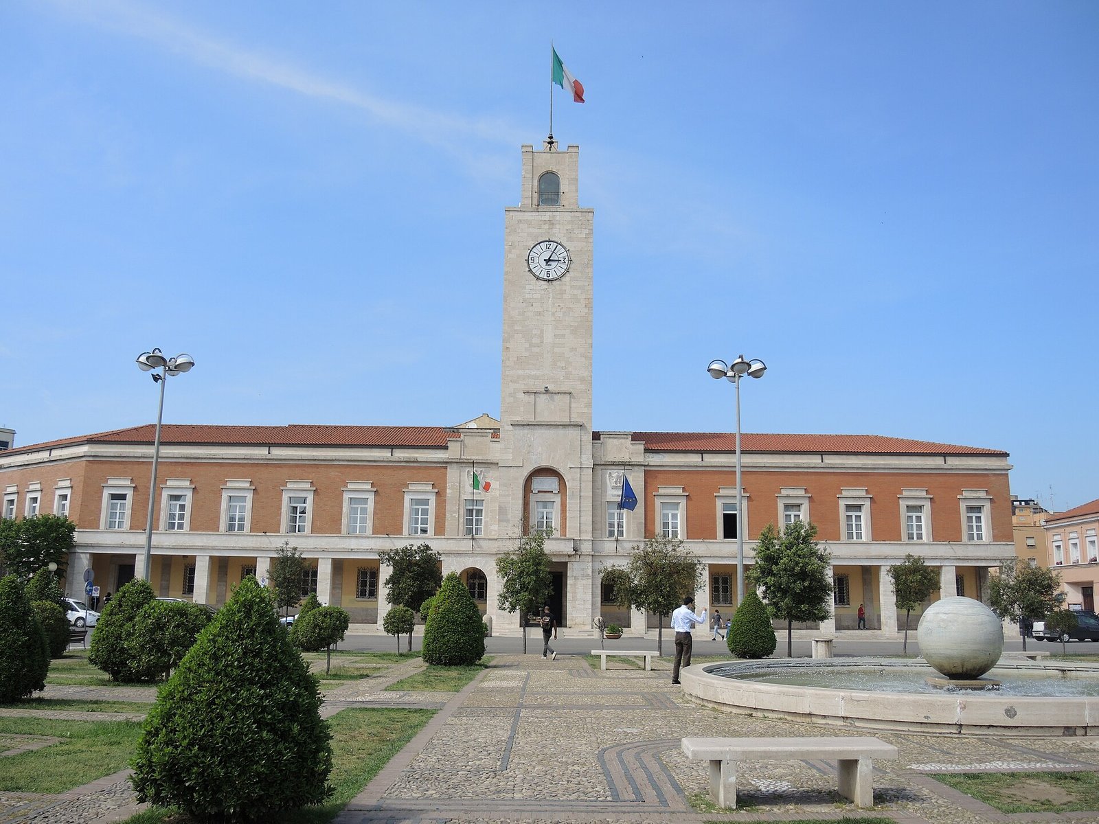
The itinerary starts at the Palazzo Comunale, Frezzotti’s town hall of 1932–33, whose 32-metre travertine clock tower was designed to be seen from the whole plain. From there it is a few minutes to the Palazzo del Governo, the prefecture Frezzotti built when the young town was promoted to provincial capital in 1934 — a sterner, more monumental front than the municipal palace.
The third stop is the Cathedral of San Marco, the rationalist cathedral of the new town, and the fourth is the building visitors photograph most: Palazzo M, Frezzotti’s block whose plan traces the letter M — the period’s propaganda written in masonry, preserved today as a document of its time. The walk ends at the former O.N.C. palace, headquarters of the agency that ran the reclamation, now the Pontine Land Museum — the right place to understand the drained landscape the whole city stands on.
Walk it with the map
The five stops are collected in the curated itinerary Latina (Littoria) Founded City Walk: an interactive map with the route, a play-through tour of the stops, and GPX and KML files to take along on your own navigator. Each stop links back to its full entry in the archive, with history, sources and practical notes.
Reading the first new town
Latina rewards a slower look than its reputation suggests. The centre is a compact catalogue of the founding years — brick and travertine, porticoes and towers, the plain classicism of public buildings meant to give a brand-new community an instant sense of permanence. Read together with Sabaudia, its celebrated rationalist sibling of 1934, it shows how wide the architectural range of the Pontine programme really was: five towns in seven years, no two alike.
These pages document that heritage place by place, without celebration and without erasure: what was built, by whom, and what it has become. The buildings are the evidence; the walk is the way to read them.
Sources
- S1 — Ghirardo, Diane. Building New Communities: New Deal America and Fascist Italy. Princeton University Press, 1989. ISBN 978-0-691-04060-8.
- S2 — Ciucci, Giorgio. Gli architetti e il fascismo: Architettura e città 1922–1944. Einaudi, 1989. ISBN 978-88-06-11656-9.
Spotted an error? Write to editorial@culturalheritageonline.com and we correct it the same day.