
Curated Itinerary
Latina (Littoria) Founded City Walk — Frezzotti’s Rationalist Centre
Latina was founded in 1932 as Littoria, the first of the new towns on the drained Pontine Marshes, and almost everything in its centre was drawn by one architect. Five stops, two kilometres. Oriolo Frezzotti’s Palazzo Comunale stands at the centre of his own radial plan, its travertine clock tower visible from across the town. The Palazzo del Governo of 1932 anchors Piazza della Libertà with a sober monumentality. The cathedral of San Marco went up in 1932–33, at the same time as the town around it. Palazzo M, built from 1938, is a four-storey block laid out in the shape of an M. The walk ends at the Museo della Terra Pontina, in the monumental former palace of the Opera Nazionale Combattenti. One hand, one decade, and a whole town centre to read it on. Stefano Vigolo tells the full story in a separate article.
Take this route into Google Maps
From Palazzo Comunale di Latina — Frezzotti’s Civic Tower on Piazza del Popolo (1932-33) to Pontine Land Museum – Former O.N.C. Palace – Virtual Tour 360°, in the order we curated them.
➤ Turn on the navigator in Google MapsIt opens in the Google Maps app with every stop already loaded, in the order we put them in. From there the route is yours: pick how you travel — on foot, by bike, by public transport or by car — change where you start and where you end, drag the stops into a different order, and add places of your own along the way.
Five stops through the founding centre of Latina (Littoria, 1932), from Frezzotti’s Palazzo Comunale to Palazzo M and the Pontine Land Museum. Read the full story in the dedicated article Latina (Littoria), 1932: Walking the First New Town of the Pontine Marshes, by Stefano Vigolo.
Step by step
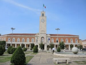
Palazzo Comunale di Latina — Frezzotti’s Civic Tower on Piazza del Popolo (1932-33)
The town hall of the first Pontine new town, built by Oriolo Frezzotti at the centre of his radial plan, its travertine clock tower visible across…
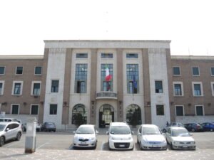
Palazzo del Governo — Latina’s Prefecture by Oriolo Frezzotti
Built in 1932 as the administrative heart of brand-new Littoria, the Palazzo del Governo still anchors Piazza della Liberta with the sober monumentality…
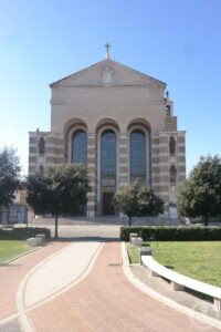
Cattedrale di San Marco Evangelista — Latina’s Rationalist Cathedral
Built in 1932–1933 to a design by Oriolo Frezzotti at the same time as the new town of Littoria — renamed Latina after the war — the church of San Marco is…
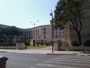
Palazzo M — Latina’s M-Shaped Rationalist Manifesto by Oriolo Frezzotti
Designed by Oriolo Frezzotti, master planner of Littoria, Palazzo M is a four-storey M-shaped block on Piazzale Araldo di Crollalanza built between 1938 and…
Pontine Land Museum – Former O.N.C. Palace – Virtual Tour 360°
The Pontine Land Museum (Museo della Terra Pontina) is housed in the former palace of the Opera Nazionale Combattenti (O.N.C.), a monumental Rationalist…
Download for tour navigation
PDF is the stop list with GPS, to print or keep on the phone. GPX for Garmin / Komoot / OsmAnd. KML for Google Earth and Maps.
Walk it with the navigator on
It opens in the Google Maps app with every stop already loaded, in the order we put them in. From there the route is yours: pick how you travel — on foot, by bike, by public transport or by car — change where you start and where you end, drag the stops into a different order, and add places of your own along the way.
To keep the route in the app instead of opening it once, download the KML above and import it into Google My Maps — Create a new map, then Import: the route then sits among your own maps in Google Maps, with the stops and our notes attached to each one.