

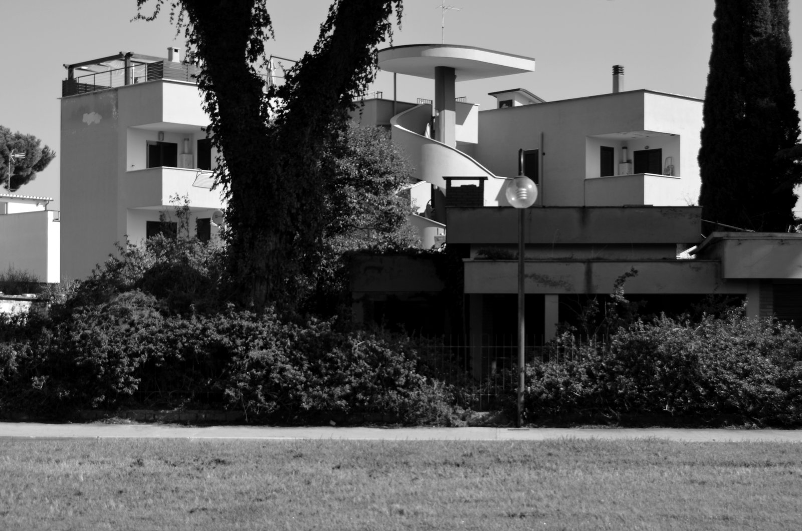
Sabaudia is one of the new towns built on the reclaimed Agro Pontino in the 1930s, and the one most consistently read as a coherent built statement of Italian rationalist urbanism. The master plan and the public buildings were designed in 1933 by Gino Cancellotti, Eugenio Montuori, Luigi Piccinato and Alfredo Scalpelli; the foundation stone was laid on 5 August 1933 and the town was inaugurated 253 days later, on 15 April 1934.
At a glance
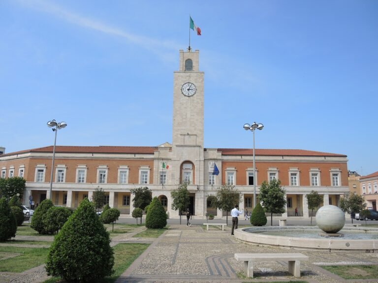
Sabaudia sits on the Tyrrhenian coast between Rome and Naples, in the province of Latina, on a narrow strip of land between the Lago di Paola and the open sea. The historic centre faces a single ceremonial square, Piazza del Comune, around which the four winning architects arranged the institutions of the new town: the town hall with its slender civic tower, the parish church of the Santissima Annunziata, the post office and the buildings of the fascist-era public welfare bodies. The street grid behind the square is rectangular and unemphatic, deliberately set against the irregular shoreline of the lake. Most of the comune territory falls inside the Parco Nazionale del Circeo, established the same year the town was inaugurated.
Key facts
- Architects: Gino Cancellotti, Eugenio Montuori, Luigi Piccinato, Alfredo Scalpelli (winners of the 1933 ONC competition); Palazzo delle Poste by Angiolo Mazzoni.
- Competition: launched by the Opera Nazionale Combattenti on 21 April 1933.
- Construction: foundation stone 5 August 1933; inaugurated by Mussolini on 15 April 1934 — 253 days from start to opening.
- Movement: Italian architectural rationalism, in the orbit of Gruppo 7 and MIAR.
- Setting: Agro Pontino reclamation; Lago di Paola and Parco Nazionale del Circeo (1934).
- Patron saint: Maria Santissima Annunziata, 25 March.
- Province: Latina, Lazio · population around 19,000.
History
The Agro Pontino, the marshy plain south of Rome, had defeated every Italian state that tried to drain it since antiquity. The fascist government turned the reclamation into a public spectacle in the late 1920s, draining the wetlands with northern labour and founding a sequence of new towns on the dried land — Littoria (now Latina) in 1932, then Sabaudia, Pontinia, Aprilia and Pomezia. The Opera Nazionale Combattenti, the para-state body in charge of resettling First World War veterans on the new farmland, ran the operation and on 21 April 1933 published the competition for the second of these towns.
The winning project was signed by Luigi Piccinato with Gino Cancellotti, Eugenio Montuori and Alfredo Scalpelli — four young Roman-trained architects who proposed an open, low-rise plan tied to the lake rather than a closed monumental composition. Construction began on 5 August 1933. Two hundred and fifty-three days later, on 15 April 1934, Mussolini inaugurated the town in front of an audience the contemporary press numbered at around twenty thousand. The new comune was named for the Savoy dynasty (dinastia sabauda), and placed under the patronage of the Annunziata, protector of the royal house.
Sabaudia became the administrative seat of the Parco Nazionale del Circeo, established later in 1934, and passed from the province of Rome to the new fascist province of Littoria, renamed Latina after the war. After 1945 the rationalist core remained largely intact, and from the 1960s the town turned into a discreet summer retreat for the Roman cultural world — among the regular visitors of the second half of the twentieth century were Pier Paolo Pasolini and Alberto Moravia, whose name was later given to one of the central squares.
What you see
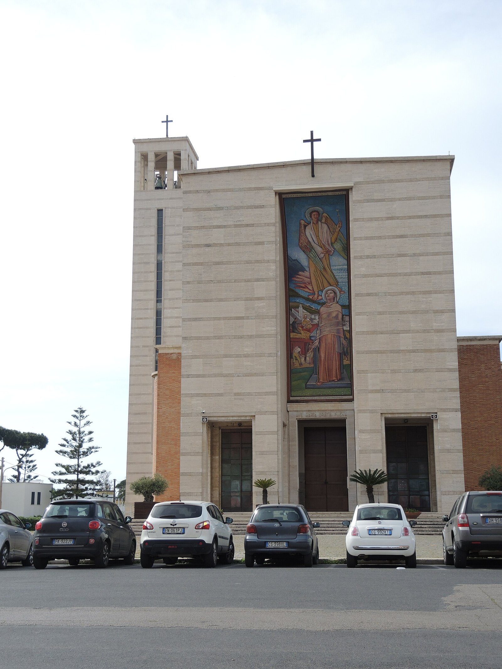
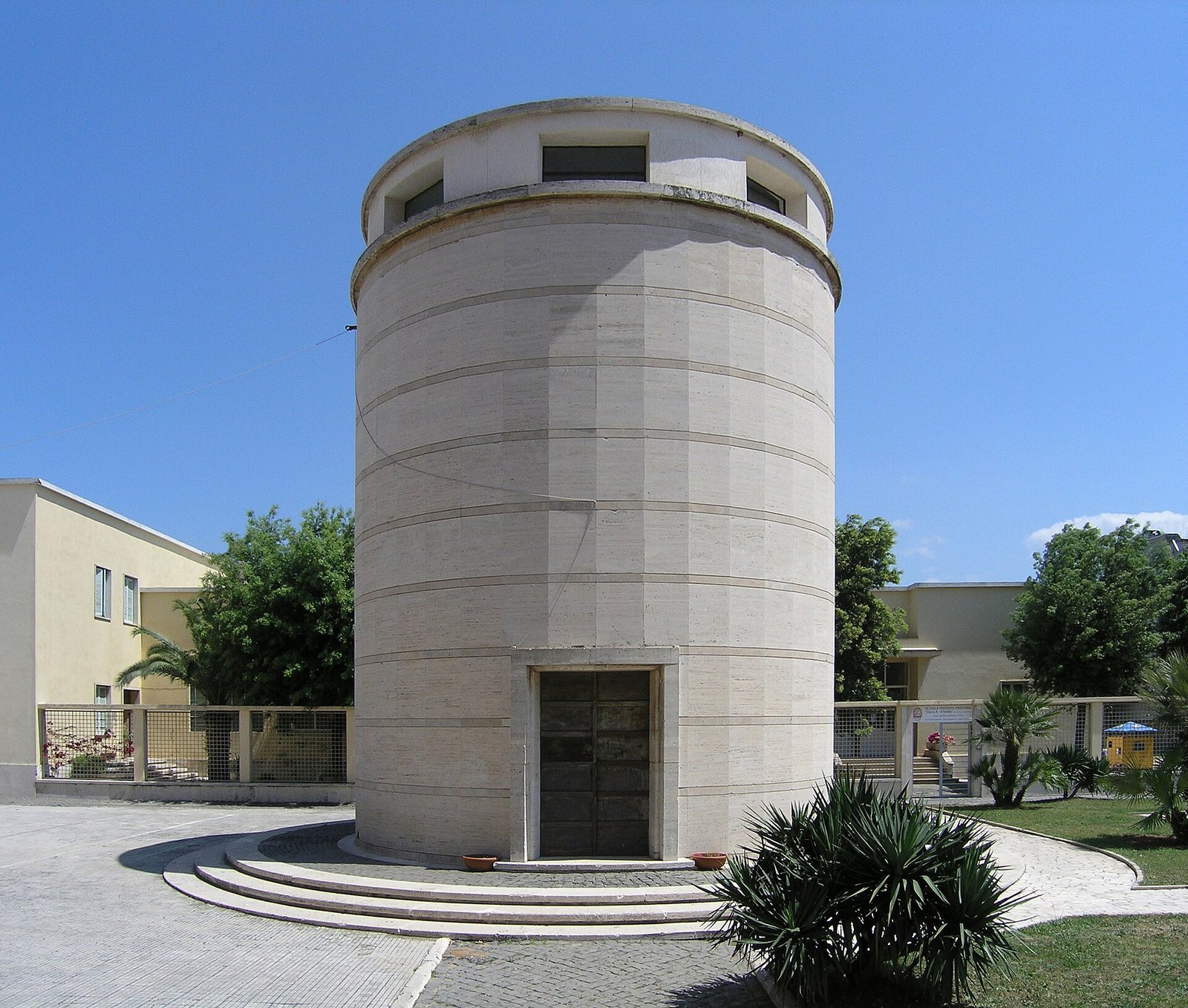
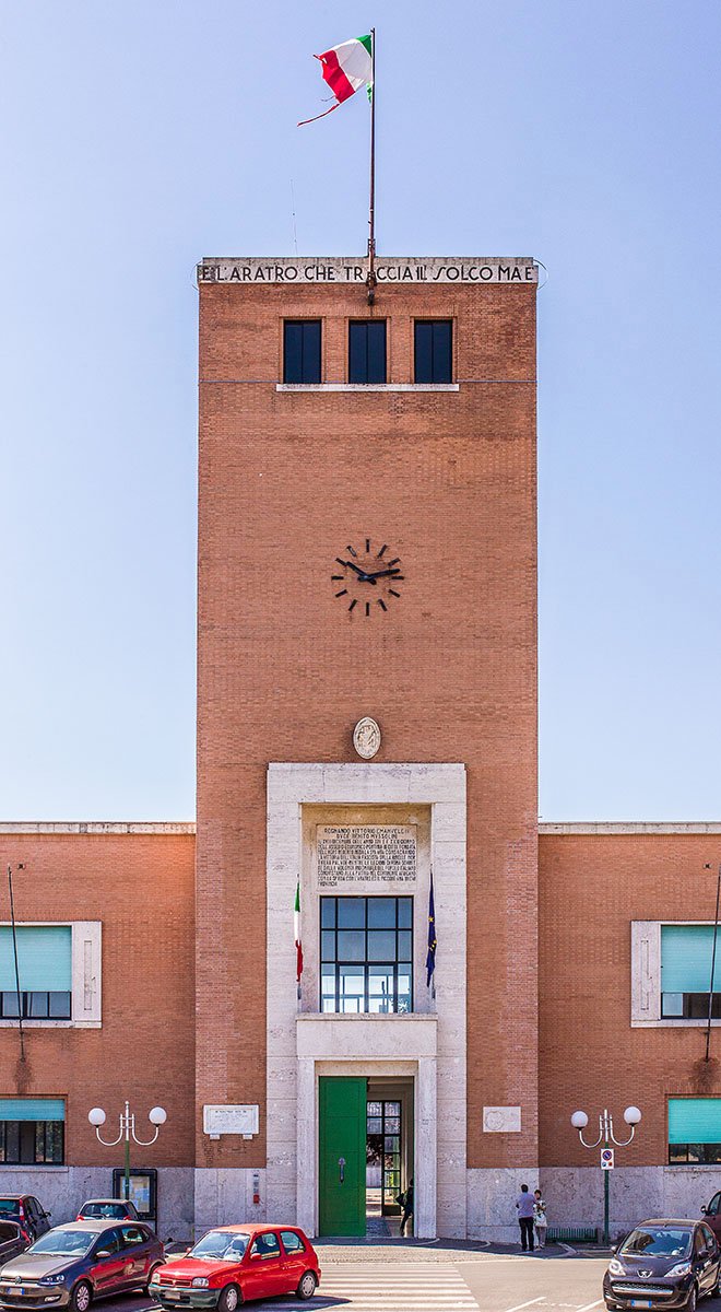
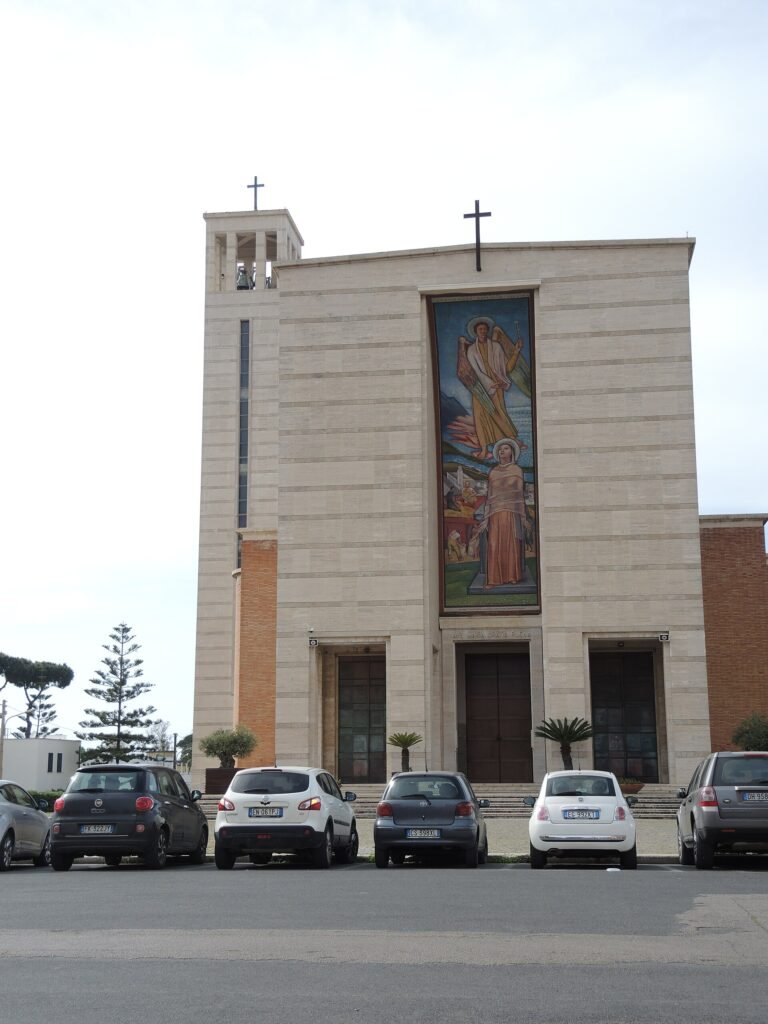
Piazza del Comune is the room where the project is most legible. The Palazzo Comunale sits on its long side as a single low block faced in white plaster, with a square Torre Civica rising on the corner: a tall, narrow shaft pierced by a single vertical slot of windows and crowned by an open belfry. The volume is deliberately stripped — no mouldings, no orders, no symmetrical wings — and reads as a piece of pure geometry against the sky. Opposite the town hall, the Chiesa della Santissima Annunziata, designed by Cancellotti and completed in 1935 with its detached baptistery, applies the same logic to a sacred building: a brick-faced nave, a free-standing campanile-tower, and a portico that frames the square rather than turning its back on it.
Along one flank stands the Palazzo delle Poste designed by Angiolo Mazzoni, the chief architect of the Italian state railways and postal service. Mazzoni raised the single ground-floor hall on a flight of steps, ran a continuous band of tall windows along its sides, and clad the entire exterior in small blue ceramic tiles — the blue of the Savoy livery — with a red Siena marble cornice. The aerodynamic profile and the saturated colour set the building apart from the white plaster of its neighbours and make it the most explicitly futurist-influenced object in the square. Behind these institutional buildings, the residential grid spreads westward in low two-storey houses with deep balconies, opening at the end of the axis onto the Lago di Paola.
Practical information
- What to see: Piazza del Comune (Palazzo Comunale, Torre Civica, Chiesa SS. Annunziata, Palazzo delle Poste); the lakeside promenade on Lago di Paola; the dunes and beaches inside the Parco Nazionale del Circeo.
- When to come: spring and early autumn give the strongest light on the white volumes; July–August is busy with Roman and Neapolitan beach traffic.
- Time needed: half a day for the town itself; a full day with the national park and the beach.
- Dress: comfortable walking shoes — the centre is flat and compact; light layers in shoulder season near the coast.
Getting there
Sabaudia lies about 90 km south of Rome and 160 km north of Naples, on the coastal road between Latina and Terracina. The nearest railway station is Priverno–Fossanova, on the Rome–Naples line, with COTRAL bus connections to Sabaudia of roughly 25–30 minutes. By car, the SS148 Pontina runs from the Rome ring road to the Sabaudia exit. The nearest airport is Rome Fiumicino.
Nearby
- Sabaudia Rationalist Walk — the curated itinerary of the civic centre, with map and GPX.
- Sabaudia, 1934 — the dedicated magazine article by Stefano Vigolo.
- Church of the Santissima Annunziata — Cancellotti’s travertine church with the Ferrazzi mosaic (1935).
- Palazzo Comunale and civic tower — the town hall of the founding plan.
- Parco Nazionale del Circeo — coastal dunes, the promontory of Monte Circeo and the four coastal lakes.
- Villa of Domitian — remains of the 1st-century imperial villa on the shore of Lago di Paola.
- San Felice Circeo — medieval hilltop village on the promontory, 15 km south.
- Latina — the first of the Agro Pontino new towns, founded 1932 as Littoria, 30 km north.
Image gallery

Sources
Find it on the map
See this place and what’s around it →Record researched and written by Stefano Vigolo for Cultural Heritage Online, 2026.
📷 Become a Cultural Heritage Online photographer
Share your photos of places: they stay published under your name as the author. The more they're seen, the more you get noticed — and soon a contest will reward the most appreciated photos.
Log in or sign up free to add a photo