
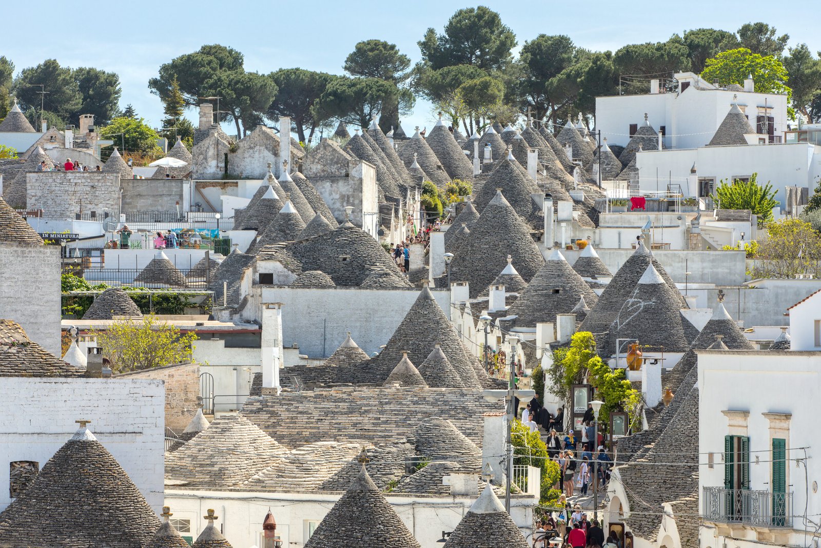
More than 1,500 dry-stone limestone dwellings with corbelled conical roofs, packed into two hillside quarters of the Itria Valley — the most intact surviving example of prehistoric corbel-vault domestic building.
At a glance
The trulli of Alberobello are a dense quarter of more than 1,500 limestone dwellings with conical dry-stone roofs, concentrated on two hills — Rione Monti and Rione Aia Piccola — in the Itria Valley of central Puglia. The town’s trulli were inscribed on the UNESCO World Heritage List in 1996 as an exceptional surviving example of the prehistoric building technique of dry-stone corbelling, kept alive into the modern era by Apulian peasant builders.
Key facts
- Location: Alberobello, Bari province, Puglia
- Coordinates: 40.7821° N, 17.2379° E
- UNESCO inscription: 1996, criteria iii, iv, v
- Two main quarters: Rione Monti (around 1,030 trulli) · Rione Aia Piccola (around 400)
- Building technique: dry-stone corbelled construction, no mortar in the roof
- Symbol of the town: Trullo Sovrano — the only two-storey trullo, built mid-18th century
History
The Itria Valley was repopulated from the fifteenth century by the Counts of Conversano, who granted land to peasant settlers on the condition that their dwellings could be dismantled quickly to evade royal census and taxation. Dry-stone trulli — built without mortar — met the requirement: a roof could be pulled down in hours when inspectors approached. The town’s name derives from the medieval oak forest, silva arboris belli, that once covered the area.
In 1797 King Ferdinand IV of Naples granted Alberobello the status of città regia, freeing its inhabitants from the count’s jurisdiction and ending the need for makeshift roofs. Construction techniques nonetheless persisted, and trulli continued to be built into the twentieth century. A 1909 royal decree protected Rione Monti as a national monument.
What you see
A trullo is built from local calcarenite split into rough slabs called chiancarelle. The walls are double, with a rubble core, often whitewashed. The conical roof rises from a circular or square base in concentric rings of progressively smaller stones, each course slightly oversailing the one below — pure corbelling, with no wooden centring and no mortar.
A keystone closes the cone, often surmounted by a carved pinnacle: sphere, disc, polyhedron or cross. Many roofs carry symbols painted in lime — zodiacal, Christian or primitive — whose exact meaning is debated by ethnographers. Highlights inside the urban perimeter: Rione Monti, the main quarter, with trulli converted to shops and short-let rooms; Rione Aia Piccola, quieter and still largely residential; the Trullo Sovrano, the only two-storey trullo, now a small museum; the Chiesa di Sant’Antonio, a 1927 church built in trullo form; and Casa d’Amore, the first building in Alberobello permitted in lime mortar, 1797.
Practical information
- Opening: the trulli quarters are an open urban area, free to enter at any time. Individual museums and Trullo Sovrano have ticketed hours.
- Best season: April–June and September–October. July–August get hot and crowded.
- Footwear: proper walking shoes — the chiancarelle streets are uneven and slippery in rain.
- Time needed: half a day for a first orientation; a full day to combine Monti, Aia Piccola and the Trullo Sovrano.
- Etiquette: many trulli in Aia Piccola are private homes — be quiet outside doorways.
Getting there
Alberobello sits on the Ferrovie Sud Est line between Bari and Taranto. Trains from Bari Centrale take roughly 1h 30m; the station is a 10-minute walk from the trulli quarters. By car, the SS172 dei Trulli connects Alberobello to Locorotondo, Martina Franca and Putignano in the surrounding Itria Valley. GPS: 40.7821, 17.2379 — open in Google Maps.
Nearby
- Locorotondo — hilltop town with concentric whitewashed streets, 9 km north.
- Martina Franca — Baroque centre and summer opera festival, 15 km south.
- Castellana Grotte — limestone cave system open to the public, 15 km north-west.
- Sassi di Matera — the natural pair in any southern-Italy vernacular-architecture itinerary, 70 km west.
Sources
- UNESCO World Heritage Centre — The Trulli of Alberobello (inscription dossier, 1996).
- Comune di Alberobello — portale istituzionale.
- Regione Puglia, Dipartimento Turismo.
- MiBACT, Soprintendenza ABAP per la città metropolitana di Bari.
Find it on the map
See this place and what’s around it →📷 Become a Cultural Heritage Online photographer
Share your photos of places: they stay published under your name as the author. The more they're seen, the more you get noticed — and soon a contest will reward the most appreciated photos.
Log in or sign up free to add a photo