
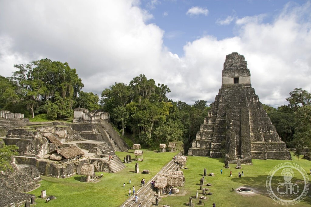
Rising above an unbroken canopy in the Petén lowlands, Tikal was the most powerful Maya city of the Classic Period, home to some 100,000 people at its sixth-century peak. Its five great temple-pyramids, still half-swallowed by jungle, remain one of the most complete records of Maya civic and religious life anywhere in Central America.
At a glance
Tikal lies within the Maya Biosphere Reserve, a vast tract of protected rainforest in northern Guatemala. More than 3,000 structures have been identified within the park, though only a fraction are open to visitors. At its centre stand five major pyramid-temples: Temple I, the funerary monument of the king Jasaw Chan K’awiil I; Temple II, built for his queen; Temple III, partly restored and partly still wrapped in tree roots; Temple IV, the tallest pre-Columbian structure known in Central America; and Temple V, whose builder remains unidentified.
Tikal was inscribed by UNESCO in 1979 as a Dual World Heritage Site, recognised for both its natural and cultural value, the first site in the Americas to receive that combined status.
Key facts
- Period: Maya Classic Period, roughly 200–900 CE, with occupation from around 900 BCE
- Temple I: the Temple of the Great Jaguar, built around 732 CE as the tomb of Jasaw Chan K’awiil I, whose burial chamber was found beneath the pyramid in 1962
- Temple IV: the tallest structure at Tikal, its summit platform giving views over the tops of the other temples above the forest canopy
- Heritage status: UNESCO Dual World Heritage Site, inscribed 1979
- Setting: within the Maya Biosphere Reserve, El Petén Department, Guatemala
History
Tikal was settled from around 900 BCE, and the oldest surviving structure, the main pyramid of the Mundo Perdido complex, dates to roughly 300 BCE. The complex appears to have had an astronomical function, its four subsidiary temples oriented to the cardinal directions with the main pyramid used as an observation point aligned to the equinox sunrise.
In 378 CE Tikal’s history was reshaped by the arrival of a figure associated with Teotihuacan, on the same day that the reigning king of Tikal died. In the following period the city absorbed Teotihuacan pottery styles, dress and imagery, before eventually defeating Teotihuacan’s regional allies and emerging as the dominant Maya power. Tikal reached its greatest extent in the sixth century, with a population estimated at 100,000.
The city was largely abandoned between 800 and 900 CE; the last Long Count date recorded at Tikal is 879 CE, and its population appears to have collapsed within a century. It was rediscovered in 1848 by Ambrosio Tut, and systematic excavation began in 1956 under the University of Pennsylvania Tikal Project. Tikal National Park was inscribed as a UNESCO Dual World Heritage Site in 1979.
What you see
The Great Plaza, flanked by Temple I and Temple II, is the natural starting point, its grass often still wet with dew in the early morning while howler monkeys call across the site. Climbing Temple I has been forbidden since 2006 following a visitor’s death, but Temple IV remains open, and its summit offers a view over the pyramid tops of Temples I, II and III breaking through the surrounding rainforest, a scene familiar from its use as the exterior of the rebel base in Star Wars: A New Hope.
The Mundo Perdido complex, Tikal’s oldest section, is generally quieter than the main plazas and rewards a slower visit. Wildlife is a constant presence throughout the park, from coatis that approach visitors in the Great Plaza to spider monkeys, toucans and parrots. A visitor centre near the entrance sets the archaeological finds in context before or after the walk through the ruins.
Practical information
- Opening times: the park operates within set daily hours; visitors wanting the Temple IV sunrise need an early-entry permit, arranged in advance through the park’s official channels
- Accommodation: a small number of lodges, including the Tikal Inn and the Jungle Lodge, sit inside the park itself and should be booked well ahead during the dry season from December to April
- Guided visits: sunrise tours departing from Flores are the most common way to combine the early entry permit with transport
Getting there
Tikal is reached via Flores/Santa Elena airport, the main gateway for visitors to the park, or overland and by domestic flight from Guatemala City. Current schedules and transfer options are best checked directly with the park or with transport operators in Flores.
Nearby
- Yaxhá — around 60 km east of Tikal along an unpaved road; a lakeside Maya site with the Temple 216 overlooking Lake Yaxhá and Lake Sacnab, considerably less visited than Tikal and known for its use as a filming location for the television series Survivor
- Caracol, Belize — around 250 km north-east via the Melchor de Mencos border crossing; the most extensively excavated Maya site in Belize, home to the Caana pyramid, the country’s tallest man-made structure
Sources
- UNESCO
- University of Pennsylvania Tikal Project
Find it on the map
See this place and what’s around it →Historical events at this place (1)
📷 Become a Cultural Heritage Online photographer
Share your photos of places: they stay published under your name as the author. The more they're seen, the more you get noticed — and soon a contest will reward the most appreciated photos.
Log in or sign up free to add a photo