

Once the largest fortified city in the ancient Near East, this monumental archaeological tell reveals the rise and fall of a Bronze Age powerhouse that commanded the Fertile Crescent.
At a glance
Tel Hazor sprawls across 82 hectares (205 acres) in the Korazim Plateau, north of the Sea of Galilee. The site comprises an upper tell of 12 hectares and a lower city exceeding 70 hectares, making it the largest archaeological site in northern Israel. From around 1750 BCE through the ninth century BCE, Hazor functioned as a vital hub of commerce, political power, and cultural exchange across the ancient Mediterranean world.
History
Hazor rose to prominence during the Middle Bronze Age and maintained its dominance through the Iron Age. The city controlled critical trade routes and conducted extensive commerce with Babylon and Syria, importing vast quantities of tin to fuel its renowned bronze industry.
The Bible situates Hazor at the center of Canaanite resistance to Joshua’s conquest, describing it as “the head of all those kingdoms” (Joshua 11:10). Archaeological evidence corroborates the city’s exceptional strategic and economic importance within the ancient Near East.
Yigael Yadin’s expedition in the mid-1950s transformed understanding of the site, becoming one of Israel’s most significant early archaeological undertakings. The excavations revealed layers of occupation spanning centuries and confirmed Hazor’s status as a major ancient metropolis.
What you see
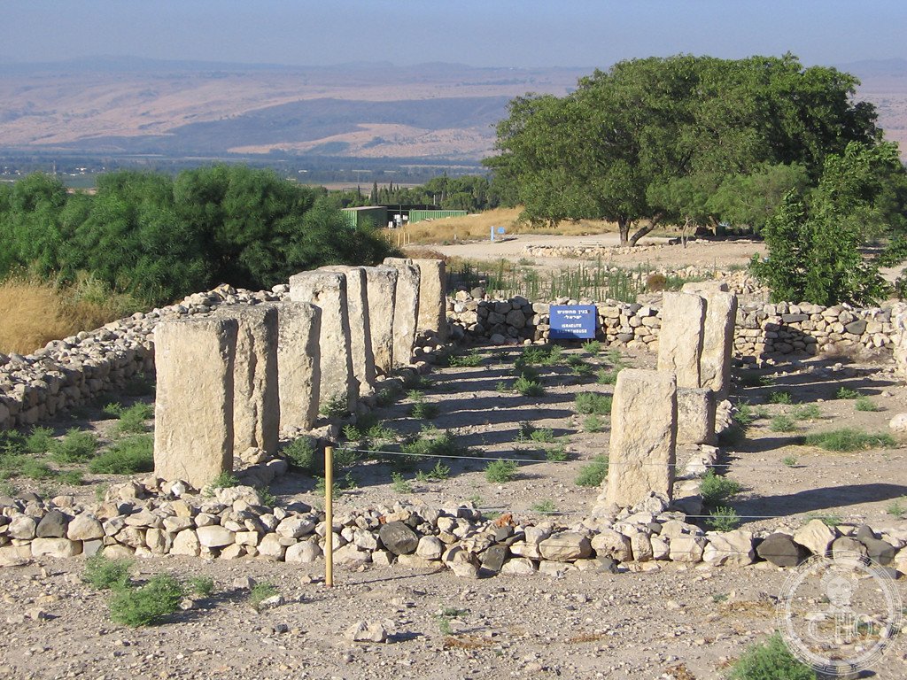
The tell’s architectural remains reveal successive phases of settlement, fortification, and urban planning. The upper tell and expansive lower city showcase the scale of Bronze Age Canaanite construction and urban organization. Excavated structures, defensive systems, and domestic quarters illustrate the daily life and governance of this ancient power center.
Cultural significance
Hazor embodies the intersection of biblical history, ancient Near Eastern archaeology, and Mediterranean Bronze Age civilizations. The site illuminates networks of trade, technology transfer, and political alliance that defined the Fertile Crescent. Its prominence in both biblical narrative and archaeological record makes Hazor essential to understanding the ancient Levant’s complexity and interconnectedness.
Key facts
- Location: Upper Galilee, north of the Sea of Galilee, northern Israel
- Coordinates: 33.017°N, 35.567°E
- Area: 82 hectares total (12 hectares upper tell; over 70 hectares lower city)
- Period: Middle Bronze Age to Iron Age (c. 1750–900 BCE)
- UNESCO Status: World Heritage Site (2005), as part of Biblical Tels—Megiddo, Hazor, Beer Sheba
- Key excavation: Yigael Yadin expedition, mid-1950s
Practical information & getting there
Tel Hazor lies in the Upper Galilee region of northern Israel. The site is accessible to visitors; consult current travel advisories and opening hours before planning your visit. The nearest significant city is Safed (Tzfat). For detailed directions and seasonal access information, check with local tourism authorities in the Galilee region.
Sources & resources
- Tel Hazor – Wikipedia
- Cultural Heritage Online
Find it on the map
See this place and what’s around it →📷 Become a Cultural Heritage Online photographer
Share your photos of places: they stay published under your name as the author. The more they're seen, the more you get noticed — and soon a contest will reward the most appreciated photos.
Log in or sign up free to add a photoIs this page about you?
This page is read by travellers and heritage enthusiasts who find it on Google. Tell us how you are connected to this place and we will take it from there.