
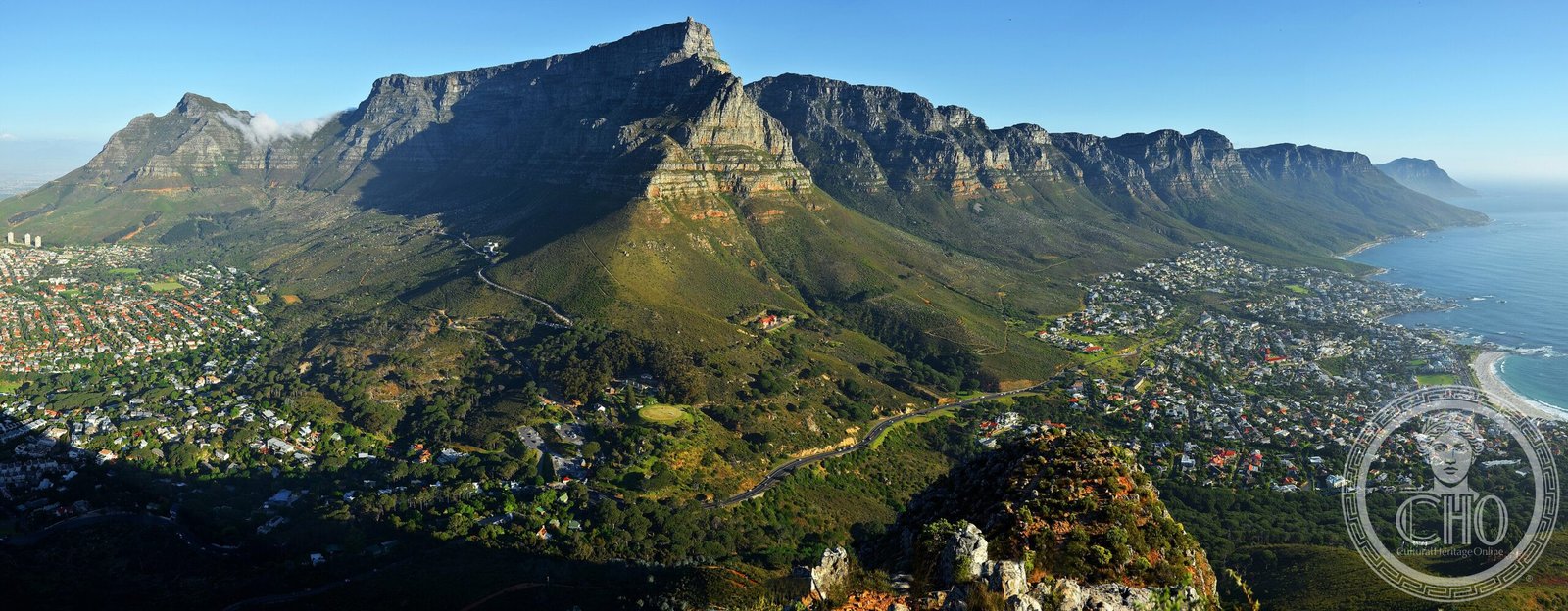
A vast protected landscape embracing Cape Town’s most iconic peaks and the continent’s southwestern tip, where dramatic mountains meet rare fynbos vegetation of global botanical significance.
At a glance
Table Mountain National Park protects the natural environment of the Table Mountain chain and its surrounding ecosystems across the Cape Peninsula. The park encompasses two celebrated landmarks: Table Mountain itself, the distinctive flat-topped peak that defines Cape Town’s skyline, and the Cape of Good Hope, Africa’s most southwestern point.
History
The park was proclaimed on 29 May 1998, originally under the name Cape Peninsula National Park. It was established with the primary purpose of safeguarding the rare fynbos vegetation and broader natural environment of the Table Mountain chain.
What you see
The landscape is dominated by Table Mountain’s commanding flat-topped silhouette, rising abruptly from the city. The park encompasses diverse terrain across the peninsula, including the dramatic cliffs and rocky shores near the Cape of Good Hope. Fynbos—a unique Mediterranean-climate vegetation type—blankets much of the terrain in a mosaic of low shrubs and flowering plants.
Cultural significance
The park forms part of the UNESCO Cape Floral Region World Heritage Site, recognizing the exceptional botanical diversity of the region. Table Mountain itself is one of the New Seven Wonders of Nature. The Cape of Good Hope holds historical importance as a maritime milestone, symbolizing the passage around Africa.
Key facts
- Location: Cape Town, South Africa
- Proclaimed: 29 May 1998
- Coordinates: 33°58′S, 18°25′E
- Management: South African National Parks (SANParks)
- UNESCO Status: Part of the Cape Floral Region World Heritage Site
- Key features: Table Mountain, Cape of Good Hope, fynbos vegetation
Practical information & getting there
The park is accessible from Cape Town. You can reach Table Mountain via hiking trails or the rotating cable car for panoramic views. The Cape of Good Hope can be accessed by vehicle and footpaths. For current visiting hours, entry fees, and detailed route information, consult the SANParks website or local tourism authorities.
Sources & resources
Find it on the map
See this place and what’s around it →📷 Become a Cultural Heritage Online photographer
Share your photos of places: they stay published under your name as the author. The more they're seen, the more you get noticed — and soon a contest will reward the most appreciated photos.
Log in or sign up free to add a photo