
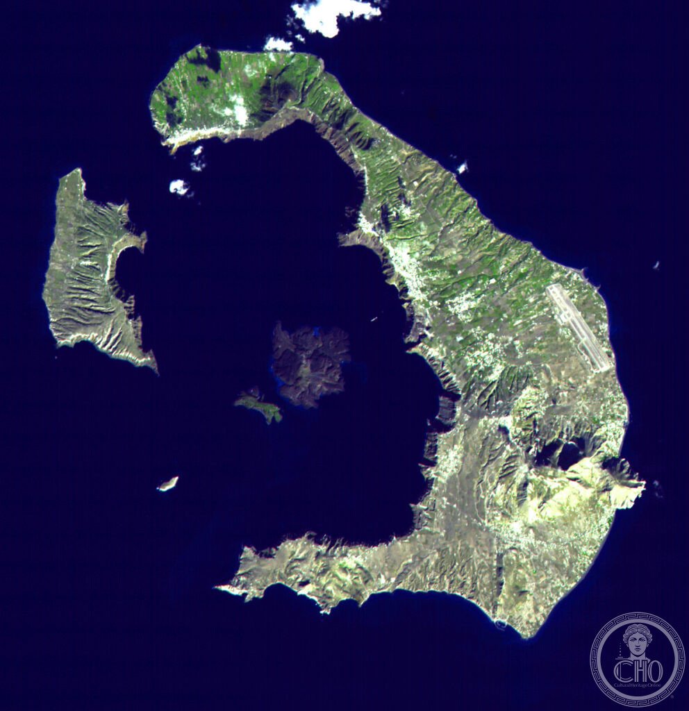
Santorini is the rim of a volcanic caldera left behind when a Bronze Age eruption emptied the magma chamber beneath the island. White-washed villages cling to the cliff edge above the flooded crater, while at the island’s southern tip the ash-buried Minoan town of Akrotiri survives in remarkable detail.
At a glance
Santorini, officially Thira, sits in the southern Cyclades and is formed by the rim of a sea-filled volcanic caldera measuring roughly 12 by 7 kilometres, with water reaching depths of up to 390 metres. The caldera cliffs rise around 300 metres at Fira and up to 400 metres at their highest point, carrying the towns of Fira and Oia along the edge.
At the centre of the caldera lie two small volcanic islets, Nea Kameni and Palea Kameni, the more active of which can be visited on boat trips that include walking the volcanic cone and bathing in warm sulphurous springs. The island has a permanent population of around 15,000 and receives very heavy seasonal tourist traffic, which puts real pressure on its narrow lanes, particularly at Oia in the evenings.
Key facts
- The Minoan eruption: a Bronze Age volcanic eruption, generally dated to around 1600 BCE though estimates range from roughly 1642 to 1600 BCE, rated at VEI 6–7 and among the most powerful of the last ten thousand years.
- Ash and tsunami: the eruption’s ash layer has been traced as far as the Nile Delta, the Black Sea and the Spanish coast, and the collapse of the emptied magma chamber triggered a tsunami with evidence found on Santorini, Crete and the Turkish Aegean coast.
- The Atlantis link: Plato’s dialogues Timaeus and Critias, written around 360 BCE, describe an advanced island civilisation destroyed by the sea, and the Minoan eruption is often proposed as the origin of that story.
- Akrotiri: a Bronze Age Minoan city buried in volcanic ash, excavated from 1967 by Spyridon Marinatos, notable for multi-storey buildings, indoor plumbing and wall paintings, and for the absence of human remains, suggesting the population evacuated before the eruption.
- Assyrtiko wine: the island’s indigenous white grape is trained low to the ground in a circular basket shape called kouloura, a technique that protects the vines from wind; some vines are said to be over 200 years old.
- Heritage status: Santorini is not inscribed as a UNESCO World Heritage Site. The Akrotiri fresco collections are held at the National Archaeological Museum in Athens, and UNESCO has supported protection efforts.
History
The island was settled by Cycladic people from around 3200 BCE, the earliest known human presence recorded on Santorini. By the Bronze Age this had grown into the town of Akrotiri, a substantial Minoan settlement at the island’s southern tip.
Around 1600 BCE a catastrophic volcanic eruption buried Akrotiri in ash and emptied the magma chamber beneath the island, causing its roof to collapse and form the caldera seen today. The island appears to have been uninhabited for a period afterwards, before Mycenaean Greeks resettled it from around 1500 BCE.
Dorian Greeks from Sparta settled the island around 1100 BCE, after which it took the name Thira.
What you see
The caldera dominates the visitor’s view: white-washed cubic houses cascade down the volcanic cliff face at Fira and Oia, many of them built as cave houses cut directly into the soft volcanic tuff and pumice, a building tradition that keeps interiors cool in summer and warm in winter without mechanical help. Blue-domed churches punctuate the townscape, the Anastasis church at Oia being the most recognisable, its cobalt dome set against white walls and the deep blue water of the caldera below.
At Akrotiri, a modern protective roof shelters the excavated Bronze Age town, with its stone buildings, drainage channels and the spaces where its celebrated frescoes, including the Blue Monkeys, the Boxing Boys and the Spring Fresco, were found; the originals are now displayed at the National Archaeological Museum in Athens. Elsewhere on the island, black volcanic sand beaches at Kamari and Perissa contrast with the pale caldera cliffs, and vineyards of low, basket-trained Assyrtiko vines spread across the volcanic soil.
Practical information
- Kameni islets: Nea Kameni and Palea Kameni are reached by boat tours from the caldera towns, combining a walk on the volcanic cone with bathing at the warm springs.
- Akrotiri site: the archaeological site is covered and air-conditioned; opening arrangements are best checked with the site’s official channels before visiting.
- Crowds at Oia: the lanes around the sunset viewpoints become very congested in the evening during the summer season; visitors preferring quieter conditions may wish to plan accordingly.
Getting there
Santorini’s caldera islets, Nea Kameni and Palea Kameni, are reached by boat tours departing from the towns on the caldera rim. Onward travel details for reaching the main island itself are best confirmed through official ferry or airline information.
Nearby
- Akrotiri — at the southern tip of the island, the excavated Bronze Age Minoan city.
- Nea Kameni and Palea Kameni — the volcanic islets at the centre of the caldera, reached by boat.
- Kamari and Perissa — black sand beaches on the island’s east coast.
- National Archaeological Museum, Athens — holds the frescoes excavated from Akrotiri.
Sources
- National Archaeological Museum, Athens
- UNESCO
- Plato, Timaeus and Critias
Gallery
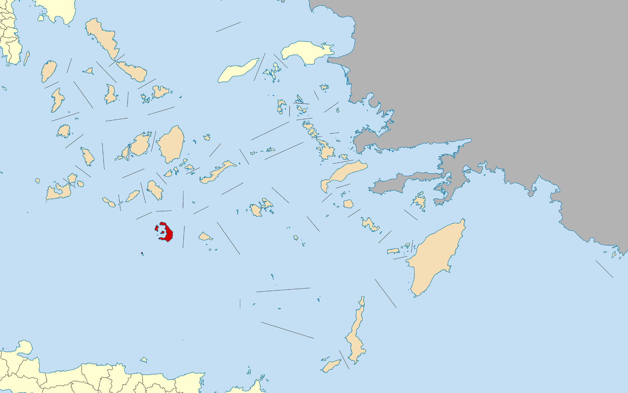
Find it on the map
See this place and what’s around it →📷 Become a Cultural Heritage Online photographer
Share your photos of places: they stay published under your name as the author. The more they're seen, the more you get noticed — and soon a contest will reward the most appreciated photos.
Log in or sign up free to add a photo