
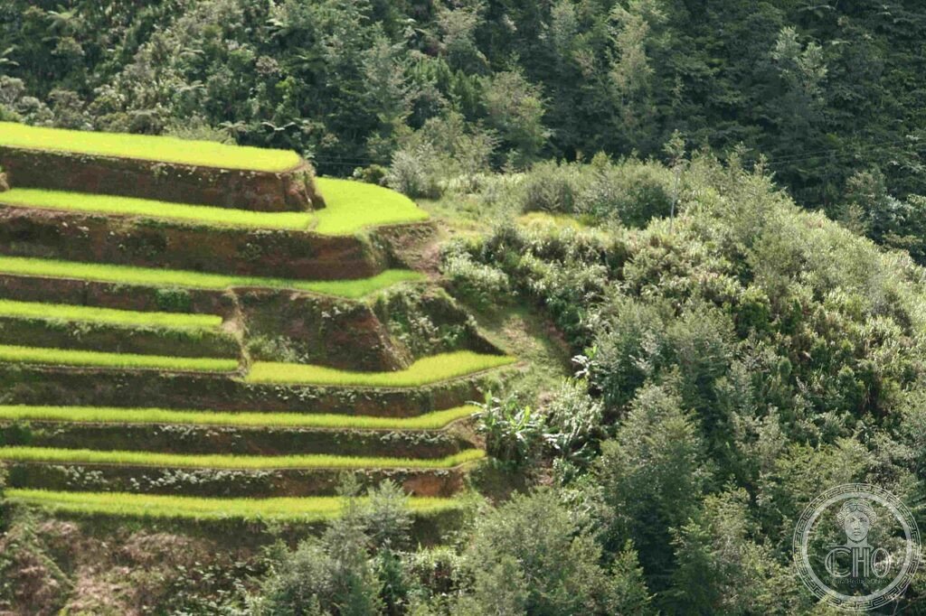
Cut into the Cordillera mountains of northern Luzon by the Ifugao people some two thousand years ago, these stone-and-earth terraces are still planted and harvested by the same communities who built them. They form a working agricultural landscape rather than a ruin, sustained generation after generation by an irrigation system drawn from the forests above.
At a glance
The Ifugao rice terraces climb the slopes of the Cordillera Central at altitudes between roughly 700 and 1,500 metres, following the contour of the mountain rather than cutting across it. They were built by the Ifugao people using stone tools, with no written records to explain the engineering: the knowledge of construction, irrigation and rice cultivation has always been passed down orally.
Five clusters of terraces are recognised under the UNESCO inscription: Batad, Bangaan, Hungduan, Mayoyao and Kiangan, covering an area of around 10,360 hectares in total. The system is kept alive not by restoration teams but by Ifugao families who still farm the terraces using traditional methods.
Key facts
- Location: Ifugao Province, Cordillera Central, northern Luzon, Philippines.
- Built: by the Ifugao people, traditionally dated to around 2,000 years ago.
- UNESCO status: inscribed as a World Heritage Site in 1995; placed on the List of World Heritage in Danger in 2001 and removed in 2012.
- Recognised clusters: Batad, Bangaan, Hungduan, Mayoyao and Kiangan.
- Irrigation system: a wooden aqueduct and canal network fed by muyong, private forest woodlots above the terraces.
- Living culture: the hudhud chants performed by Ifugao women during harvest were declared a UNESCO Intangible Cultural Heritage in 2001.
History
The terraces are traditionally dated to some two thousand years ago, though there are no written records to fix a precise date: the Ifugao had no pre-colonial writing system, and knowledge of the construction technique, the irrigation engineering and the management of rice varieties has always been transmitted orally between generations. The terraces were cut and built using stone tools.
The Ifugao successfully resisted Spanish colonisation, and the Spanish administration in the Philippines never penetrated the Cordillera deeply enough to alter the agricultural system it found there. The terraces developed instead within an Ifugao cosmology built around a large pantheon of deities and rituals tied closely to the rice-growing calendar. Bulul, carved wooden rice-god figures made by mombaki priest-ritualists, are the most important form of Ifugao ritual art and are kept in the family granary; every stage of cultivation, from clearing the fields to harvest, carries its own prescribed rites.
What you see
The Banaue Viewpoint, close to the town on the national highway, gives the most commonly photographed view of the valley, with several terrace levels visible in a single sweep. Early morning is considered the best time to see it, before mist lifts off the valley floor. Wood carvings and woven bags made by Ifugao craftspeople are sold at the viewpoint.
Many visitors continue on foot to Batad, reached only by trail rather than road. The village sits at the base of a semicircular bowl of terraces rising sharply behind it, often described as an amphitheatre of green and gold. A path from the village leads to the Tappiya waterfall at the base of the terrace system. A longer route continues from Batad along the terrace ridge to Bangaan, following one of the most dramatic edges of the whole system before returning to Banaue.
Practical information
- Best season: April to May, when the terraces have just been replanted and are vividly green, or October to November, during harvest, when they turn gold and brown; June to September is the wet season, with heavier rain and slippery paths.
- Guides: hiring a local guide for the Batad and Bangaan trails is recommended; it helps protect the terraces from damage and supports the Ifugao communities who maintain them.
- Access to Batad: reachable only on foot from the road, via a marked trail.
- Accommodation: simple guesthouses are available in Banaue town, including the Banaue Hotel and Youth Hostel.
Getting there
Banaue lies north of Manila and is most commonly reached by overnight bus from the capital, with several operators running the route; travellers can also fly to Cauayan Airport further south and continue overland by van. Current timetables, fares and journey times are best checked directly with bus operators or the airport before travelling.
Nearby
- Buscalan, Kalinga Province — around 60 km north, known for its traditional tattoo culture and for Apo Whang-Od, the oldest practising mambabatok tattooist in the Philippines; reached by jeepney followed by a hike.
- Sagada — around 60 km west, famous for the hanging coffins of the Kankanaey people, suspended on cliff faces and in caves above the valley; Echo Valley is the main viewpoint for them.
- Sumaguing Cave, Sagada — a large limestone cavern open for guided caving trips.
Sources
- Wikipedia, Rice Terraces of the Philippine Cordilleras.
- Wikipedia, Ifugao people.
- Wikipedia, Banaue rice terraces.
- UNESCO, Rice Terraces of the Philippine Cordilleras, World Heritage List reference 722.
Find it on the map
See this place and what’s around it →📷 Become a Cultural Heritage Online photographer
Share your photos of places: they stay published under your name as the author. The more they're seen, the more you get noticed — and soon a contest will reward the most appreciated photos.
Log in or sign up free to add a photo