

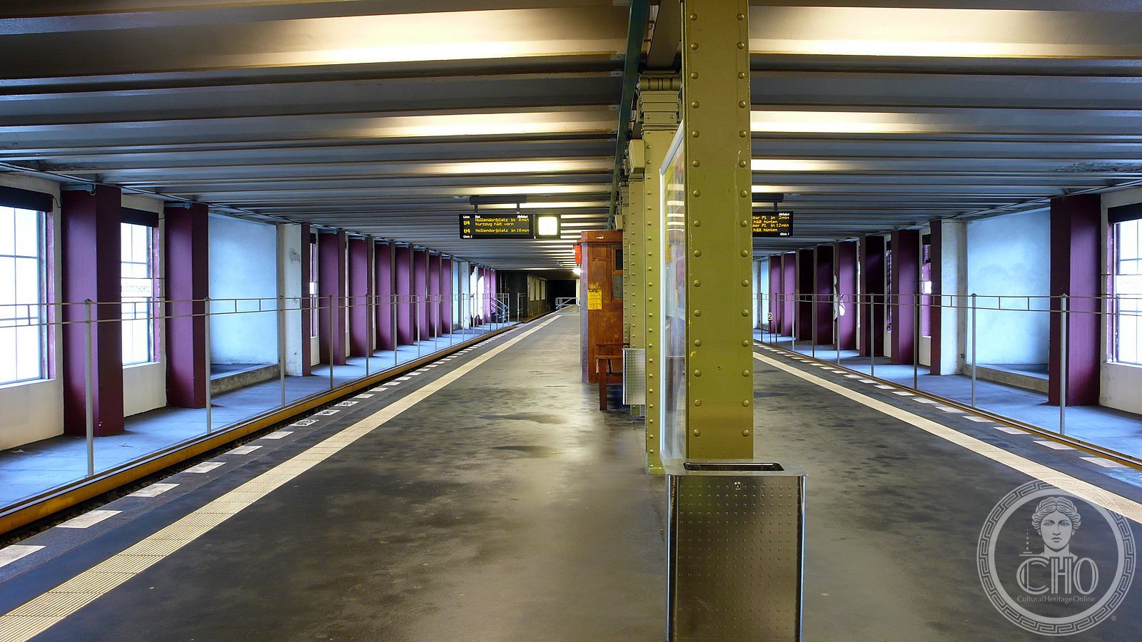
An early modernist U-Bahn station that survived wartime destruction to become a landmark of Berlin’s rapid transit network.
At a glance
Rathaus Schöneberg is a station on the U4 line of the Berlin underground train network. Architect Johann Emil Schaudt designed the structure with the confident lines of early 20th-century Modernism. The station opened in 1910 under the original name Stadtpark.
History
The station was operational for three decades before the Second World War brought severe damage. From 1940 to 1951, it remained closed for repairs and reconstruction. When it reopened in 1951, it assumed its present name, Rathaus Schöneberg, reflecting the town hall that anchors the surrounding district of Tempelhof-Schöneberg.
What you see
Schaudt’s design exemplifies the functional aesthetic of early modernist transport architecture. The station carries the hallmarks of his work, which also included the Bismarck Monument in Hamburg. Its clean geometry and utilitarian materials reflect the efficiency ideals of turn-of-the-century urban planning.
Cultural significance
The station represents a crucial phase in Berlin’s expansion as a modern metropolis. Its survival through wartime damage and subsequent restoration illustrates the city’s commitment to restoring its built heritage. Rathaus Schöneberg remains part of the everyday fabric of urban transit and memory.
Key facts
- Location: Tempelhof-Schöneberg, Berlin, Germany
- Coordinates: 52.48°N, 13.34°E
- Architect: Johann Emil Schaudt
- Opened: 1910 as Stadtpark
- Reopened: 1951 under current name
- Line: U4
Practical information & getting there
The station is accessible via the U4 line of the Berlin U-Bahn. It serves the Schöneberg district in Tempelhof-Schöneberg borough. For current opening hours and service information, consult the Berlin Transport Authority (BVG).
Sources & resources
Find it on the map
See this place and what’s around it →📷 Become a Cultural Heritage Online photographer
Share your photos of places: they stay published under your name as the author. The more they're seen, the more you get noticed — and soon a contest will reward the most appreciated photos.
Log in or sign up free to add a photoIs this page about you?
This page is read by travellers and heritage enthusiasts who find it on Google. Tell us how you are connected to this place and we will take it from there.