Pimachiowin Aki — The Land That Gives Life
At 29,040 km², Pimachiowin Aki is the largest undisturbed boreal landscape on Earth still managed according to Indigenous Anishinaabe principles — a living cultural and natural heritage inscribed by UNESCO in 2018.
At a glance
Pimachiowin Aki (“the land that gives life” in Anishinaabe) is a vast boreal wilderness in northern Manitoba and Ontario, Canada, centred on the Lake Winnipeg watershed. Inscribed as Canada’s first mixed cultural and natural UNESCO World Heritage Site in 2018, it represents an unbroken 7,000-year record of Anishinaabe presence in one of the world’s last truly intact boreal forest ecosystems. Four Anishinaabe First Nations — Bloodvein River, Little Grand Rapids, Pauingassi, and Poplar River — co-own and co-manage the site with provincial and federal governments.
Key facts
- UNESCO inscription: 2018 (mixed cultural and natural, criteria iii, v, vii, ix)
- Area: 29,040 km² — roughly the size of Belgium
- Forest cover: 92% continuous boreal forest
- Indigenous heritage: 7,000 years of Anishinaabe occupation and land stewardship
- First Nations: Bloodvein River, Little Grand Rapids, Pauingassi, Poplar River
- Location: Northern Manitoba and Ontario, Canada
- Notable species: Woodland caribou, grey wolf, black bear, bald eagle, osprey, rare orchids
- Cultural features: Hundreds of pictograph sites, ceremonial grounds, traditional portage routes
- Significance: Canada’s first mixed (natural + cultural) World Heritage Site
History and living heritage
The Anishinaabe people have lived in and actively managed this boreal landscape for at least 7,000 years, as documented by archaeological evidence including pictograph sites, ceremonial grounds, and the ancient network of portage routes that form the cultural geography of the “aski” (homeland). These are not relics of a vanished culture — the four First Nations resident within Pimachiowin Aki maintain continuous occupation and stewardship based on the principle of “mino-bimaadiziwin” (the good life): living in balance with the land, the water, and all living beings.
The Anishinaabe knowledge system embedded in this landscape — encompassing place names, seasonal land-use practices, ceremonial sites, oral histories, and ecological relationships — represents one of the most complete surviving records of Indigenous boreal land management in the world. UNESCO’s inscription in 2018 recognised that the landscape’s extraordinary natural integrity is inseparable from millennia of Indigenous stewardship.
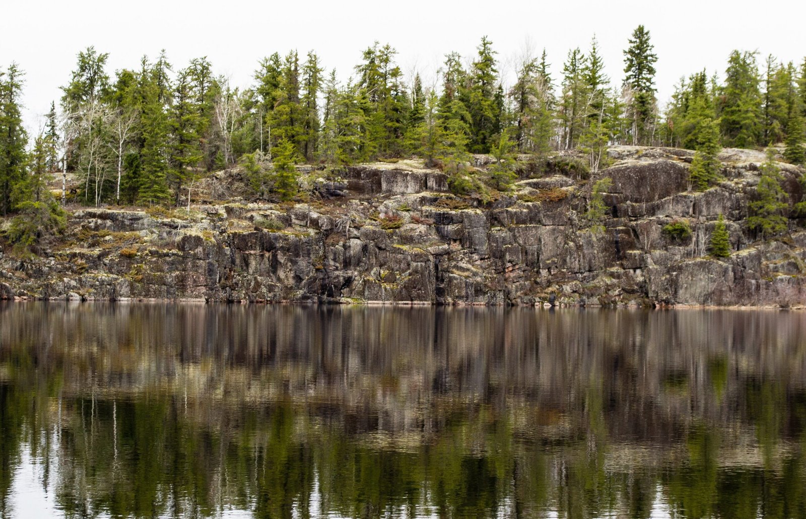
What you see
Pimachiowin Aki is above all a vast, quiet wilderness. Boreal forest — black spruce, jack pine, trembling aspen, white birch — stretches unbroken to the horizon. Hundreds of lakes and river systems glitter through the canopy. The landscape is punctuated by red ochre pictographs painted by Anishinaabe ancestors on cliff faces overlooking rivers and portage entry points: human figures, animals, and spiritual beings rendered in iron oxide pigment that has survived millennia of freeze-thaw cycles.
Woodland caribou move through the forest in small herds. Wolves follow traditional travel corridors documented by Anishinaabe hunters across generations. Rare orchid species — including the calypso orchid and yellow lady’s slipper — flower in the mossy forest floor. In winter the landscape transforms: frozen lake surfaces become highways, and dog-team travel remains a living practice in the communities.
Practical information
- Access: Extremely remote — no roads reach the interior. Access by floatplane or, in winter, by ice road and snowmobile.
- Base communities: Bloodvein River First Nation and Poplar River First Nation are the nearest communities with airstrip access.
- Visitor protocol: Visitors must obtain permission from the relevant First Nation before entering traditional territory. Guided cultural experiences are available through the communities.
- Nearest city: Winnipeg, Manitoba — approximately 250–400 km south.
- Season: Summer (June–August) for canoe and floatplane access; winter for ice-road access.
Getting there
Gateway city is Winnipeg, Manitoba (Winnipeg Richardson International Airport, YWG). Charter floatplane services fly to the First Nations communities within the site — Bloodvein River (approx. 1 hour by air), Little Grand Rapids, Pauingassi, and Poplar River. Air Mikisew and Keewatin Air are among northern Manitoba charter operators serving the region. The First Nations Band offices can advise on recommended operators and current access conditions.
Nearby
Pimachiowin Aki adjoins Woodland Caribou Provincial Park in Ontario to the east, together forming one of the largest protected boreal wilderness areas in the world. Atikaki Provincial Wilderness Park (Manitoba) connects to the south. The Bloodvein River — a Canadian Heritage River — flows south from the site and offers one of Canada’s finest wilderness canoe routes, passing dozens of pictograph sites. Lake Winnipeg forms the western boundary of the watershed.
Sources
Find it on the map
See this place and what’s around it →📷 Diventa un fotografo di Cultural Heritage Online
Condividi le tue foto dei luoghi: restano pubblicate con la tua firma come autore. Più vengono viste, più ti fai conoscere — e presto un concorso premierà le foto più apprezzate.
Accedi o registrati gratis per aggiungere una foto