
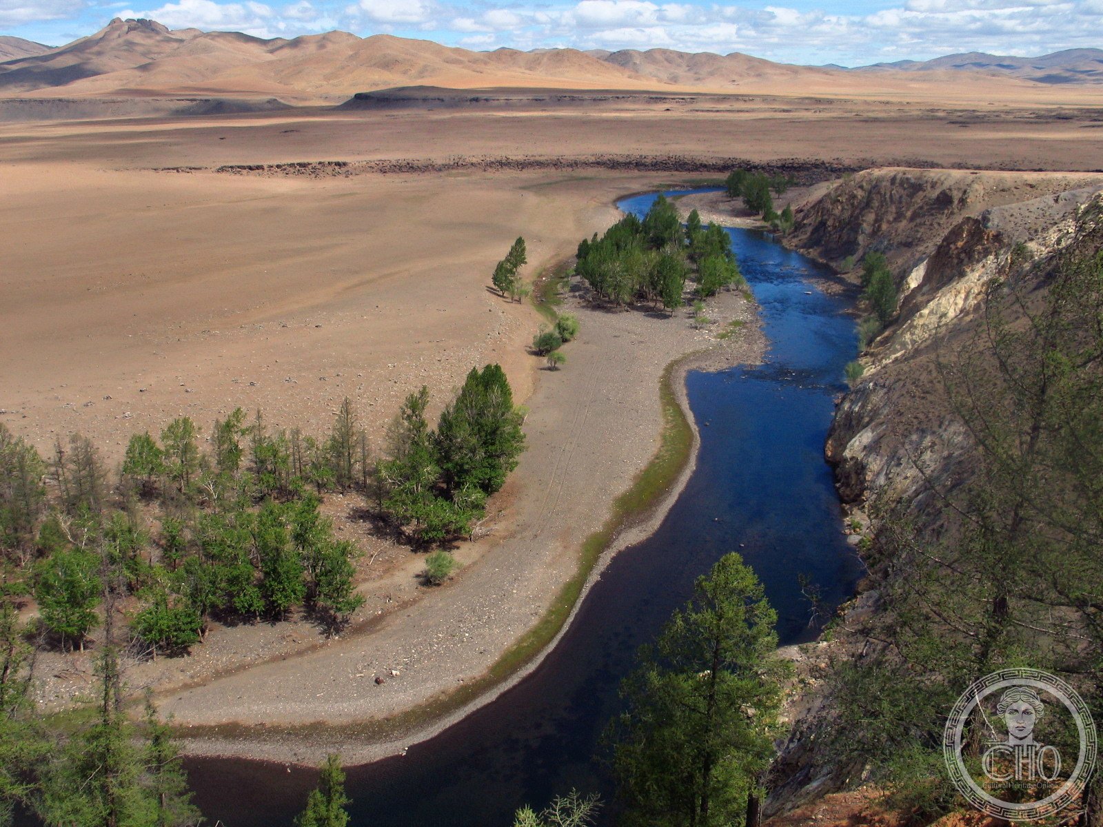
For over two millennia, the Orkhon valley in central Mongolia served as the symbolic and political heart of successive Eurasian empires – from the Xiongnu who forced the construction of the Great Wall, through the Göktürks and Uyghur Empire, to Genghis Khan’s Mongol Empire, whose capital Karakorum stood here. The 121,967-hectare UNESCO landscape contains the layered ruins of all these civilisations alongside a living nomadic tradition essentially unchanged from the steppe cultures of the Iron Age.
At a glance
The Orkhon Valley Cultural Landscape encompasses 121,967 hectares along the Orkhon River in central Mongolia, inscribed as a UNESCO World Heritage Site in 2004. The valley has been the gravitational centre of Inner Asian civilisation for at least 2,000 years – a fact that archaeologists attribute to its combination of water, grazing land, strategic position, and what can only be described as a symbolic magnetic pull that drew successive imperial founders to establish their capitals on or near the same ground.
The archaeological layers are extraordinary in their depth and variety: Xiongnu burial mounds from the 1st century BCE; 8th-century Göktürk memorial stelae with inscriptions in the oldest known Turkic writing; the ruins of Khar Balgas (Ordu Baliq), capital of the Uyghur Empire and once one of the largest cities in Central Asia; the ruins of Karakorum, capital of the Mongol Empire; and Erdene Zuu Monastery (1586), the first Buddhist monastery in Mongolia, built with stones taken from Karakorum’s ruins. All of this exists within a living landscape of nomadic pastoralism – ger camps, horse herds, yak pastures – that has changed little in form since the Xiongnu era.
Key facts
- UNESCO inscription: 2004
- Total area: 121,967 hectares
- Period: 1st century BCE – 17th century CE (successive steppe empires)
- Key sites within landscape: Khar Balgas (Uyghur capital), Karakorum (Mongol capital), Erdene Zuu Monastery, Tövkhön Hermitage, Turkic stelae
- Karakorum founded: c. 1220 CE by Ögedei Khan (son of Genghis Khan)
- Erdene Zuu Monastery founded: 1586 CE – first Buddhist monastery in Mongolia
- Nearest town: Kharkhorin (formerly Karakorum), Övörkhangai Province
- Coordinates: 47.2000 N, 102.8500 E
Two thousand years of empire
The Xiongnu were the first steppe confederation to make the Orkhon valley their heartland, in the 1st-2nd centuries BCE. Their power was such that China’s Han Dynasty spent enormous resources – and ultimately built the Great Wall in its definitive form – to contain them. The Orkhon valley was probably the ritual and administrative centre of the Xiongnu empire, though no capital city has been definitively identified; their rulers were buried in large tumuli scattered across the steppe.
After the Xiongnu dissolved, the valley passed through the hands of the Xianbei, the Rouran, and then the Göktürks (6th-8th centuries CE), who were the first Turkic-speaking empire. The Göktürks left remarkable memorial stelae inscribed in the Old Turkic runic script – the oldest Turkic writing yet discovered – commemorating their great khagans. These Orkhon inscriptions are among the founding texts of Turkic literary culture.
The Uyghur Empire (744-840 CE) established its capital Ordu Baliq (also called Khar Balgas) on the Orkhon River. At its height in the 8th-9th centuries, Ordu Baliq may have had a population of 40,000-50,000, making it one of the largest cities in Central Asia. The ruins of its walls, palace district, and outer city still extend across the steppe. The Uyghur Empire fell to the Yenisei Kyrgyz in 840 CE.
The Mongol Empire, founded by Genghis Khan (r. 1206-1227), established its capital Karakorum on the Orkhon around 1220 CE. Under Ögedei Khan (r. 1229-1241), Karakorum was substantially built up, with a palace district, a Muslim quarter, a Chinese quarter, twelve Buddhist temples, two mosques, and a Nestorian Christian church – reflecting the cosmopolitan empire it served. Marco Polo’s account (though he likely never visited) mentions Karakorum. William of Rubruck, the Flemish friar who visited in 1254, left the most detailed contemporary description of its layout. Karakorum’s fame was immense in medieval Europe and Asia, but the city itself was abandoned when the capital moved to Khanbaliq (Beijing) under Kublai Khan.
Erdene Zuu Monastery, built in 1586 from the stones of Karakorum’s ruins, became the most important Buddhist complex in Mongolia. Its massive white walls with 108 stupas are the most immediately striking element of the Orkhon landscape today. Despite severe damage during the Stalinist purges of 1937-38, when nearly all of Mongolia’s monasteries were destroyed and thousands of monks were killed, Erdene Zuu survived partially intact and was restored after independence.
What you see on the landscape
The Orkhon Valley is not a compact archaeological site but a vast landscape where major ruins are spread across tens of kilometres. The most visited area around Kharkhorin contains Erdene Zuu Monastery – whose 108-stupa white wall is immediately visible and whose surviving temple interiors contain remarkable Buddhist art collections – and the excavated ruins of Karakorum, partially interpreted by the Karakorum Museum in Kharkhorin (opened 2011, one of the best archaeological museums in Central Asia).
The ruins of Khar Balgas (Uyghur capital) are approximately 25 km north of Kharkhorin – a more remote site with impressive earth walls still standing several metres high, with a central palace mound and a 27-metre-high Manichaean temple tower. The site sees relatively few visitors and conveys the sheer scale of what was once a major city.
The Tövkhön Hermitage, a 17th-century Buddhist monastery on a forested hill approximately 60 km southwest of Kharkhorin, offers a very different experience – a small, visually dramatic monastery clinging to cliff faces in a pine forest, associated with the great Mongolian Buddhist artist and polymath Zanabazar.
Throughout the valley, Turkic balbal memorial stones and deer stones (earlier Bronze Age stelae carved with flying deer images) mark the landscape. Ger camps of nomadic herder families are visible on the steppe, and it is common to encounter horse herders, yak drivers, and eagle hunters – a living continuity with the nomadic world that produced the Mongol Empire.
Practical information
- Erdene Zuu Monastery: Open daily approximately 9:00-18:00; admission fee applies; temple interiors require tickets
- Karakorum Museum: Open daily (hours vary by season); excellent introductory exhibition to the archaeology of the valley
- Khar Balgas: Open steppe site, no admission fee; self-drive or guided tour required
- Guided tours: Strongly recommended – most sites are on open steppe without interpretation; local guides available in Kharkhorin
- Best season: June-September (July-August peak season, Naadam festival in July); harsh winters make October-April difficult
- Naadam Festival: July 11-13 – the national festival features wrestling, horse racing, and archery; celebrated throughout Mongolia but particularly vivid at rural venues near Kharkhorin
Getting there
Kharkhorin is approximately 360 km southwest of Ulaanbaatar by road (4-5 hours by car on a partially paved highway). Organised tours from Ulaanbaatar make this the most common approach for international visitors. Shared minibuses operate from Ulaanbaatar’s Dragon Bus Station to Kharkhorin daily, taking 5-6 hours. There is no train service.
Within the valley, a car (ideally a 4WD) is essential to visit sites beyond Kharkhorin – the steppe roads to Khar Balgas and Tövkhön Hermitage are unpaved. Horses can also be hired locally for shorter exploration of the valley. Many visitors combine Orkhon Valley with a night or two in a traditional ger camp to experience nomadic hospitality.
Nearby
- Karakorum Museum: In Kharkhorin town – the best starting point for understanding the Mongol capital and valley archaeology
- Tövkhön Hermitage: 60 km southwest – 17th-century Buddhist cliff monastery associated with Zanabazar, one of Mongolia’s most revered cultural figures
- Orkhon Waterfall (Ulaan Tsutgalan): Approximately 60 km south – a dramatic 20-metre basalt canyon waterfall, popular for camping
- Ögii Lake: 100 km north – a major wetland bird lake and popular ger camp destination
- Ulaanbaatar National Museum of Mongolia: Contains the most comprehensive collection of steppe empire artefacts, including Xiongnu, Göktürk, and Mongol period objects
Sources
- UNESCO World Heritage Centre: Orkhon Valley Cultural Landscape (List No. 1081)
- Sinor, Denis (ed.). The Cambridge History of Early Inner Asia. Cambridge University Press, 1990.
- Morgan, David. The Mongols. 2nd edition, Blackwell, 2007.
- Wikipedia: Orkhon Valley Cultural Landscape
Find it on the map
See this place and what’s around it →📷 Become a Cultural Heritage Online photographer
Share your photos of places: they stay published under your name as the author. The more they're seen, the more you get noticed — and soon a contest will reward the most appreciated photos.
Log in or sign up free to add a photo