At a Glance
Noel Kempff Mercado National Park, in the far north-east of Bolivia near the Brazilian border, is one of South America’s largest and most pristine protected areas — a 1.5-million-hectare wilderness centred on the Huanchaca Plateau, a Precambrian sandstone massif that rises abruptly 700 metres above the surrounding Amazon lowlands. UNESCO inscribed it in 2000 (ref. 967) for its extraordinary biodiversity and for preserving intact ecological communities across one of the most biologically rich landscapes on Earth.
The Lost World
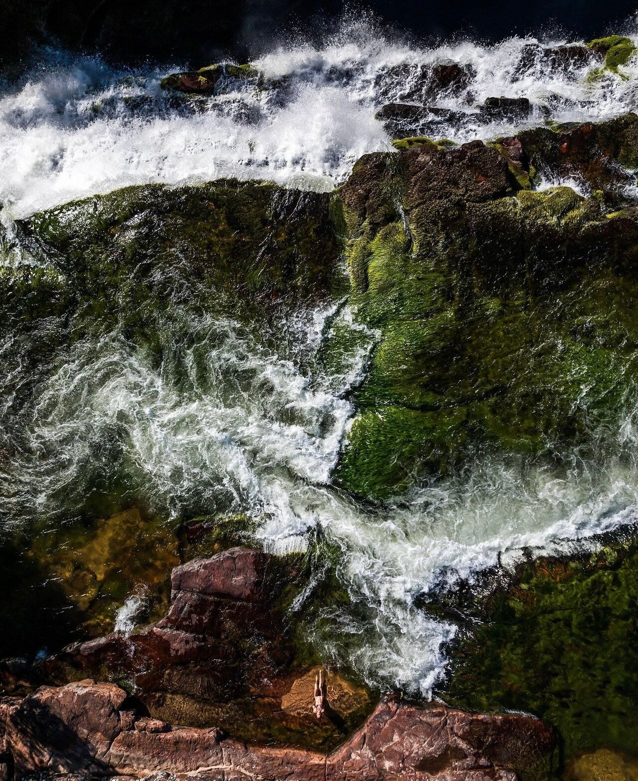
The Huanchaca Plateau (also called the Serranía de Caparucho) was the inspiration for Arthur Conan Doyle’s novel The Lost World (1912). The story goes that biologist Percy Fawcett explored the region in 1910 and reported isolated tablelands ringed by vertical cliffs — tepui-like formations appearing unreachable and primeval — and shared his account with Conan Doyle. The plateau’s near-vertical sandstone escarpments, topped with ancient grassland and cloud forest, and the spectacular waterfalls that plunge over its edge (including the Arcoíris Falls, “Rainbow Falls”, and the Los Fierros Falls) give the site an otherworldly, timeless quality that amply justified Conan Doyle’s imagination.
Biodiversity
The park lies at the intersection of four major South American biomes: Amazonian rainforest, Cerrado (Brazilian savanna), Chiquitano dry forest and Pantanal wetlands. This meeting point creates an extraordinary concentration of species. The park supports over 4,000 plant species, 139 mammal species (including giant otters, giant anteaters, maned wolves, jaguars, tapirs and all six Neotropical cat species), 621 bird species, 74 reptile species and 62 amphibian species. Many of these are endemic to Bolivia or to the Huanchaca region. Giant river otters use the park’s river systems, which drain both into the Amazon basin and into the Pantanal.
Huanchaca Plateau
The plateau itself — approximately 100 km long and 60 km wide — is ancient Precambrian sandstone estimated at over 1 billion years old. Its flat summit, at 850–950 metres altitude, supports a completely different ecosystem from the lowland forest below: open savanna, gallery forest, and isolated rock formations draped in bromeliads and orchids. The vertical escarpment walls are host to nesting populations of Harpy Eagles. Several waterfalls cascade over the plateau edge in spectacular fashion: the Arcoíris Falls (approximately 80 m high) and the Federico Ahlfeld Falls are among Bolivia’s most dramatic natural features.
Conservation and Naming
The park was originally named Huanchaca National Park, created in 1979. In 1988 it was renamed in honour of biologist Noel Kempff Mercado, who was murdered at the Los Fierros airstrip within the park by drug traffickers in the same year while conducting a scientific expedition. His death galvanised conservation attention on the park. A major expansion in 1996 — supported by US and Bolivian NGOs and carbon credit financing — tripled the park’s area. It was the world’s first large-scale carbon offset conservation project.
Visiting
The park is extremely remote and requires significant logistical planning. Access is by small aircraft to the airstrips at Los Fierros or Flor de Oro, from Santa Cruz (1.5–2 hrs flight). Alternatively, a 4WD overland journey from the town of San Ignacio de Velasco takes 2–3 days via rough tracks. Eco-lodges and ranger stations provide basic accommodation. Activities include hiking, wildlife watching, piranha fishing, and boat trips on the Iténez River.
Practical Information
The best season is May–October (dry season; roads more passable; wildlife concentrated near water). Flights from Santa Cruz can be chartered. All visits require coordination with SERNAP (Bolivia’s national park authority) and with the park’s eco-tourism operators in Santa Cruz. GPS (park centre): 14.230° S, 60.850° W.
Nearby
San Ignacio de Velasco (the nearest town of any size, 200 km south-west) is the starting point for overland expeditions. The Jesuit Mission Circuit of the Chiquitania — including UNESCO-listed San Miguel de las Misiones — is 120–250 km south-west of the park and makes a compelling cultural complement to the wilderness experience.
Find it on the map
See this place and what’s around it →📷 Diventa un fotografo di Cultural Heritage Online
Condividi le tue foto dei luoghi: restano pubblicate con la tua firma come autore. Più vengono viste, più ti fai conoscere — e presto un concorso premierà le foto più apprezzate.
Accedi o registrati gratis per aggiungere una foto