
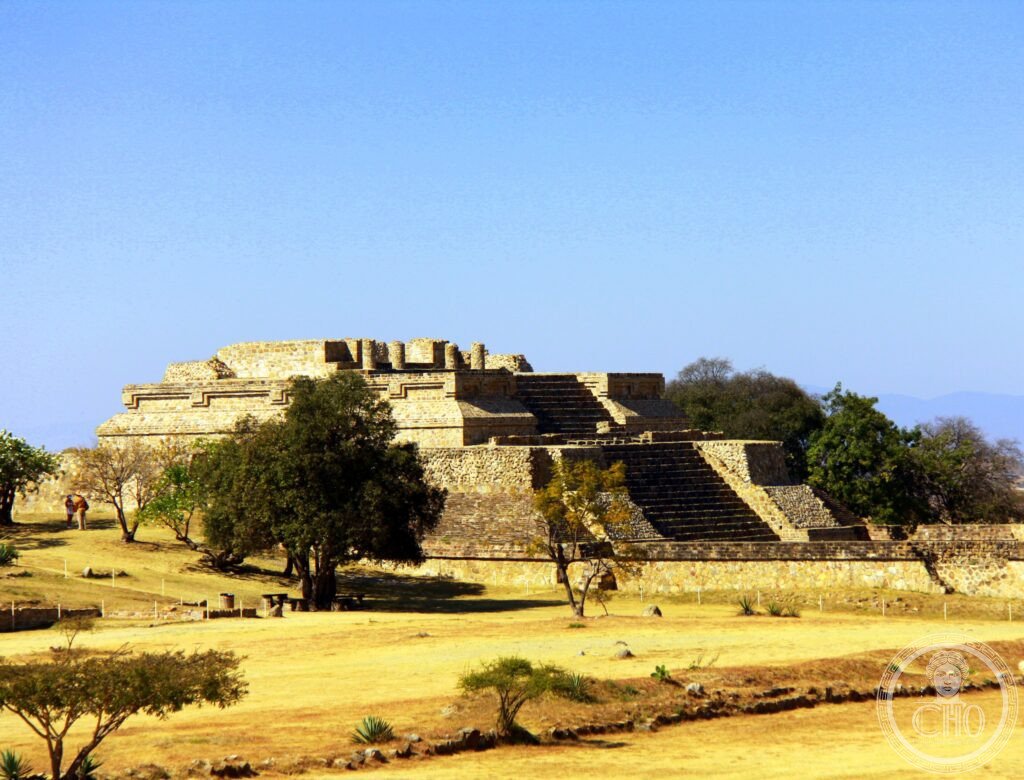
Monte Albán stands on a mountaintop the Zapotec deliberately flattened to build the first true city in Mesoamerica. Its plaza, tombs and carved stones record centuries of political power, early writing and, later, a Mixtec burial rich enough to rewrite what was known about pre-Columbian goldwork.
At a glance
Monte Albán sits above the Oaxaca Valley on a mountain whose summit the Zapotec people levelled from around 500 BCE to create a vast artificial plaza. It became the first true city in Mesoamerica, occupied continuously from roughly 500 BCE to 700 CE, and at its height held a population estimated between 25,000 and 45,000. The Spanish name means White Mountain; the original Zapotec name, Danibaan, is usually translated as Sacred or Principal Hill.
The site is known for the Gran Plaza carved out of the hilltop, for the carved Danzantes stones bearing some of the earliest writing in Mesoamerica, and for Tomb 7, whose Mixtec grave goods form one of the richest pre-Columbian burial finds made in Mexico.
Key facts
- Location: Monte Albán Archaeological Zone, Santa Cruz Xoxocotlán Municipality, Oaxaca, Mexico.
- Founded: around 500 BCE, on a mountain levelled to roughly 1,500 metres above sea level within the Oaxaca Valley.
- Main plaza: the Gran Plaza measures about 300 by 200 metres, created by removing the summit of a 400-metre peak.
- Population peak: estimated between 25,000 and 45,000 inhabitants during the Monte Albán IIIa–IIIb period.
- Tomb 7: a Zapotec tomb built around 300–500 CE, reused by the Mixtec around 1350 CE for a burial of nine individuals with 121 grave objects, discovered by Alfonso Caso in 1932.
- Recognition: inscribed as a UNESCO World Heritage Site in 1987.
History
Monte Albán’s earliest phase, known as Albán I, saw the first Zapotec writing and calendar representations appear between roughly 500 and 100 BCE. During Albán II, from around 100 BCE to 200 CE, major platforms, carved stelae and buildings aligned for astronomical observation were constructed. The city reached its peak in the Monte Albán IIIa–IIIb period, between about 100 and 700 CE, when it functioned as the capital controlling much of the Oaxaca Valley, with some 170 hilltop sites in the region allied to or dependent on it.
By around 500 CE Monte Albán was in contact with Teotihuacan, and evidence of mutual influence appears at both sites. Teotihuacan’s collapse around 700 CE removed an important trading partner and is thought to have accelerated Monte Albán’s own decline during the Monte Albán IV period, between roughly 700 and 900 CE. The reasons for the city’s eventual abandonment are debated, with drought, political fragmentation and shifting trade routes all suggested as factors. The site was never entirely deserted, however: around 1350 CE the Mixtec reused Tomb 7 for a rich burial, showing that Monte Albán continued to be visited as a sacred place long after its political power had faded.
Following the Spanish conquest of the Oaxaca Valley in 1521, the site lay largely unexcavated until Alfonso Caso undertook systematic archaeological work between 1931 and 1943 across twelve seasons, including the 1932 discovery of Tomb 7. Monte Albán was inscribed as a UNESCO World Heritage Site in 1987.
What you see
The Gran Plaza forms the heart of the visit, a levelled ceremonial space with the North Platform, topped by a 25-metre pyramid, at one end and the South Platform at the other. The South Platform is the highest accessible point on the main site and gives a 360-degree view over the Oaxaca Valley, taking in the city of Oaxaca below and the surrounding Sierra Madre del Sur.
Along the plaza stand the Danzantes, carved stone slabs dated to between 300 BCE and 100 CE showing distorted, apparently sacrificed figures, and among the earliest examples of writing found anywhere in Mesoamerica. Nearby, Building J is an unusual arrow-shaped, pentagonal structure whose orientation is thought to relate to astronomical observation, though its exact purpose is uncertain; its base carries around 40 carved stones showing captives, place glyphs and calendar dates. Ballcourt I-B, in the southeast corner of the plaza, has sloped walls but lacks the stone rings typical of Maya ballcourts. Around 200 tombs have been excavated across the site, the most elaborate being Tomb 7, north of the main plaza, and Tomb 105, noted for its carved entrance and painted interior.
Practical information
- Museum: the gold and other objects from Tomb 7 are held at the Regional Museum of Oaxaca, in the former Convento de Santo Domingo, rather than at the archaeological site itself.
- Site coordinates: approximately 17.0431° N, 96.7674° W.
- Terrain: the site occupies high, open ground with uneven ancient stonework; comfortable footwear and sun protection are advisable.
- Current visitor information: opening times and admission arrangements should be checked with the site’s official Mexican heritage authority before travelling.
Getting there
Monte Albán lies above the city of Oaxaca, within the Santa Cruz Xoxocotlán municipality in Oaxaca State, southern Mexico. It is most commonly reached from Oaxaca city itself; current transport options are best confirmed locally or through official tourism channels.
Nearby
- City of Oaxaca — the valley city visible from the South Platform, home to the Regional Museum of Oaxaca where Tomb 7’s grave goods are displayed.
- Ex-Convento de Santo Domingo — in Oaxaca city, now housing the Regional Museum and its Mixtec goldwork collection.
- Oaxaca Valley hilltop sites — around 170 smaller settlements across the valley were once allied to or dependent on Monte Albán.
Sources
- UNESCO
Find it on the map
See this place and what’s around it →📷 Become a Cultural Heritage Online photographer
Share your photos of places: they stay published under your name as the author. The more they're seen, the more you get noticed — and soon a contest will reward the most appreciated photos.
Log in or sign up free to add a photoIs this page about you?
This page is read by travellers and heritage enthusiasts who find it on Google. Tell us how you are connected to this place and we will take it from there.