
Landscapes of Dauria
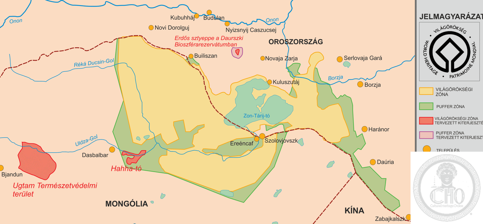
A transnational World Heritage Site spanning the Daurian forest steppe, one of the world’s largest intact grassland ecosystems, shared across Mongolia, Russia, and northeastern China.
At a glance
The Landscapes of Dauria represent a vast, ecologically vital region where rolling steppe grasslands meet boreal forest. This cross-border protected area preserves one of Earth’s most dynamic and least-altered temperate grassland systems, home to migratory birds, grazing mammals, and endemic species found nowhere else.
History
The Dauria region has long sustained nomadic pastoral cultures and remains a landscape shaped by natural cycles rather than intensive human modification. Its designation as a transnational World Heritage Site reflects international recognition of the area’s ecological importance and the need for coordinated conservation across political boundaries.
What you see
The landscape is characterized by open steppe grasslands punctuated by wetlands, lakes, and sparse forest. The Torey Lakes—seasonal water bodies that dramatically expand and contract—anchor the ecosystem and attract vast congregations of waterfowl during migration. Gentle rolling terrain, minimal tree cover, and vast horizons dominate the visual experience.
Cultural significance
Dauria represents a living model of grassland conservation and transnational environmental cooperation. The region’s cultural heritage is inseparable from its ecology: traditional pastoralist practices have coexisted with these landscapes for centuries. Its World Heritage status acknowledges both the ecological irreplaceability of intact steppe and the cultural traditions it sustains.
Key facts
- Location: Mongolia and Russia (extends into northeastern China)
- Coordinates: 49.93022°N, 115.42544°E
- UNESCO World Heritage Site: Yes
- Ecosystem: Daurian forest steppe ecoregion
- Notable feature: Torey Lakes
- Type: Transnational protected area
Practical information & getting there
The Dauria landscape spans remote territory across Mongolia and Russia. Access varies by location; the Mongolian side is most easily reached from Khowd or Ulaanbaatar. Roads are often unpaved and seasonal. The region experiences extreme continental climate with short summers and long, severe winters. Best visited June to September. Consult local guides and check current border regulations before planning cross-border travel.
Sources & resources
Find it on the map
See this place and what’s around it →📷 Diventa un fotografo di Cultural Heritage Online
Condividi le tue foto dei luoghi: restano pubblicate con la tua firma come autore. Più vengono viste, più ti fai conoscere — e presto un concorso premierà le foto più apprezzate.
Accedi o registrati gratis per aggiungere una foto