
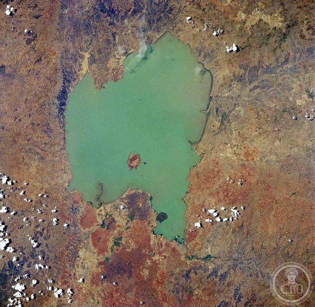
Ethiopia’s largest lake and a vital source of the Blue Nile, Lake Tana spans the north-western highlands with both ecological and cultural significance recognized globally.
At a glance
Lake Tana dominates the Ethiopian landscape as the country’s most expansive body of water. Approximately 84 kilometres long and 66 kilometres wide, it occupies between 3,000 and 3,500 square kilometres depending on seasonal rainfall. The lake sits at an elevation of 1,788 metres in the Amhara Region.
History
The lake has long served as a source of the Blue Nile, which flows northward to Sudan and Egypt. Control of its waters intensified with the construction of a weir where the lake discharges into the river, regulating flow to the Blue Nile Falls and a hydro-power station. In 2015, the Lake Tana region achieved recognition as a UNESCO Biosphere Reserve, acknowledging its natural and cultural importance at both national and international scales.
What you see
The lake itself defines the landscape—a shallow expanse with a maximum depth of only 15 metres. It is fed by three principal rivers: the Gilgel Abay, Reb, and Gumara. The shoreline and surrounding highlands showcase the terrain of the Ethiopian Highlands.
Cultural significance
Lake Tana holds profound importance for Ethiopia and the wider region. As a principal source of the Blue Nile, it sustains ecosystems and communities across three nations. Its UNESCO Biosphere Reserve designation reflects both its natural biodiversity and the cultural heritage of communities that depend on its waters.
Key facts
- Country: Ethiopia
- Region: Amhara, north-western Ethiopian Highlands
- Coordinates: 12°N, 37.25°E
- Length: 84 kilometres (52 miles)
- Width: 66 kilometres (41 miles)
- Surface area: 3,000–3,500 square kilometres (seasonal variation)
- Maximum depth: 15 metres (49 feet)
- Elevation: 1,788 metres (5,866 feet)
- UNESCO Biosphere Reserve: designated 2015
Practical information & getting there
Lake Tana is accessed via Bahir Dar, the regional capital, located on the southern shore. The lake and its islands are best explored by boat. For details on current access routes, accommodation, and seasonal conditions, consult local tourism authorities in Bahir Dar.
Sources & resources
Find it on the map
See this place and what’s around it →📷 Become a Cultural Heritage Online photographer
Share your photos of places: they stay published under your name as the author. The more they're seen, the more you get noticed — and soon a contest will reward the most appreciated photos.
Log in or sign up free to add a photo