
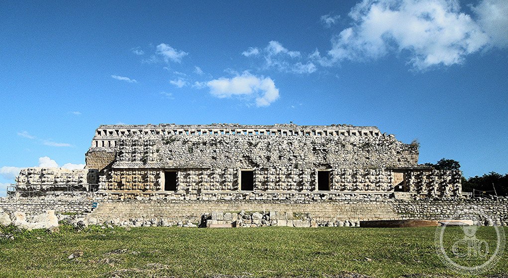
A monumental Maya ceremonial center in the Puuc architectural tradition, Kabah ranks among the most significant ruins of western Yucatán. Connected to nearby Uxmal by an ancient raised causeway spanning 18 kilometers, this archaeological complex reveals the ambitions and craftsmanship of pre-Columbian Maya civilization.
At a glance
Kabah is the second-largest ruin in the Puuc region, a zone known for distinctive architectural innovation. The site sprawls across both sides of Federal Highway 261, approximately 140 kilometers south of Mérida. Many structures remain surrounded by forest, little visited and gradually being cleared through ongoing restoration efforts.
History
Kabah flourished as a Maya settlement during the Classic and Postclassic periods, reaching prominence within the Puuc cultural sphere. The site’s monumental causeway—5 meters wide with grand arches at each terminus—connected it directly to Uxmal, suggesting not merely proximity but ceremonial and political integration between these two important centers. Archaeological investigation under the direction of Ramón Carrasco has been ongoing since at least 2003, revealing new details of occupation and construction techniques.
What you see
The site showcases the Puuc style’s characteristic corbeled vaults, intricate stone mosaic patterns, and precisely fitted stonework. The monumental archways marking each end of the causeway to Uxmal remain impressive feats of Maya engineering. Buildings range from ceremonial temples to residences, with many still partially buried beneath centuries of vegetation—a visual reminder of the site’s recovery from abandonment.
Cultural significance
Kabah embodies the Puuc region’s architectural and organizational sophistication. As part of the Uxmal UNESCO World Heritage Site inscription, it contributes to international recognition of Maya achievement. The causeway linking Kabah and Uxmal remains one of the region’s most striking examples of pre-Columbian infrastructure, demonstrating the Maya capacity for monumental urban planning.
Key facts
- Location: Yucatán, Mexico (coordinates: 20.248425, −89.64729722)
- Region: Puuc, western Yucatán
- UNESCO World Heritage Site: Inscribed 1996 (with Uxmal, Sayil, and Labná)
- Causeway to Uxmal: 18 kilometers long, 5 meters wide
- Status: Yucatán state park (designated 1993)
Practical information & getting there
Kabah is located on Federal Highway 261, approximately 140 kilometers south of Mérida toward Campeche. The site functions as a popular tourism destination. Though many central structures are easily accessible from the highway, exploring the more distant ruins requires willingness to venture into areas still overgrown with forest. Plan time to see both principal buildings and the impressive causeway terminus.
Sources & resources
Find it on the map
See this place and what’s around it →📷 Become a Cultural Heritage Online photographer
Share your photos of places: they stay published under your name as the author. The more they're seen, the more you get noticed — and soon a contest will reward the most appreciated photos.
Log in or sign up free to add a photoIs this page about you?
This page is read by travellers and heritage enthusiasts who find it on Google. Tell us how you are connected to this place and we will take it from there.