
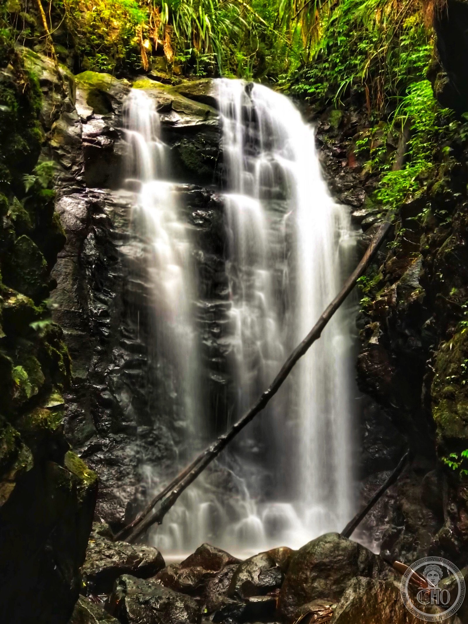
The largest and most extensive subtropical rainforests on Earth, and among the best-preserved remnants of the ancient Gondwana ecosystems that covered the southern hemisphere 180 million years ago. These forests hold living fossils — plant lineages unchanged since the breakup of the supercontinent — and more threatened bird and frog species than any comparable area of Australia.
At a glance
The Gondwana Rainforests of Australia World Heritage Site encompasses a cluster of protected areas straddling the border of Queensland and New South Wales in eastern Australia, covering 366,527 hectares. First inscribed in 1986 and extended in 1994, it was one of the first natural World Heritage Sites in Australia. The forests represent the most biologically diverse terrestrial ecosystem on the continent, growing on and around a series of ancient shield volcanoes — including the remnant of the Tweed Volcano, the largest shield volcano Australia has ever produced (23 million years old).
Key facts
- UNESCO inscription: 1986 (extended 1994), Natural Heritage (criteria viii, ix, x)
- Location: Queensland–New South Wales border, eastern Australia; GPS approx. -28.3167, 153.0500
- Total area: 366,527 hectares across multiple protected areas
- Geological anchor: Remnant of the Tweed Volcano — Australia’s largest shield volcano (23 Ma)
- Living fossil: Antarctic beech (Nothofagus moorei) — relatives only in New Zealand, New Caledonia, South America
- Notable fauna: Albert’s lyrebird (world’s largest songbird); Richmond birdwing butterfly; Fleay’s barred frog
- Key parks: Dorrigo, New England, Springbrook, Lamington, Nightcap
History
The Gondwana Rainforests preserve the evolutionary heritage of an ancient world. When the supercontinent Gondwana began breaking apart approximately 180 million years ago, the plant communities that covered its cooler, wetter regions were gradually isolated on different continental fragments. In eastern Australia, protected by the Great Dividing Range from the arid interior, a relic of that ancient flora survived. The Antarctic beech forests on the cooler escarpments are the most dramatic examples: these trees are living members of the genus Nothofagus that colonised Gondwana in the Cretaceous and whose nearest relatives are now separated by entire oceans.
The shield volcanoes that underpin the landscape add another layer of geological heritage. The Tweed Caldera — the eroded remnant of what was once a massive shield volcano — created the fertile soils and rugged topography that allowed the rainforests to persist through ice ages and periods of aridity. UNESCO’s 1986 inscription recognised these forests as an irreplaceable biological archive and a living laboratory for understanding the evolution of the southern continents.
What you see
The experience of these rainforests ranges dramatically by altitude and park. In the lowland subtropical zones (as at Lamington and Springbrook), the canopy towers to 40 metres with strangler figs, brush box, and hoop pine, and the floor is thick with ferns and mosses. On cooler escarpments above 900 metres, the Antarctic beech forms cathedral-like forests — the gnarled, moss-covered trunks draped in green feel prehistoric and otherworldly.
Waterfalls are a recurring feature throughout: Box Log Falls (Springbrook), Minnamurra Falls (Budderoo), and the famous Ebor Falls (Guy Fawkes River) are among the most spectacular. The World Heritage Walk at Dorrigo National Park offers a rainforest canopy walkway, while the Border Ranges provide sweeping views of the Tweed Caldera — the full collapsed rim of the ancient volcano visible as a ring of ranges stretching to the horizon.
Practical information
- Access: Multiple entry points across Queensland and NSW; each park has its own visitor centre
- Entry fees: NSW national parks: pass required (day or annual); Queensland parks: free entry
- Best time: April–October (dry season) for clearest walks; summer for lush growth but leeches and higher rainfall
- Facilities: Visitor centres at Dorrigo, Lamington (O’Reilly’s), and Springbrook
- Walking: Extensive marked trail networks from 1 km boardwalks to multi-day wilderness routes
- Wildlife: Best dawn and dusk; Albert’s lyrebird most visible in winter (June–August)
Getting there
The WHS clusters around the Queensland–NSW border region, approximately 100–150 km south of Brisbane and 500–600 km north of Sydney. Key access points: Dorrigo NP (90 km west of Coffs Harbour, NSW); Lamington NP (110 km south of Brisbane via Canungra); Springbrook NP (100 km south of Brisbane via Mudgeeraba); New England NP (50 km east of Armidale, NSW). Driving is strongly recommended — public transport options are very limited. Nearest major airports are Brisbane (QLD) and Coffs Harbour (NSW).
Nearby
The Gold Coast hinterland (Springbrook/Lamington) is 90 minutes from Brisbane city and combines with Surfers Paradise for mixed nature-urban itineraries. The Tweed Valley (NSW side) contains the village of Murwillumbah, gateway to the Wollumbin (Mount Warning) area — the first place in Australia touched by sunlight each morning, at the geographical centre of the ancient Tweed Caldera. Byron Bay (50 km east) anchors the coastal end of multi-day hinterland circuits.
Sources
- UNESCO WHL: Gondwana Rainforests of Australia (No. 368, 1986/1994)
- Wikipedia: Gondwana Rainforests of Australia
- NSW National Parks: nationalparks.nsw.gov.au
- Queensland National Parks: parks.des.qld.gov.au
Find it on the map
See this place and what’s around it →📷 Become a Cultural Heritage Online photographer
Share your photos of places: they stay published under your name as the author. The more they're seen, the more you get noticed — and soon a contest will reward the most appreciated photos.
Log in or sign up free to add a photo