
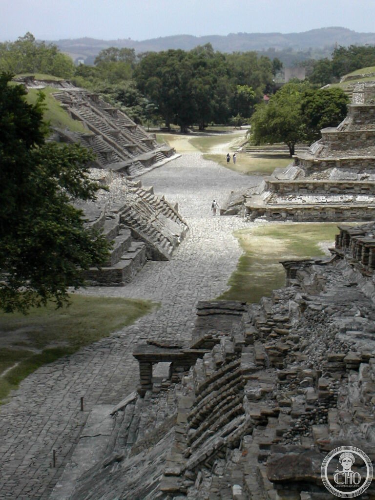
Rising from tropical forest on Mexico’s Gulf Coast, El Tajín was the capital of the Totonac civilisation and is dominated by the Pyramid of the Niches, a seven-tiered structure whose 365 recessed squares mark the days of the solar year. The site also holds more ball courts than any other in Mesoamerica.
At a glance
El Tajín was the capital of the Totonac civilisation, which flourished here from around 600 to 1200 CE on the Gulf Coast of Mexico. The site covers roughly ten square kilometres and includes more than 150 identified structures, among them seventeen ball courts, more than at any other site in Mesoamerica, a reflection of how central the ritual ball game was to Totonac religion.
The most elaborately carved of these is the South Ball Court, whose six bas-relief panels narrate scenes from the game, including the sacrifice by decapitation of a player and a skeleton emerging from his spilled blood. These are regarded as among the finest narrative reliefs produced anywhere on the Gulf Coast.
Key facts
- Pyramid of the Niches: built around 600–900 CE, seven stepped platforms roughly 25 metres high, with 365 square niches originally painted red against a white building, one niche for each day of the solar year.
- Voladores de Papantla: a ritual flying ceremony linked to El Tajín since at least the Classic period, in which four men descend from a pole making thirteen rotations each while a fifth plays flute and drum from the top; the four rotations of thirteen correspond to the 52-year Mesoamerican calendar round.
- Tajín Chico: the upper city quarter, seat of the administration and elite residences, notable for roofs built in a concrete-like material made from local limestone, an unusually advanced technique for Mesoamerica.
- Recognition: El Tajín was inscribed as a UNESCO World Heritage Site in 1992; the Voladores ceremony was separately declared UNESCO Intangible Cultural Heritage of Humanity in 2009.
- Location: approximately 20.4478° N, 97.3778° W.
History
By the late fifteenth century the Aztec Empire had conquered the Totonac region and imposed tribute, including vanilla, which the Totonac had domesticated and held under monopoly, considering it sacred to the goddess Xanat, and cacao. It was largely to escape this tribute that the Totonac allied themselves with Hernán Cortés in 1519.
El Tajín was effectively rediscovered for the outside world in 1785, when the Spanish colonial official Diego Ruiz came upon it while searching for illegal tobacco plantations in the surrounding jungle; he found local Totonac people still tending the site. The name El Tajín means thunder in the Totonac language.
What you see
On the highest terrace of Tajín Chico stands the Building of the Columns, the largest structure at the site, whose six columns, each around twelve metres in circumference, are carved with a narrative account of the Totonac ruler known as 13-Rabbit, named for his calendrical birth date. The reliefs depict his rise to power, his victories in the ball game and his eventual deification, making this the only identified sequence of royal narrative portraiture at El Tajín.
Unlike the highland sites of central Mexico, El Tajín sits within humid tropical forest, and vegetation growing between the structures gives the site a distinctive atmosphere. The contrast between the precise stone geometry of the Pyramid of the Niches and the surrounding jungle is unlike anything else in Mesoamerica.
Practical information
- Voladores ceremony: performed on a wooden pole near the site entrance; a tip for the performers is customary.
- Festival Cumbre Tajín: an annual gathering held in March that brings music, indigenous culture and Voladores performances to the site; it draws large crowds, so visitors preferring a quieter visit should plan around it.
- Visiting time: allow a good part of a day to see the main structures properly.
- Tickets and access: check the official site channels for current entry arrangements and opening times before travelling.
Getting there
El Tajín can be reached by flying into Poza Rica, the nearest airport, or into Mexico City and continuing overland, with a bus connection to Papantla followed by local transport to the site. Papantla, twelve kilometres away, is the closest town and the usual base for visiting.
Nearby
- Papantla — 12 km south; a fragrant market town regarded as the vanilla capital of Mexico, home to the original Totonac vanilla variety and to a large mural by Teodoro Cano on the Presidencia Municipal depicting Totonac history.
- Veracruz City — 180 km south; Mexico’s great port city, founded by Hernán Cortés in 1519 and considered the first European city on mainland North America, with the Malecón waterfront, the fortress of San Juan de Ulúa and the Naval History Museum; also the birthplace of son jarocho music and the danzón.
Sources
- Wikipedia, El Tajín
- Wikipedia, Pyramid of the Niches
- Wikipedia, Voladores
- UNESCO, Pre-Hispanic City of El Tajín, World Heritage Site reference 631
Find it on the map
See this place and what’s around it →📷 Become a Cultural Heritage Online photographer
Share your photos of places: they stay published under your name as the author. The more they're seen, the more you get noticed — and soon a contest will reward the most appreciated photos.
Log in or sign up free to add a photo