
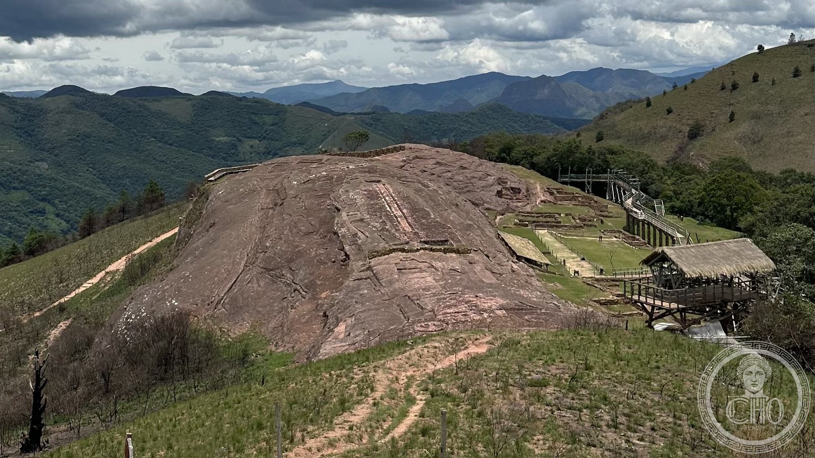
A massive sandstone rock at 1,950 metres altitude in the Bolivian foothills, covered with ritual carvings spanning two millennia — the largest known carved rock with a ritual function in the world.
At a glance
El Fuerte de Samaipata is a UNESCO World Heritage Site in the foothills of the Andes, about 120 kilometres southwest of Santa Cruz de la Sierra. The site centres on an enormous sandstone outcrop — approximately 250 metres long and 60 metres wide — whose surface has been carved, channelled, and sculpted by successive cultures over more than two thousand years.
The rock is recognised as the largest known carved rock with a ritual function in the world. Its name combines the Spanish “El Fuerte” (the Fort) and the Quechua “Samaipata” (resting place on high). UNESCO inscribed the site in 1998.
What was carved and by whom
The earliest carvings predate the Inca by more than a thousand years and are attributed to the Chane people. Their work includes zoomorphic figures, particularly two large parallel feline forms (likely jaguars), geometric channels, a ceremonial seat, and drainage networks — all cut directly from living rock.
Around 1470 AD, the Inca Empire expanded to Samaipata and added their own imperial symbols: a usnu (ceremonial platform) and modifications consistent with Inca ritual geography. The two parallel grooves running 2 metres wide from the jaguar figure down the rock face are believed to align with the ecliptic path of certain stars, though their precise function remains debated. The labyrinthine channels of unknown purpose are one of the site’s enduring mysteries.
History
The Chane people occupied the site from approximately 300 BC onward. The Inca incorporated it into their imperial network around 1470 AD. Spanish colonisers arrived in 1574 and established a fort at the base of the rock (hence “El Fuerte”), using the strategic elevated position for military purposes. By the early 17th century the site had been abandoned.
Swedish archaeologist Erland Nordenskiöld was the first professional researcher to document El Fuerte in 1913. Alfred Métraux and others contributed subsequent ethnographic and archaeological descriptions. Systematic excavation was conducted by Albert Meyers of the University of Bonn beginning in 1981, revealing occupation layers and artefacts across the full span of the site’s use.
Cultural significance
The site is a palimpsest of pre-Columbian South American history: Chane, Inca and Spanish layers overlap on a single rock. In Quechua, “Samaipata” means “resting place on high,” a name that captures both its altitude and its function as a waypoint on Inca roads. The site’s ritual landscape — carvings, platforms, drainage channels — suggests ceremonies linked to water, mountain spirits, and celestial observation.
El Fuerte is one of the few sites where pre-Inca and Inca architecture can be directly compared on the same surface, making it invaluable for understanding the Inca expansion into lowland South America.
Key facts
- Country: Bolivia
- Coordinates: 18.158°S, 63.867°W
- Altitude: 1,950 m
- Rock dimensions: approx. 250 m × 60 m
- Cultures: Chane (c. 300 BC), Inca (c. 1470 AD), Spanish (1574 AD)
- UNESCO World Heritage Site: 1998
- Discovered by: Erland Nordenskiöld, 1913
- Nearest city: Santa Cruz de la Sierra, approx. 120 km northeast
Getting there
El Fuerte is located near the town of Samaipata, accessible by road from Santa Cruz de la Sierra (approximately 2.5 hours). The surrounding Santa Cruz foothills are known for their transitional Andean-Amazon ecology. An on-site museum provides context for the carvings. Check current visiting hours and admission fees with Bolivia’s Ministry of Cultures before travelling.
What to see on site
The carved rock is reached via a short uphill walk from the parking area. The surface carvings are best seen in morning or late afternoon light, when low-angle illumination reveals the channels and relief carving. The twin jaguar figures and the long parallel grooves running down the rock face are the most visually striking elements. The museum at the base displays excavated ceramics and explains the different cultural layers.
Sources
Find it on the map
See this place and what’s around it →📷 Become a Cultural Heritage Online photographer
Share your photos of places: they stay published under your name as the author. The more they're seen, the more you get noticed — and soon a contest will reward the most appreciated photos.
Log in or sign up free to add a photoIs this page about you?
This page is read by travellers and heritage enthusiasts who find it on Google. Tell us how you are connected to this place and we will take it from there.