

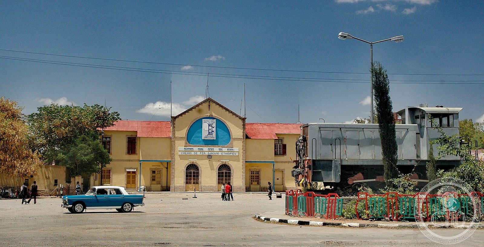
Dire Dawa did not grow; it was drawn. When the railway from Djibouti could not climb to Harar, engineers laid out a brand-new town on the plain below — a planned grid of asphalt streets, piped water and aligned façades that became Ethiopia’s first designed city. Beside it, an older market quarter grew on its own terms. The two still face each other across a dry riverbed.
At a glance
Dire Dawa sits in eastern Ethiopia, at the foot of a ring of cliffs, divided by the seasonal Dechatu River into two opposite ideas of a city. On the north-west bank lies Kezira, the orderly quarter built by the railway company: a planned colonial enclave of straight asphalt roads, drainage, piped water and regular buildings, laid out for the railway’s European staff and the Greek, Armenian and Arab merchants who followed the line. On the south-east bank spreads Magala — the word means “market” in both Somali and Oromo — a dense, organic quarter that grew without a plan and remains the heart of the city’s trade. Together they make Dire Dawa one of the most legible railway towns in the Horn of Africa.
Key facts
- Country: Ethiopia (chartered city, eastern highlands edge)
- Founded: 24 December 1902, when the Addis Ababa–Djibouti railway reached the site
- Why it exists: Harar was too steep for the railway, so a new town was planned on the plain below
- Two quarters: Kezira (the planned railway town) and Magala (the older market quarter), split by the Dechatu River
- Cosmopolitan founders: Greeks, Armenians, Arabs, Indians and other Europeans; a French Capuchin mission settled in 1909
- Later layer: Italian administrative buildings added during the occupation of 1936–1941
History
The town was founded on 24 December 1902, the day the railway being built inland from the port of Djibouti reached the plain below Harar. The ancient walled city of Harar stood on ground too steep for a line, so the railway company simply created a new settlement where its tracks could run — and built it to a plan. The result was Kezira, whose name comes from the Arabic jazeera, “island”: a colonial enclave set apart from the surrounding country, with a street grid, drainage and piped water that made it, by most accounts, the first properly planned urban centre in Ethiopia. A formal layout for the quarter dates to 1909.
The railway was reorganised as the Franco-Ethiopian Railway in 1908 and completed its run to Addis Ababa by 1917, fixing Dire Dawa as the great inland junction of the Horn. Around the station gathered an unusually mixed population — Greeks, Armenians, Arabs and other Europeans who opened shops, hotels and small industries, alongside Indian traders with their own schools and a French Capuchin mission established in 1909. Across the Dechatu, Magala drew Somalis, Oromos, Hararis, Arabs and Indians into a market quarter that thrived precisely because no engineer had designed it.
During the Italian occupation of 1936–1941, the new administration added a further layer of building to Dire Dawa, much of it for government and the Fascist party — the same colonial-modern impulse that reshaped Asmara and central Addis Ababa in the same years. The railway-age fabric of Kezira and this later layer together give the city the cosmopolitan architecture for which it is still known.
What you see
Kezira is the part to walk. Its regular blocks, shaded verandas and low railway-era buildings still read as a planned colonial town, and the railway station — the western terminus of the historic line — remains the quarter’s anchor and its most photographed building. The contrast is the lesson: cross the dry bed of the Dechatu and the grid dissolves into the crowded lanes and stalls of Magala, where the city’s commercial life has always actually happened.
Much of Kezira’s early fabric is fragile, and parts of it have been lost, so the quarter is best understood as a heritage landscape under pressure rather than a polished monument. That fragility is part of why Dire Dawa matters: it is one of the clearest surviving examples of how a railway, a plan and a frontier economy could conjure an entire city in a single generation.
Practical information
- Best approach: on foot through Kezira around the station, then across to the Magala market
- The station: the historic terminus is the visual heart of the railway town; check locally before photographing railway property
- Climate: hot and dry (tropical savanna), with a mean annual temperature near 26 °C — visit outside the hottest hours
- Time needed: half a day for a walking circuit of both quarters
Getting there
Dire Dawa has its own airport with domestic and some regional flights, making air the simplest arrival from Addis Ababa. The modern standard-gauge Addis Ababa–Djibouti railway also serves the city, with its station some way north-west of the centre, and long-distance buses connect Dire Dawa to Harar and the rest of eastern Ethiopia. The historic city centre and the two quarters are compact enough to explore on foot once you arrive.
Related in CHO
- Addis Ababa — The Piazza and the Italian-Period Layer
- Asmara — Africa’s Modernist City and Italian Rationalism
- Massawa — The Red Sea Port of Italian Eritrea
- Algiers — Le Corbusier’s Plan Obus and the Modern Bay
Sources
Find it on the map
See this place and what’s around it →📷 Become a Cultural Heritage Online photographer
Share your photos of places: they stay published under your name as the author. The more they're seen, the more you get noticed — and soon a contest will reward the most appreciated photos.
Log in or sign up free to add a photo