
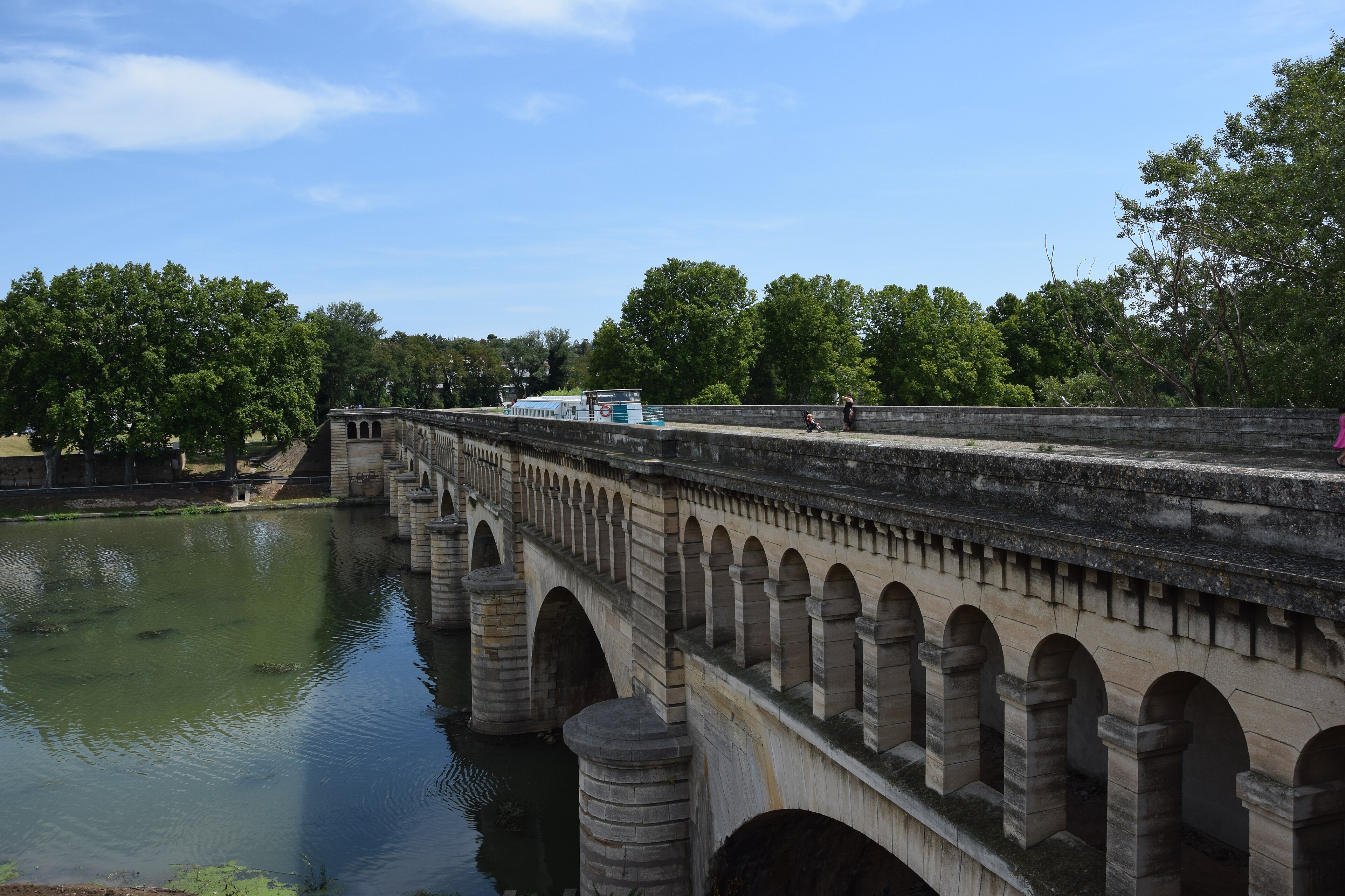
A 240-kilometre waterway linking the Atlantic to the Mediterranean, the Canal du Midi represents one of the greatest engineering triumphs of the 17th century and remains a marvel of hydraulic design.
At a glance
The Canal du Midi stretches 240 kilometres across Southern France, connecting the Garonne river to the Étang de Thau on the Mediterranean. Together with the Canal de Garonne (193 km), it forms the Canal des Deux Mers—a navigable route joining the Atlantic and Mediterranean seas. This engineering feat remains operational after more than three centuries.
History
Jean-Baptiste Colbert authorized construction by royal edict in October 1666, intending to develop the wheat trade between France’s coasts. Pierre-Paul Riquet supervised the project under King Louis XIV, with work continuing from 1666 to 1681. The canal’s original name, Canal Royal en Languedoc, was changed to Canal du Midi by French revolutionaries in 1789.
Riquet identified the crucial technical challenge: conveying water from the Montagne Noire (Black Mountains) across the Seuil de Naurouze, the canal’s highest point. His innovative solutions established principles of inland water transport still relevant today.
What you see
The canal features a systematic series of locks, aqueducts, and water management systems designed to overcome significant elevation changes. The waterway is lined with towpaths and tree-lined banks, creating a navigable corridor that blends functional engineering with landscape design.
Cultural significance
The Canal du Midi stands as one of Europe’s oldest continuously operating canals—predated only by the Briare Canal. UNESCO recognized its outstanding engineering and artistic design by inscribing it as a World Heritage Site in 1996. The canal received further acknowledgement as an International Historic Civil Engineering Landmark in 2016, cementing its place in the history of infrastructure development.
Key facts
- Length: 240 kilometres (150 miles)
- Construction period: 1666–1681
- Location: Southern France
- UNESCO World Heritage Site: 1996
- International Historic Civil Engineering Landmark: 2016
- Coordinates: 43.61°N, 1.42°E
Practical information & getting there
The canal is open to the public for leisure boating and walking. Access points are distributed throughout its length, with major cities including Toulouse and Sète serving as starting and ending points. For current visiting information, navigation permits, and boat-rental options, consult local tourism offices along the route.
Sources & resources
Find it on the map
See this place and what’s around it →📷 Become a Cultural Heritage Online photographer
Share your photos of places: they stay published under your name as the author. The more they're seen, the more you get noticed — and soon a contest will reward the most appreciated photos.
Log in or sign up free to add a photo