
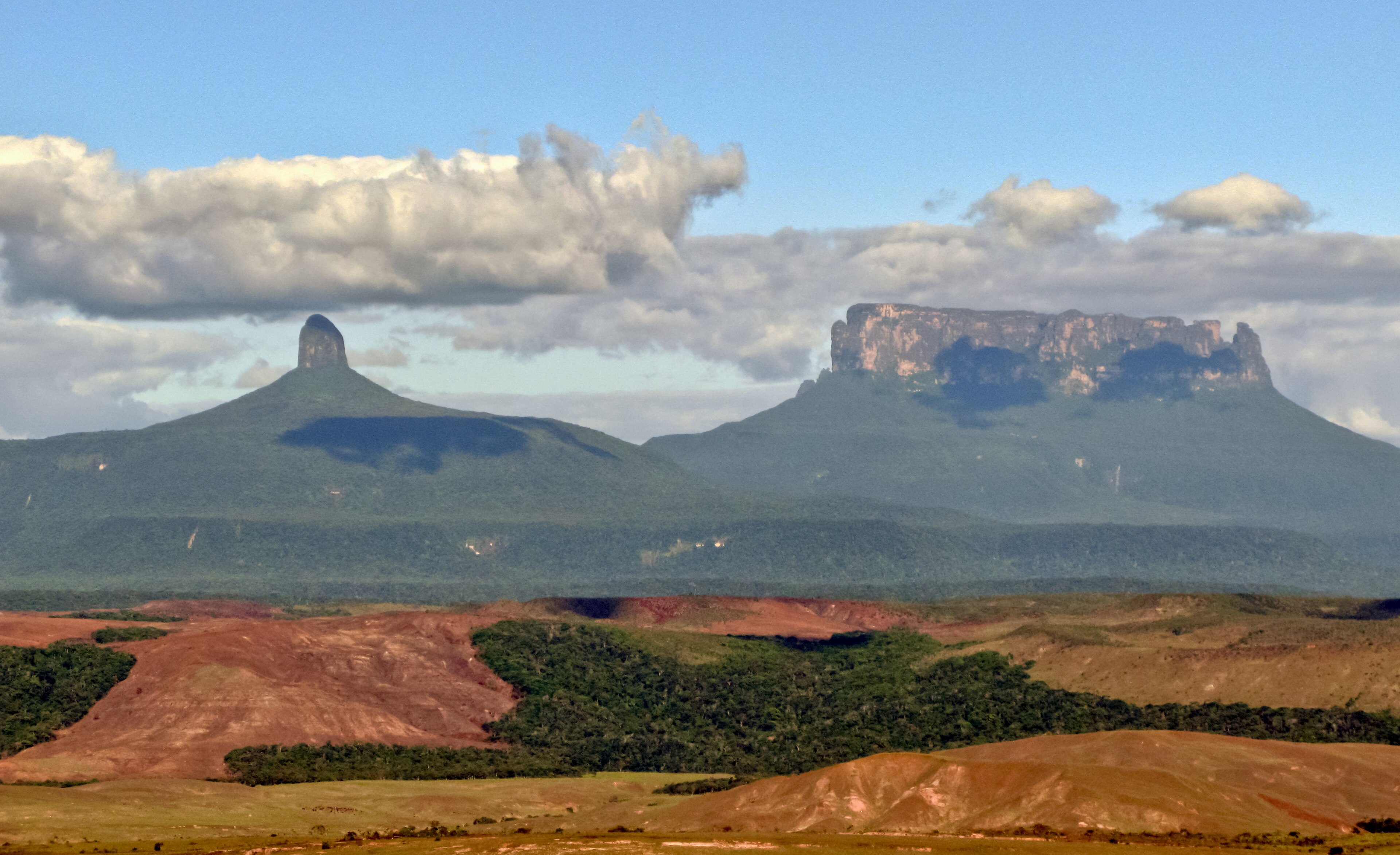
A vast protected wilderness in south-eastern Venezuela spanning 30,000 square kilometres, where three nations converge and ancient landscapes define the Gran Sabana region.
At a glance
Canaima National Park encompasses one of South America’s most pristine and geographically significant territories. The park’s boundaries extend to the borders of both Brazil and Guyana, making it a critical landscape for regional biodiversity and indigenous cultures. Its scale—roughly 12,000 square miles—reflects the ambition of Venezuela’s conservation efforts in the late 20th century.
History
The park was established to protect the Gran Sabana region, a landscape shaped by millennia of geological and ecological processes. UNESCO designated Canaima a World Heritage Site, recognising its outstanding universal value and the need for international stewardship of its ecosystems and cultural heritage.
What you see
Canaima is defined by its vast plateau landscape, characterized by tepuis—table-top mountains that rise dramatically from savanna floors. The terrain encompasses diverse ecosystems, from grasslands to forests, supporting complex networks of waterways and geological formations unique to the region.
Cultural significance
The park holds profound importance for indigenous peoples of the region, particularly the Pemon communities, whose ancestral territories and traditions are integral to Canaima’s cultural identity. The landscape itself—its formation and features—has shaped human settlement and spiritual practices for generations.
Key facts
- Location: Bolívar State, Venezuela
- Area: 30,000 km² (12,000 sq mi)
- Coordinates: 6.17°N, 62.50°W
- UNESCO World Heritage Site: Yes
- Borders: Brazil and Guyana
Practical information & getting there
Access to Canaima requires planning; the remote location in south-eastern Venezuela demands preparation. Visitors should consult current travel advisories and local authorities regarding access routes, permits, and conditions before attempting to visit this protected wilderness.
Sources & resources
Find it on the map
See this place and what’s around it →📷 Become a Cultural Heritage Online photographer
Share your photos of places: they stay published under your name as the author. The more they're seen, the more you get noticed — and soon a contest will reward the most appreciated photos.
Log in or sign up free to add a photo