
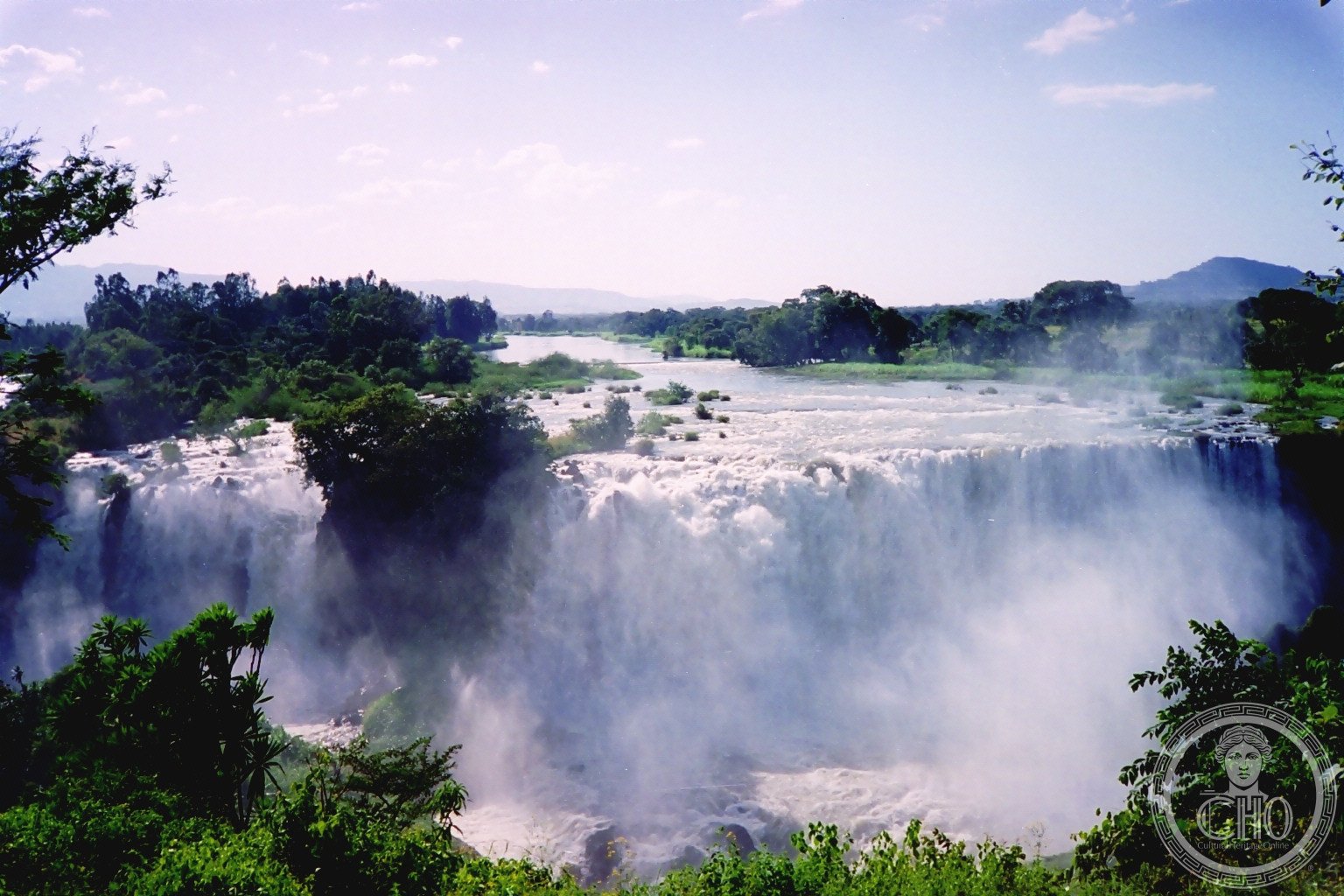
A dramatic 42-metre waterfall on Ethiopia’s Blue Nile, known locally as Tis Abay—the ‘great smoke’—for the mist that rises from its thundering cascade during the rainy season.
At a glance
The Blue Nile Falls plunge 42 metres into the river below, swelling to over 400 metres wide during the monsoon months. The waterfall’s name in Amharic, Tis Abay, captures the spectacle of spray and mist that dominates the landscape when water volume peaks. Located roughly 30 kilometres downstream from Bahir Dar and Lake Tana, the falls rank among Ethiopia’s most visited natural attractions.
History
The falls’ historical significance extends beyond their natural drama. Emperor Susenyos ordered construction of Ethiopia’s first stone bridge just downstream in 1626. The craftsman supervising the work had travelled from India with Afonso Mendes, the Catholic Patriarch of Ethiopia. Stone for lime-making was quarried nearby along the Alata tributary, supporting local construction traditions.
What you see
Four distinct streams converge at the falls, their volume transforming seasonally from a modest flow in the dry months to a torrential spectacle. The rainy season unleashes the full force of the Blue Nile here, creating a dramatic amphitheatre of water, rock, and spray. The downstream stone bridge, built in the 17th century, remains visible as a testament to early Ethiopian masonry.
Cultural significance
Beyond their role as a major tourist draw, the falls carry profound ecological importance. They isolate Lake Tana’s ecosystem from the rest of the Nile basin—a separation that has shaped the evolution of the lake’s endemic fauna over millennia. Since 2003, hydroelectric regulation has modified the falls’ natural rhythm, though seasonal variation persists.
Key facts
- Height: 42 metres (138 feet)
- Maximum width during rainy season: over 400 metres (1,300 feet)
- Location: West Gojjam, Amhara Region, Ethiopia
- Distance from Bahir Dar: approximately 30 kilometres downstream
- Local name: Tis Abay (‘great smoke’ in Amharic)
- Coordinates: 11.4905°N, 37.5878°E
Practical information & getting there
The falls lie 30 kilometres south of Bahir Dar, accessible by road and foot. Visitor experience depends heavily on season: the rainy season (June to September) offers the most dramatic water volume, while the dry season reveals the underlying rock structure. A hydroelectric facility now diverts significant flow except during peak monsoon months.
Sources & resources
- Blue Nile Falls – Wikipedia
- Cultural Heritage Online
Find it on the map
See this place and what’s around it →📷 Become a Cultural Heritage Online photographer
Share your photos of places: they stay published under your name as the author. The more they're seen, the more you get noticed — and soon a contest will reward the most appreciated photos.
Log in or sign up free to add a photo