Polder di Beemster (1612): il paesaggio geometrico dell’ingegneria idraulica olandese
A nord di Amsterdam si distende un paesaggio che sembra disegnato a squadra e compasso: il Beemster è il primo grande polder dei Paesi Bassi, strappato alle acque di un lago tra il 1609 e il 1612 grazie a quarantaquattro mulini a vento. Da quattro secoli mantiene la sua forma originale — canali dritti, strade geometriche, fattorie regolari — un esempio straordinario di pianificazione rinascimentale applicata a un territorio creato dall’uomo, e dal 1999 è Patrimonio UNESCO.
At a glance
The Beemster Polder, drained between 1609 and 1612, was the first large body of water in the Netherlands to be reclaimed as dry land, creating 7,100 hectares of fertile agricultural land from a shallow lake. Planned on a Renaissance grid by the engineer Jan Adriaenszoon Leeghwater and the cartographer Lucas Jansz Sinck, the polder retains its original geometric pattern of roads, canals, dykes and farmsteads with extraordinary completeness. Inscribed by UNESCO in 1999, it is regarded as the most perfect surviving example of Dutch 17th-century land reclamation planning.
Key facts
- UNESCO: World Heritage since 1999 (Ir.D.F. Woudagemaal listed separately; Beemster ref. 899)
- Drained: 1609–1612, using 44 windmills
- Area: 7,100 hectares of reclaimed land from Beemster Lake
- Planned: on a strict Renaissance grid by engineer Leeghwater and cartographer Sinck
- Preserved: the original 1612 landscape survives almost unchanged
- Setting: North Holland, 18 km north of Amsterdam
History
The Beemster was a large, shallow lake in North Holland, plagued by flooding and storms. In 1607, a consortium of Amsterdam merchants obtained permission to drain it as an investment. Engineer Jan Adriaenszoon Leeghwater, then still in his twenties, designed a ring canal and dyke system with forty-four windmills to pump the lake dry in stages. By May 1612, the Beemster was drained — the first major inland lake in the Netherlands to be reclaimed. The newly created land was surveyed and divided into a regular grid of rectangular plots following Renaissance planning ideals, with roads, canals and farmsteads distributed with geometric precision.
The Beemster remained productive farmland for four centuries, its original plan surviving the industrialisation that transformed most Dutch polders. Its windmills were replaced by steam-powered pumping stations in the 19th century, then electric ones — but the landscape geometry remained intact. UNESCO inscribed it in 1999 as an outstanding example of the Dutch landscape planning tradition that would go on to drain much of the Netherlands.
What you see
The Beemster is a perfectly flat, open agricultural landscape of extraordinary geometric clarity. Straight roads and canals intersect at right angles; the horizon is punctuated by isolated farm buildings, rows of poplars and church spires. Cycling through the polder gives a sense of the logic and scale of the enterprise: every field, ditch and road is exactly where 17th-century engineers planned it.
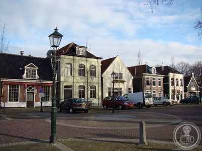
The village of Middenbeemster, at the centre, has a church and farmhouses dating from the early 17th century. The ring canal and dyke that define the polder’s perimeter are still fully functional.
Practical information
- Access: best explored by bicycle; rental available in the area
- Best time: spring (tulip fields nearby) or summer; winter fogs can be atmospheric
- Time needed: 2–4 hours cycling the polder perimeter
- Setting: 18 km north of Amsterdam, North Holland
Getting there
The Beemster is 18 km north of Amsterdam. By public transport: bus from Purmerend (trains from Amsterdam). By car: exit A7 at Purmerend-Noord. Cycling from Amsterdam via the North Holland Cycle Route is a popular option. GPS: 52.55° N, 4.93° E.
Nearby
- Purmerend — the market town just south, with regular cheese markets
- Edam — the historic cheese and canal town, 10 km east
- Amsterdam — the city founded by the same merchant class that drained the Beemster, 18 km south
Sources
- UNESCO World Heritage Centre — “Droogmakerij de Beemster (Beemster Polder)” (ref. 899)
- Encyclopaedia Britannica — Beemster polder
- Netherlands Cultural Heritage Agency (RCE) — official documentation
Find it on the map
See this place and what’s around it →📷 Diventa un fotografo di Cultural Heritage Online
Condividi le tue foto dei luoghi: restano pubblicate con la tua firma come autore. Più vengono viste, più ti fai conoscere — e presto un concorso premierà le foto più apprezzate.
Accedi o registrati gratis per aggiungere una foto