
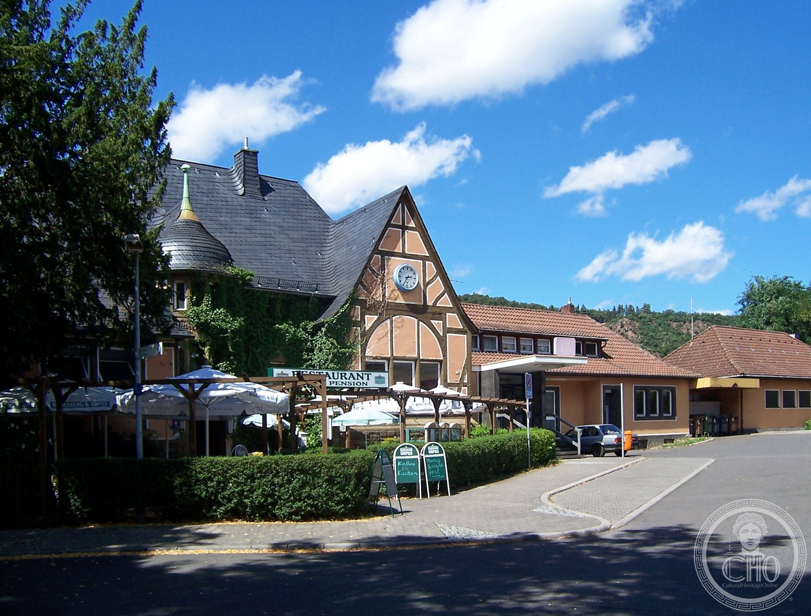
A railway junction station in the Rhineland-Palatinate, opened in 1859 and crowned by a monument-protected building from circa 1910. Once a vital transport hub connecting three regional valleys.
At a glance
Bad Münster am Stein station served as a strategic railway junction in the valley region of western Germany. Its Edwardian-era station building reflects the importance of rail transport in the early twentieth century. Today it operates as a Deutsche Bahn category 4 station within the Rhine-Nahe local transport network.
History
The station opened in 1859 as a through station on the Nahe Valley Railway, constructed by the Rhine-Nahe Railway Company. In 1871, the Alsenz Valley Railway extended northward from Hochspeyer, establishing its terminus at the town then known simply as Münster. From 1904 to 1961, the station also anchored the north-eastern end of the Glan Valley Railway, a strategic line that connected to Homburg. This triple convergence made Bad Münster am Stein a significant regional transport interchange throughout the twentieth century.
What you see
The station building dates from approximately 1910 and carries protection as a cultural monument. Its design reflects the Edwardian railway aesthetic that dominated German station architecture of that era. The structure remains a testament to turn-of-the-century engineering ambition and civic pride.
Cultural significance
As a protected monument, the station building preserves evidence of the railway age that transformed rural valleys into connected economic zones. The junction itself embodies the strategic thinking of nineteenth-century German railway planners, who saw rail routes as instruments of regional integration and industrial development.
Key facts
- Country: Germany
- City: Bad Kreuznach, Rhineland-Palatinate
- Opened: 1859
- Station building: circa 1910, protected monument
- Deutsche Bahn classification: Category 4
- Coordinates: 49.813398, 7.8470063
- Address: Berliner Straße 20
Practical information & getting there
The station is located within the Rhein-Nahe-Nahverkehrsverbund (Rhine-Nahe local transport association) network and operates in fare zone 401. You can reach it by regional rail services connecting Bad Kreuznach and the surrounding valleys. The station building may be viewed from the platform; inquire locally about access to the interior or guided heritage visits.
Sources & resources
Find it on the map
See this place and what’s around it →📷 Become a Cultural Heritage Online photographer
Share your photos of places: they stay published under your name as the author. The more they're seen, the more you get noticed — and soon a contest will reward the most appreciated photos.
Log in or sign up free to add a photoIs this page about you?
This page is read by travellers and heritage enthusiasts who find it on Google. Tell us how you are connected to this place and we will take it from there.