Aosta Romana — Augusta Praetoria Salassorum: Arco, Porta, Teatro e Anfiteatro (25 a.C.)
The most complete surviving Roman city north of the Alps — Augusta Praetoria Salassorum, founded in 25 BCE at the junction of the Alpine passes to France and Switzerland — whose four principal monuments (Arco d’Augusto, Porta Praetoria, Teatro Romano, Criptoportico) are embedded in the living city of Aosta with almost no modern interference, so that walking between them is an experience of ancient urban planning at the scale at which it was designed.
At a glance
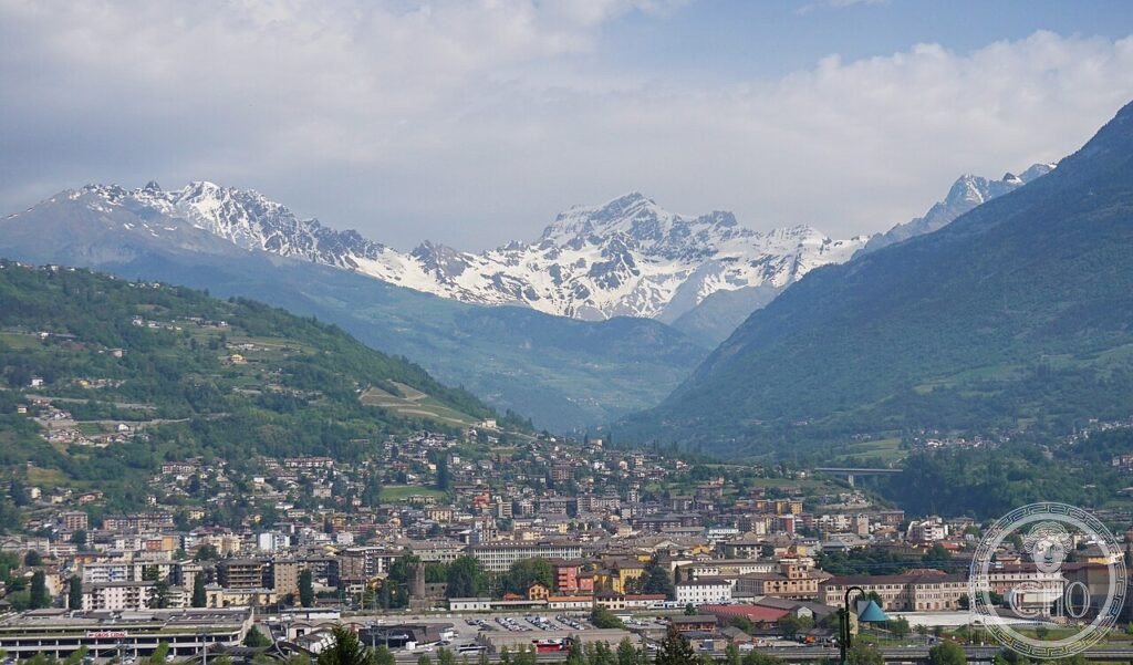
Aosta (ancient Augusta Praetoria Salassorum) is the capital of the Valle d’Aosta region at the junction of the Aosta Valley (which connects the Po plain to the Mont Blanc and Great St. Bernard passes) with the lateral valleys leading to the Matterhorn and Monte Rosa. It was founded in 25 BCE by the Emperor Augustus after the defeat and displacement of the Salassi tribe, who had controlled the Alpine passes and taxed the gold-washing in the valley rivers. The city was a garrison town, planned on the Roman castrum model (rectangular grid, two main axes crossing at right angles), sized for approximately 3,000 soldiers with space for civilian settlement.
Aosta is remarkable for the density and completeness of its Roman monuments within the modern city: the Arco d’Augusto (25 BCE), the Porta Praetoria (25 BCE), the Teatro Romano (first century CE), the Criptoportico (first century BCE–CE), and the Anfiteatro (first–second century CE) are all within the historic centre, none more than 600 metres from the others, and all accessible to visitors with varying degrees of excavation and consolidation.
Key facts
- Foundation: 25 BCE; Emperor Augustus; after the defeat of the Salassi tribe; garrison for 3,000 soldiers
- Arco d’Augusto: 25 BCE; single arch, 11.4 m high, 8.6 m wide; positioned on the original Via delle Gallie (the road to the Great St. Bernard pass); perfectly preserved (only the original bronze chariot missing from the attic)
- Porta Praetoria: 25 BCE; the principal city gate; three arches (one for vehicles, two for pedestrians); the outer facade is 7 m high; the inner face and the medieval tower above are clearly distinguishable
- Teatro Romano: first century CE; 4,000 seats; the south facade (21 m of the original 22 m survive) is the most dramatic Roman wall north of the Alps; performances were held in the theatre until at least the third century CE
- Criptoportico: first century BCE–CE; underground vaulted gallery 90 m long, 7 m wide; probably a covered market or administrative building; partially excavated in the 1980s
- Anfiteatro: first–second century CE; partially excavated; absorbed into the medieval Convent of Santa Caterina; the curve of one end of the arena is visible in the street pattern
- GPS: 45.7375, 7.3195 (Porta Praetoria) — Google Maps
History
The foundation of Augusta Praetoria in 25 BCE was a military-strategic operation of considerable significance. The Salassi, a Ligurian Alpine tribe who had settled the Aosta valley in the pre-Roman period, had long resisted Roman control; they taxed the gold-washing in the Dora Baltea river (which was substantial: Roman sources claim the Salassi could divert the entire river to expose the gold-bearing gravel) and charged tolls on the mountain passes to France. The Roman general Aulus Terentius Varro Murena defeated the Salassi in 25 BCE, sold approximately 36,000 of them into slavery (according to Strabo), and founded the garrison city to secure the passes permanently.
The city was planned on the standard Roman military model: a rectangular perimeter (724 × 572 metres) with a circuit of walls and towers, two main axes (decumanus maximus east-west, cardo maximus north-south), a forum at their intersection, and a regular grid of insulae. The speed of construction was remarkable: the Arco d’Augusto, the Porta Praetoria, and the main street grid were all completed by 23 BCE, within two years of the foundation. The theatre and the criptoportico were probably added in the reign of Augustus or shortly after.
What you see
The most immediately impressive monument is the south facade of the Teatro Romano, visible from the Via Anfiteatro: a wall 21 metres high and approximately 70 metres long, pierced by three tiers of arched windows in the Roman pattern, in a warm grey local stone (stone of Aosta, a gneiss that weathers to a rich texture). This facade is the largest standing Roman wall north of the Alps and the visual icon of the city. The theatre area is partly excavated and the seating cavea visible from outside the main excavation area; entry to the archaeological area (Museo Regionale di Aosta) gives access to the stage, the orchestra, and the cavea from the inside.
The Arco d’Augusto is on the eastern edge of the historic centre, at the point where the Via delle Gallie entered the city: a single arch, its proportions classical Augustan, the stone still carrying the marks of the original stucco and paint that would have coloured it. The medieval tower that was later built above the arch is still attached and gives the ensemble a stratified appearance. The Porta Praetoria (200 metres west) has a more complex form: the original three-arched Roman gate, with a medieval courtyard built between the inner and outer arches during the Middle Ages, so that two time-strata are legible simultaneously.
Gallery

Practical information
- Museo Regionale di Aosta (Archaeological Areas): includes the Teatro Romano, the Criptoportico, and the Roman Forum. Open Tuesday–Sunday 9:00–19:00 (winter 10:00–18:00). Admission ~€7; combined ticket with other city museums ~€10.
- Arco d’Augusto: Always accessible; free. The arch is on the Via Sant’Anselmo.
- Porta Praetoria: Always visible from outside; the courtyard between the two gate arches is accessible during museum hours (free).
- Anfiteatro: Partially visible; the convent of Santa Caterina incorporates the structure; access to the excavated section through the museum.
- Season: Aosta is cooler than the Po valley even in summer (564 m altitude); pleasant for visiting in all seasons. The city is less crowded than the ski resorts (Courmayeur, Cervinia) 1–2 hours up the valley.
Getting there
Aosta, Valle d’Aosta. By train: Turin–Aosta direct (2h; 9–10 trains daily); Milan–Turin–Aosta (2h50). The Aosta station is 5 minutes on foot from the Porta Praetoria. By car: A5 Turin–Aosta motorway (toll); from Turin 115 km, 1h20; from Milan 200 km, 2h30. The motorway ends at Aosta; follow signs “Centro Storico.” Parking: Piazzale della Stazione (free, large), or Piazza Cavalieri di Vittorio Veneto (paid, central). The historic centre is compact and best visited on foot; all the Roman monuments are within 600 metres of each other.
Nearby
- Castello di Fénis — 12 km east on the Via delle Gallie; the most spectacularly photographed medieval castle in the Valle d’Aosta (XIV–XV century; multiple round towers, external courtyard frescoes); now a regional museum
- Gran Paradiso National Park — 30 km south via Cogne; the first Italian national park (1922); ibex, chamois, and marmot; the Cogne valley is the easiest access point; summer trekking and winter cross-country skiing
- Mont Blanc and Courmayeur — 35 km west; the largest Alpine massif in Europe (4,808 m); Courmayeur is the Italian ski and hiking resort; the Mont Blanc Tunnel to France (Chamonix) begins here; the Skyway Monte Bianco cable car reaches 3,466 m for views of the Mont Blanc massif
Sources
- Wikipedia EN: Aosta
- Wikipedia EN: Arch of Augustus, Aosta
- Strabo, Geographica IV, 6, 7 (on the conquest of the Salassi and the foundation of Augusta Praetoria)
- Museo Regionale di Aosta: regione.vda.it/turismo/Musei
Find it on the map
See this place and what’s around it →📷 Diventa un fotografo di Cultural Heritage Online
Condividi le tue foto dei luoghi: restano pubblicate con la tua firma come autore. Più vengono viste, più ti fai conoscere — e presto un concorso premierà le foto più apprezzate.
Accedi o registrati gratis per aggiungere una foto