
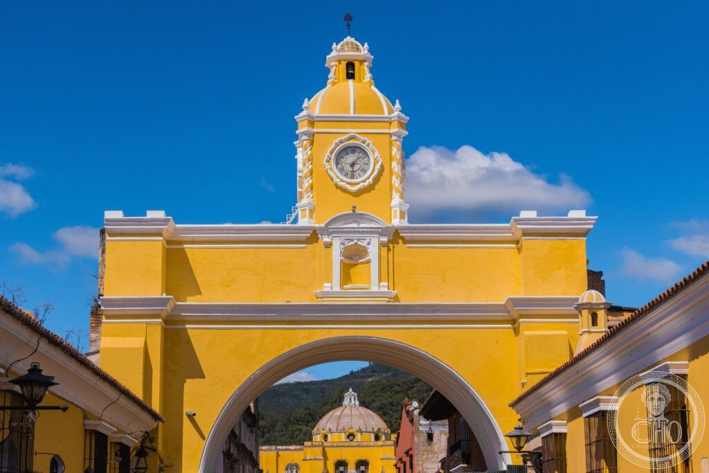
A Spanish colonial capital left half in ruins by earthquake, Antigua sits in a valley ringed by three volcanoes, one of which smokes almost daily. Its Baroque churches, convents and the Arch of Santa Catalina survive alongside the wreckage the 1773 earthquake never cleared, and every Holy Week the streets fill with processions and sawdust carpets.
At a glance
Founded in 1543 as Santiago de los Caballeros de Guatemala, after two earlier capitals were abandoned to floods and indigenous attacks, Antigua served as capital of the Kingdom of Guatemala until 1776. The city is enclosed by three volcanoes: Agua, dormant since it collapsed in 1541; Fuego, active and prone to near-daily ash plumes; and Acatenango, which can be climbed overnight. Antigua also stages the most elaborate Holy Week processions in the Americas, with purple-robed penitents carrying large floats over streets patterned with coloured sawdust.
Key facts
- Founded: 1543, as Santiago de los Caballeros de Guatemala
- Capital status: seat of the Kingdom of Guatemala from 1543 to 1776
- Population at peak: around 60,000 in the 18th century
- Volcanoes: Agua (3,766m, dormant), Fuego (3,763m, active), Acatenango (3,976m)
- Recognition: inscribed as a UNESCO World Heritage Site in 1979
History
Pedro de Alvarado, a lieutenant of Hernán Cortés, conquered the K’iche’ and Kaqchikel Maya of the region in 1524, and Antigua’s founding followed soon after. The Dominican and Franciscan orders arrived with the conquest and built some of the largest religious complexes in colonial Central America here.
The Santa Marta earthquakes of 29 July 1773 devastated the city. The Spanish colonial authorities decided to relocate the capital to the site of present-day Guatemala City, though many residents refused to leave. More than thirty ruined churches, convents and palaces from that period survive, left standing rather than cleared, which gives Antigua its distinctive character.
What you see
The Parque Central, the city’s main square, holds a fountain of 1738 carved with mermaid figures, the Cathedral, partly reduced to ruins after standing between 1680 and 1820, the Palace of the Captains General, built between 1549 and 1763 as the seat of colonial government, and the Cabildo.
The Church of La Merced, completed in 1767, carries a yellow and white Baroque facade considered the most exuberant in the city, and its courtyard contains what is described as the largest colonial fountain in Guatemala. Elsewhere the Cathedral ruins, the Jesuit church of La Compañía de Jesús with its ruined facade, and the round tower of cells at the Las Capuchinas Convent complete the picture of a city built and then partly abandoned by design.
Practical information
- Best season: the dry months from January to April are considered the most favourable, with cooler weather from December to February
- Semana Santa: accommodation for Holy Week should be arranged well in advance given the scale of the processions
- Access to ruins: the Cathedral ruins and several convents charge modest entry; check current arrangements with local tourism authorities before visiting
- Acatenango hike: the overnight climb is normally arranged through a local agency
Getting there
Antigua is reached by road from Guatemala City’s La Aurora International Airport, a short shuttle or taxi journey away. Once there, the historic centre is compact and best explored on foot.
Nearby
- Lake Atitlán — around 100km west, a lake ringed by the volcanoes Tolimán, Atitlán and San Pedro, with Maya Kaqchikel and Tz’utujil communities maintaining traditional dress and markets around its shores
- Tikal — around 550km north, a UNESCO World Heritage Site inscribed in 1979 and the largest Maya archaeological site in Guatemala, with Temple I rising 47 metres and Temple IV, at 64 metres, the tallest known pre-Columbian structure in the Americas
Sources
- Wikipedia, Antigua Guatemala
- Wikipedia, Arch of Santa Catalina
- Wikipedia, Semana Santa in Guatemala
- UNESCO, Antigua Guatemala, World Heritage Site reference 65
Find it on the map
See this place and what’s around it →📷 Become a Cultural Heritage Online photographer
Share your photos of places: they stay published under your name as the author. The more they're seen, the more you get noticed — and soon a contest will reward the most appreciated photos.
Log in or sign up free to add a photo