
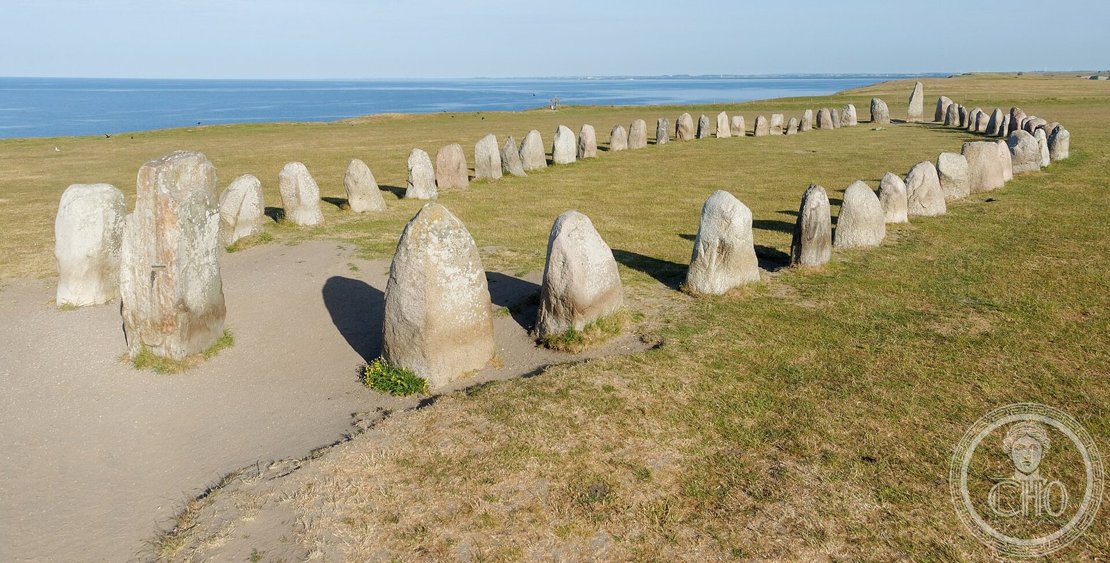
On a chalk headland above the Baltic Sea near Kaseberga in southern Sweden, 59 sandstone boulders arranged as a ship 67 metres long form the largest stone ship setting in Scandinavia — a cliff-edge burial monument of extraordinary visual power and disputed astronomical significance.
At a glance
Ales Stenar stands on the cliff edge at Kaseberga on Sweden’s southernmost coast. Its 59 standing sandstone boulders — the largest approximately 1.8 metres tall — form a ship outline 67 metres long and 19 metres wide, the largest stone ship setting in Scandinavia by a wide margin and the most visually commanding prehistoric monument in Sweden. Current OSL dating suggests construction around 600 AD in the Vendel period. The ship marks a burial site, and its orientation aligns the prow and stern stones with midsummer sunrise and midwinter sunset respectively — alignments that have generated sustained scholarly debate.
Key facts
- Dimensions: 67 metres long, 19 metres wide; 59 standing sandstone boulders
- Largest stones: the prow stones at both ends, approximately 1.8 m tall
- Date: OSL dating suggests c. 600 AD — Vendel period
- Burial evidence: cremation pit excavated at the ship centre in 1916; charred bone found at multiple internal points
- Astronomical alignments: midsummer sunrise over the northeast prow stone; midwinter sunset over the southwest stern stone
- Popular name: sometimes called Sweden’s Stonehenge
- Access: freely accessible at all hours; managed by the Swedish National Heritage Board
History
The name Ales Stenar derives from a legendary Swedish king Ale mentioned in Old Norse sources. A 2011 study using OSL dating placed construction around 600 AD in the Vendel period, contemporary with the great royal burial mounds at Gamla Uppsala and the warrior graves at Valsgarde. This date remains the current scientific consensus, though it is disputed by researchers favouring an earlier date. Earlier studies proposed Iron Age origins on typological grounds.
The site functions as a burial monument: a cremation pit at the ship’s centre was excavated in 1916, producing charred bone and small finds. The identity of the buried individuals is unknown. Some stones were displaced by 19th-century treasure hunters; the current arrangement reflects original placement combined with 20th-century restoration.
The astronomical alignment hypothesis was developed from the 1990s onward. At the midsummer solstice, the sun rises over the northeast prow stones as seen from the ship’s centre; at midwinter, it sets over the southwest stern stones. These alignments are accurate to approximately 1 degree. Whether this was intentional or coincidental remains genuinely unresolved among archaeologists and archaeoastronomers.
What you see today
Ales Stenar stands on a grassy chalk headland at the extreme cliff edge, with open Baltic sea to the south and the flat Scanian plain stretching northward. The ship outline is immediately legible: the two tall prow-stones mark the bow and stern, and the flanking boulders diminish in height toward midships. The cliff-top position, with the sea horizon in the direction of the sunset alignment, makes the monument genuinely dramatic at midsummer and midwinter.
The village of Kaseberga below the headland has a small fishing harbour and a seasonal cafe. There are no facilities at the monument beyond a gravel path and information panels. The approach from the car park offers a progressively revealed view of the stone ship against the sea horizon — among the most effective approaches to any prehistoric monument in northern Europe.
Practical information
- Address: Kaseberga, 276 52 Loderup, Sweden
- Opening: Always open; free admission
- Best time to visit: Midsummer (21-22 June) for sunrise alignment; midwinter (21-22 December) for sunset alignment
- Facilities: Gravel car park at site; toilets and seasonal cafe in Kaseberga village
- Accessibility: Gravel path from car park; some uneven ground near the stones
Getting there
Kaseberga is approximately 25 km east of Ystad and 60 km southeast of Malmö. By car from Malmö, take the E65 east toward Ystad, then continue toward Simrishamn and follow signs to Kaseberga. There is no direct public transport; from Ystad a taxi is practical. From Copenhagen, the Oresund Bridge to Malmö and then the E65 takes approximately 90 minutes by car.
Nearby
- Ystad — 25 km west; well-preserved medieval market town with a 13th-century Franciscan monastery; ferry to Bornholm
- Glimmingehus medieval castle — 10 km north; the best-preserved late medieval castle in Scandinavia, built c. 1499
- Kivik Tomb — 40 km northeast; a Bronze Age passage grave c. 1400 BC with carved interior slabs unique in Scandinavia
- Bornholm island, Denmark — by ferry from Ystad (90 min); Bronze Age rock carvings, medieval round churches, cliff landscapes
Sources
- Martin Rundkvist and Howard Williams, Ales Stones at Kaseberga: a reinterpretation of a Viking Age monument, 2008
- OSL dating study, Lund University, 2011: c. 600 AD construction date for the stone settings
- Nils-Axel Morner, Ales stenar — en astronomisk kalenderplats, 1994
- Swedish National Heritage Board (Riksantikvareibambetet): official site record
- Märta Stromberg, Inhumation und Kremation, 1961
Find it on the map
See this place and what’s around it →📷 Become a Cultural Heritage Online photographer
Share your photos of places: they stay published under your name as the author. The more they're seen, the more you get noticed — and soon a contest will reward the most appreciated photos.
Log in or sign up free to add a photoIs this page about you?
This page is read by travellers and heritage enthusiasts who find it on Google. Tell us how you are connected to this place and we will take it from there.