
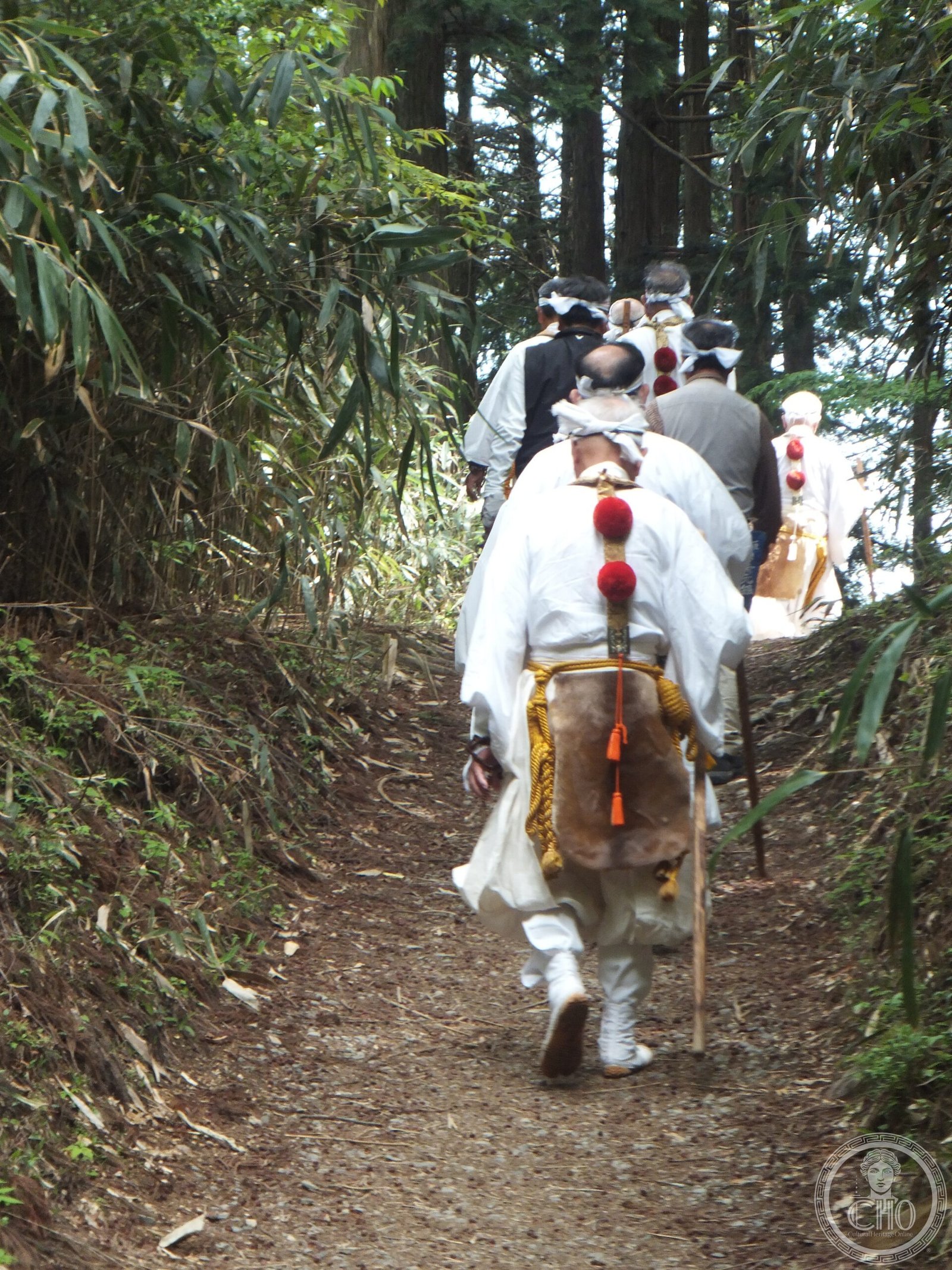
Ōmine Okugakemichi
A 170-kilometer pilgrimage route through Japan’s Kii Peninsula, threading the high peaks of Ōmine mountain from the Yoshino River valley to the sacred shrine at Kumano Hongū.
At a glance
The Ōmine Okugakemichi (大峯奥駈道)—literally “deep inner path of the grand peaks”—is one of Japan’s most demanding pilgrimage walks. Beginning at Yanagi-no-shuku, a former ferry station on the Yoshino River in Nara Prefecture, the route ascends into the mountains of Yoshino and Kumano in Wakayama Prefecture, traversing elevations between 1,200 and 1,900 meters before descending to the Kumano Hongū Taisha shrine.
History
The route developed as a sacred pathway connecting pilgrimage sites across the Kii Peninsula. Pilgrims have followed this mountain trail for centuries, seeking spiritual purification through the rigorous journey across the inner peaks.
What you see
The path winds through pristine mountain terrain, passing through forest and high alpine zones. Elevation changes define the experience—the route climbs repeatedly through the Ōmine range before its final descent toward Kumano Hongū Taisha, one of Japan’s oldest Shinto shrines.
Cultural significance
The Ōmine Okugakemichi represents a living tradition of Japanese mountain pilgrimage. The journey tests both body and spirit, embodying centuries of religious practice across Japan’s sacred geography. The route connects with the broader pilgrimage network of the Kii Peninsula, a UNESCO World Heritage site.
Key facts
- Country: Japan
- Prefectures: Nara and Wakayama
- Distance: approximately 170 kilometers
- Elevation range: 1,200–1,900 meters
- Starting point: Yanagi-no-shuku (former ferry station, Yoshino River)
- Destination: Kumano Hongū Taisha shrine
- Coordinates: 34.1797°N, 135.9094°E
Practical information & getting there
The pilgrimage requires serious preparation and mountain experience. Most pilgrims undertake sections of the route over multiple visits rather than completing it in one expedition. Access the starting point via public transport to Nara Prefecture; from there, organized guided walks and local tourism information can assist with logistics and accommodation in mountain villages along the way.
Sources & resources
Find it on the map
See this place and what’s around it →📷 Diventa un fotografo di Cultural Heritage Online
Condividi le tue foto dei luoghi: restano pubblicate con la tua firma come autore. Più vengono viste, più ti fai conoscere — e presto un concorso premierà le foto più apprezzate.
Accedi o registrati gratis per aggiungere una foto