
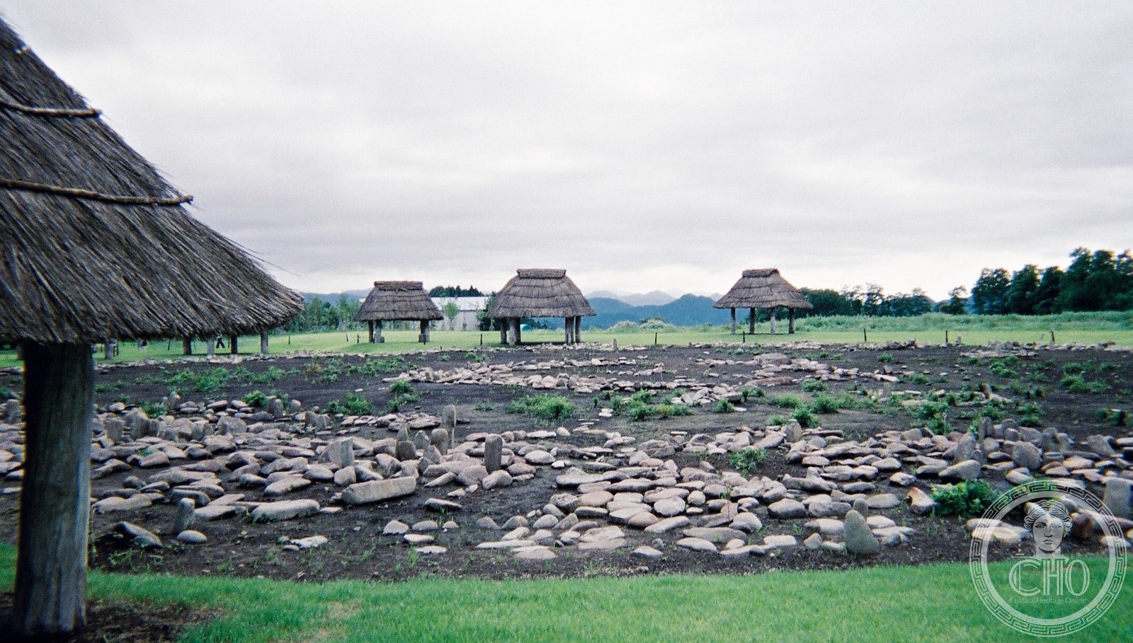
Two concentric rings of standing stones reveal the ceremonial practices of Japan’s hunter-gatherer societies in the late Jōmon period, nearly 4,000 years ago.
At a glance
The Ōyu Stone Circles represent one of Japan’s most significant Jōmon-period archaeological sites. Located in Akita Prefecture’s Tōhoku region, the monument consists of two distinct circular stone arrangements that suggest ritual or communal gathering purposes. The site was recognized as a Special National Historic Site of Japan in 1956, underscoring its importance to understanding early Japanese civilization.
History
The Ōyu Stone Circles date to the late Jōmon period, approximately 2,000 to 1,500 BC—a time when Japan was populated by sedentary hunter-gatherers. The precise function of the two stone rings remains subjects of scholarly debate, though their deliberate construction and circular geometry suggest ceremonial or communal significance. Archaeological investigation has revealed the site as a rare window into Jōmon social organization and spiritual life.
What you see
Two concentric stone circles dominate the landscape. The arrangement of standing stones, some set upright and others horizontal, creates distinct geometric patterns. The scale and precision of the construction indicate considerable community effort and planning. Visitors encounter the weathered stones in their landscape setting, where the original topography remains largely unchanged since the Jōmon era.
Cultural significance
The Ōyu Stone Circles rank among Japan’s earliest monumental structures, predating written history by millennia. They offer evidence of complex Jōmon societies capable of coordinating labor for non-utilitarian purposes. The site illuminates the spiritual and social dimensions of prehistoric Japan, challenging assumptions about hunter-gatherer communities and their capabilities.
Key facts
- Country: Japan
- City: Kazuno, Akita Prefecture
- Period: Late Jōmon (approx. 2,000–1,500 BC)
- Designation: Special National Historic Site of Japan (1956)
- Coordinates: 40.27°N, 140.80°E
Practical information & getting there
The site lies approximately ten minutes by car from Towada-Minami station on the JR East Hanawa Line. Access via the Towada Interchange on the Tōhoku Expressway is available. The site remains open to visitors year-round; specific visiting hours and seasonal conditions should be confirmed locally before travel.
Sources & resources
Find it on the map
See this place and what’s around it →📷 Become a Cultural Heritage Online photographer
Share your photos of places: they stay published under your name as the author. The more they're seen, the more you get noticed — and soon a contest will reward the most appreciated photos.
Log in or sign up free to add a photoIs this page about you?
This page is read by travellers and heritage enthusiasts who find it on Google. Tell us how you are connected to this place and we will take it from there.