
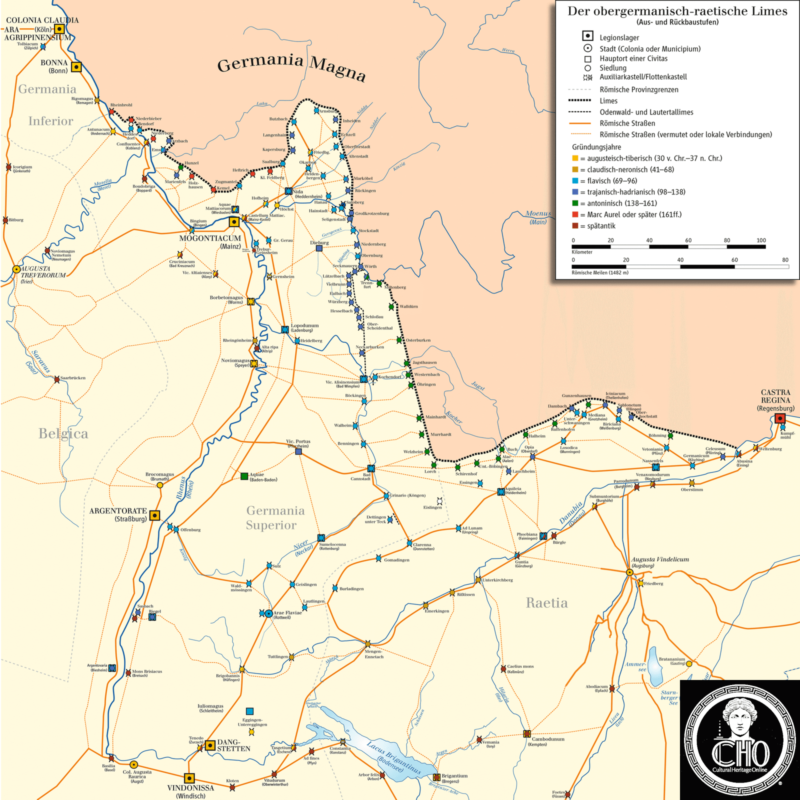
Upper Germanic-Rhaetian Limes
A 550-kilometre frontier fortification marking Rome’s northeastern border, stretching from the Rhine to the Danube across what is now Germany.
At a glance
The Upper Germanic-Rhaetian Limes represents one of the Roman Empire’s most ambitious defensive engineering projects. This archaeological monument extends from Rheinbrohl on the Rhine to Eining on the Danube, forming a crucial section of the larger Limes Germanicus system. Recognized as a UNESCO World Heritage Site since 2005, it preserves evidence of Roman frontier strategy and construction technique across nearly 550 kilometres.
History
The Limes Germanicus was the Roman Empire’s external frontier in Central Europe. The Upper Germanic-Rhaetian Limes ran between two of Europe’s mightiest rivers, the Rhine and Danube, protecting the empire’s northern territories. The entire system, including the Lower Germanic Limes to the north, represented Rome’s military organization during its period of maximum territorial extent.
What you see
The frontier employed both natural and engineered defences. Where possible, the Romans utilized rivers as barriers. Elsewhere they constructed earth banks topped with wooden palisades, punctuated by watchtowers at regular intervals. Behind this linear fortification lay a coordinated system of linked forts, creating depth and tactical flexibility for troop deployment and communication across the frontier.
Cultural significance
The Limes stands as tangible evidence of Roman military planning, engineering prowess, and frontier governance. Its remains illuminate how Rome managed vast distances and diverse terrain. The site documents a pivotal moment in European history when imperial boundaries shifted and reshaped the continent’s political geography.
Key facts
- Length: 550 kilometres
- Extends from Rheinbrohl (Rhine) to Eining (Danube)
- Country: Germany
- UNESCO World Heritage Site: designated 2005
- Coordinates: 49.796388888889°N, 9.1575°E
Practical information & getting there
The Limes is an archaeological site visible in sections across southern Germany. Modern roads and hiking trails often follow the ancient frontier route. Visit local museums in towns along the frontier for artefacts, reconstructions, and interpretive displays. Tourist information offices in the Rhine and Danube regions can guide you to accessible excavation sites and heritage trails.
Sources & resources
Find it on the map
See this place and what’s around it →📷 Diventa un fotografo di Cultural Heritage Online
Condividi le tue foto dei luoghi: restano pubblicate con la tua firma come autore. Più vengono viste, più ti fai conoscere — e presto un concorso premierà le foto più apprezzate.
Accedi o registrati gratis per aggiungere una fotoDo you manage this place?
This page is read by travellers and heritage enthusiasts who find it on Google. Keep it accurate — and make it work for you. Free for non-profit heritage institutions.