Parco Nazionale del Vatnajökull (sito naturale): dove il ghiaccio incontra i vulcani
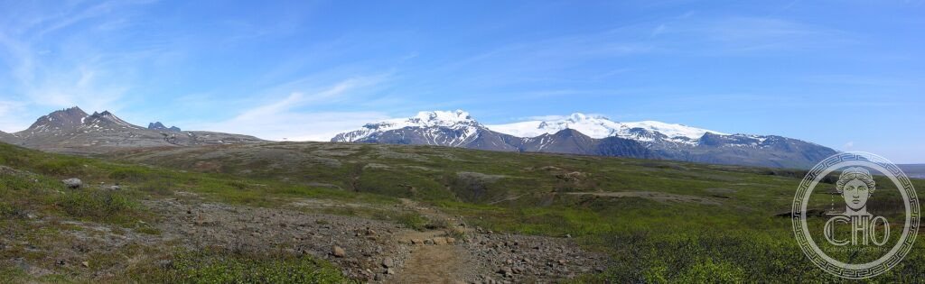
Copre un’area immensa dell’Islanda sud-orientale ed è dominato dalla più grande calotta glaciale d’Europa. Ma sotto i suoi ghiacci ribollono vulcani attivi: a Vatnajökull, ghiaccio e fuoco si scontrano di continuo, creando un paesaggio in perenne trasformazione di colate, eruzioni subglaciali e laghi di iceberg.
At a glance
Vatnajökull National Park, covering a vast area of south-eastern Iceland, is dominated by Vatnajökull, the largest ice cap in Europe. What makes it extraordinary is the meeting of ice and fire: beneath the glacier lie some of Iceland’s most active volcanoes, whose eruptions melt the ice and send vast floods bursting out, while the moving ice carves the land. With its glaciers, volcanoes, lava fields, iceberg lagoons and waterfalls, this dynamic landscape was inscribed by UNESCO in 2019.
Key facts
- UNESCO: World Heritage since 2019 (Vatnajökull National Park)
- Largest in Europe: Vatnajökull is the continent’s biggest ice cap
- Ice and fire: active volcanoes lie beneath the glacier
- Glacial floods: eruptions trigger sudden meltwater bursts (jökulhlaups)
- Jökulsárlón: a famous lagoon filled with icebergs
- Vast park: covers around 14% of Iceland
History
Iceland sits astride the Mid-Atlantic Ridge and a volcanic hotspot, and at Vatnajökull this fire is capped by ice: subglacial volcanoes such as Grímsvötn and Bárðarbunga erupt beneath the glacier, melting the ice and unleashing the catastrophic glacial floods Icelanders call jökulhlaups. The interplay of eruption, ice and flood has shaped the black sands and lava fields of the region for millennia.
Long a land of farms huddled between glacier and sea, the area was protected as a national park, greatly enlarged to encompass the whole ice cap and its surroundings, and inscribed by UNESCO in 2019 as an outstanding example of this rare dialogue between glacial and volcanic forces.
What you see
The park offers glacier tongues reaching down to the lowlands, the iceberg-filled lagoon of Jökulsárlón and its “diamond beach”, the green oasis and peaks of Skaftafell with the Svartifoss waterfall framed by basalt columns, and vast plains of black volcanic sand. Glacier walks and ice-cave tours lead onto and into the ice itself.
The contrast of blue ice, black sand and green oasis, all shaped by fire below, is the wonder of Vatnajökull.
Practical information
- Park: several areas (Skaftafell, Jökulsárlón) off the Ring Road
- Best time: summer for access; winter for ice caves
- Time needed: one to several days
- Note: go onto the glacier only with guides
Getting there
Vatnajökull National Park is in south-eastern Iceland, crossed by the Ring Road (Route 1) between Höfn and Kirkjubæjarklaustur, about 320 km from Reykjavík. GPS: 64.40° N, 16.80° W.
Nearby
- Jökulsárlón — the iceberg lagoon and diamond beach
- Skaftafell — the green oasis with Svartifoss waterfall
- Höfn — the harbour town at the park’s eastern edge
Sources
- UNESCO World Heritage Centre — “Vatnajökull National Park” (ref. 1604)
- Vatnajökull National Park (Iceland) — official body
- Encyclopaedia Britannica — Vatnajökull
Find it on the map
See this place and what’s around it →📷 Diventa un fotografo di Cultural Heritage Online
Condividi le tue foto dei luoghi: restano pubblicate con la tua firma come autore. Più vengono viste, più ti fai conoscere — e presto un concorso premierà le foto più apprezzate.
Accedi o registrati gratis per aggiungere una foto