
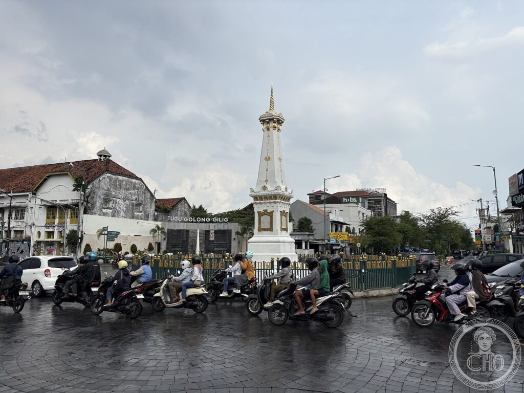
Asse cosmologico di Yogyakarta (XVIII sec.): la città costruita come un’idea del mondo
Quando nel Settecento fu fondata Yogyakarta, il sultano la dispose lungo una linea immaginaria che unisce la montagna sacra al mare: dal monumento Tugu al palazzo reale fino al padiglione di Krapyak, ogni elemento esprime la filosofia giavanese sul ciclo della vita umana e l’armonia fra uomo, natura e cosmo.
At a glance
The Cosmological Axis of Yogyakarta, on the island of Java, is the conceptual line along which the city was laid out when it was founded in 1755. Running north–south between the sacred volcano Merapi and the Indian Ocean, it links the Tugu monument, the royal palace (Kraton), and the Panggung Krapyak pavilion, with ceremonial roads and landmarks between them. Each element embodies Javanese philosophy about the cycle of human life and the harmony of people, nature and the cosmos. This living urban-philosophical landscape was inscribed by UNESCO in 2023.
Key facts
- UNESCO: World Heritage since 2023 (Cosmological Axis of Yogyakarta)
- Founded 1755: the city laid out by Sultan Hamengkubuwono I
- North–south axis: aligned between Mount Merapi and the ocean
- Key landmarks: Tugu monument, the Kraton palace, Panggung Krapyak
- Javanese philosophy: expresses the cycle of human life
- Living capital: still the seat of the Yogyakarta sultanate
History
In 1755 the founder of the Yogyakarta sultanate, Sultan Hamengkubuwono I, planned his new capital around a sacred axis linking the volcano Merapi to the north with the Indian Ocean to the south, the realms of the mountain spirit and the goddess of the southern sea. Along this line he placed the Panggung Krapyak pavilion, the royal palace (Kraton) at the centre, and, to the north, the Tugu monument, with ceremonial avenues, gates and squares between.
The arrangement encodes Javanese ideas about the journey of human life from birth to return, and the unity of the human and natural worlds, expressed in the buildings, their orientation and the rituals performed along the axis. Still living, with the sultan’s palace at its heart, the axis was inscribed by UNESCO in 2023.
What you see
Walking or riding the axis leads from the Panggung Krapyak in the south, up the ceremonial avenue past the royal palace with its courtyards and the great alun-alun squares, to the white Tugu monument at the northern end, a beloved city landmark. Along the way are gates, markets and the fort of Vredeburg.
The living city, ordered by an idea that joins mountain, palace and sea, is the meaning of Yogyakarta’s axis.
Practical information
- Axis: a series of landmarks through the heart of the city
- Time needed: half a day to a day
- Note: combine with the Kraton palace and the Water Castle
- Setting: in the city of Yogyakarta, central Java
Getting there
The axis runs through the centre of Yogyakarta, a major city of central Java, Indonesia, served by an international airport and rail. GPS: 7.783° S, 110.367° E.
Nearby
- Borobudur — the great UNESCO Buddhist temple nearby
- Prambanan — the UNESCO Hindu temple complex
- Kraton and Taman Sari — the palace and Water Castle on the axis
Sources
- UNESCO World Heritage Centre — “The Cosmological Axis of Yogyakarta and its Historic Landmarks” (ref. 1671)
- Yogyakarta Sultanate / Indonesian Ministry of Culture — official body
- Encyclopaedia Britannica — Yogyakarta
Find it on the map
See this place and what’s around it →📷 Diventa un fotografo di Cultural Heritage Online
Condividi le tue foto dei luoghi: restano pubblicate con la tua firma come autore. Più vengono viste, più ti fai conoscere — e presto un concorso premierà le foto più apprezzate.
Accedi o registrati gratis per aggiungere una foto