Schokland and Surroundings
An abandoned island bearing seven thousand years of human occupation — from Neolithic pile-dwellers to medieval fishermen — now stranded in the middle of a flat, drained sea floor, a monument to both stubborn habitation and the Dutch mastery of water.
At a glance
Schokland and Surroundings was inscribed as a UNESCO World Heritage Site in 1995 — the first Dutch site on the list, and one of the first in the world to be recognised primarily for its archaeological landscape rather than a single monument. The site is a former island in the Zuiderzee (the inland sea that occupied what is now the IJsselmeer and surrounding polders), located in the modern province of Flevoland. Schokland preserves over 7,000 years of continuous human occupation in a compressed, easily readable cross-section: Neolithic settlements, Bronze Age pile-dwellings, Iron Age farming, medieval fishing community, and 19th-century near-abandonment — all within a few square kilometres. The surroundings — the drained farmland of the Noordoostpolder (1942 CE) — represent the most dramatic application of Dutch hydraulic engineering in modern history.
Key facts
- UNESCO inscription: 1995 (Cultural, criteria iii, v)
- Location: Noordoostpolder municipality, Flevoland Province, Netherlands
- Period of occupation: c. 4200 BCE (Neolithic) to 1859 CE (evacuation by royal decree)
- Polder drained: 1942 CE (Noordoostpolder); former seabed turned farmland
- Evacuation: Royal decree, 1859 — one of the only forced evacuations of a settled community in Dutch history due to flood risk
- Museum: Schokland Museum on site; artefacts span 7,000 years including Bronze Age finds and medieval church fragments
- Status: Now a peninsula surrounded by agricultural land; no permanent residents
History
The first settlers arrived at Schokland during the Neolithic, around 4200 BCE, when the area was still marginal wetland rather than open sea. They built pile-dwellings (paalwoningen) on platforms above the waterlogged ground — a technology documented in archaeological finds now held in the Schokland Museum. Over the millennia, the settlers adapted to progressive flooding: as the Almere lake expanded and eventually broke through to the North Sea (forming the Zuiderzee by the 13th century CE), Schokland became an island, its inhabitants rebuilding on terpen (artificial mounds) to stay above the tide.
By the medieval period Schokland was a small fishing community of a few hundred souls, dependent on herring and eel from the Zuiderzee. The island had its own church, several terpen settlements, and a small harbour. But centuries of peat extraction had stripped the island’s natural protection, and by the 18th century violent storm surges regularly breached the earthen dykes. The population gradually fell as conditions worsened. In 1859, King William III of the Netherlands issued a royal decree ordering the remaining inhabitants — around 430 people — to leave. Schokland was abandoned, one of the only instances in Dutch history of an inhabited community being forcibly evacuated for flood risk. The buildings were demolished or left to collapse; only the church mound and some terpen earthworks survived.
In 1942, the Noordoostpolder drainage project transformed the landscape entirely: the Zuiderzee sea floor was pumped dry and turned into farmland, and Schokland — once an island — suddenly found itself stranded in the middle of flat agricultural land. Archaeological surveys of the newly exposed seabed revealed extraordinary finds, including Bronze Age boats, medieval ship timbers, and the remarkably preserved remains of the Neolithic settlements. UNESCO inscribed the site in 1995 as a place that uniquely illustrates long-term human adaptation to a threatened landscape.
What you see
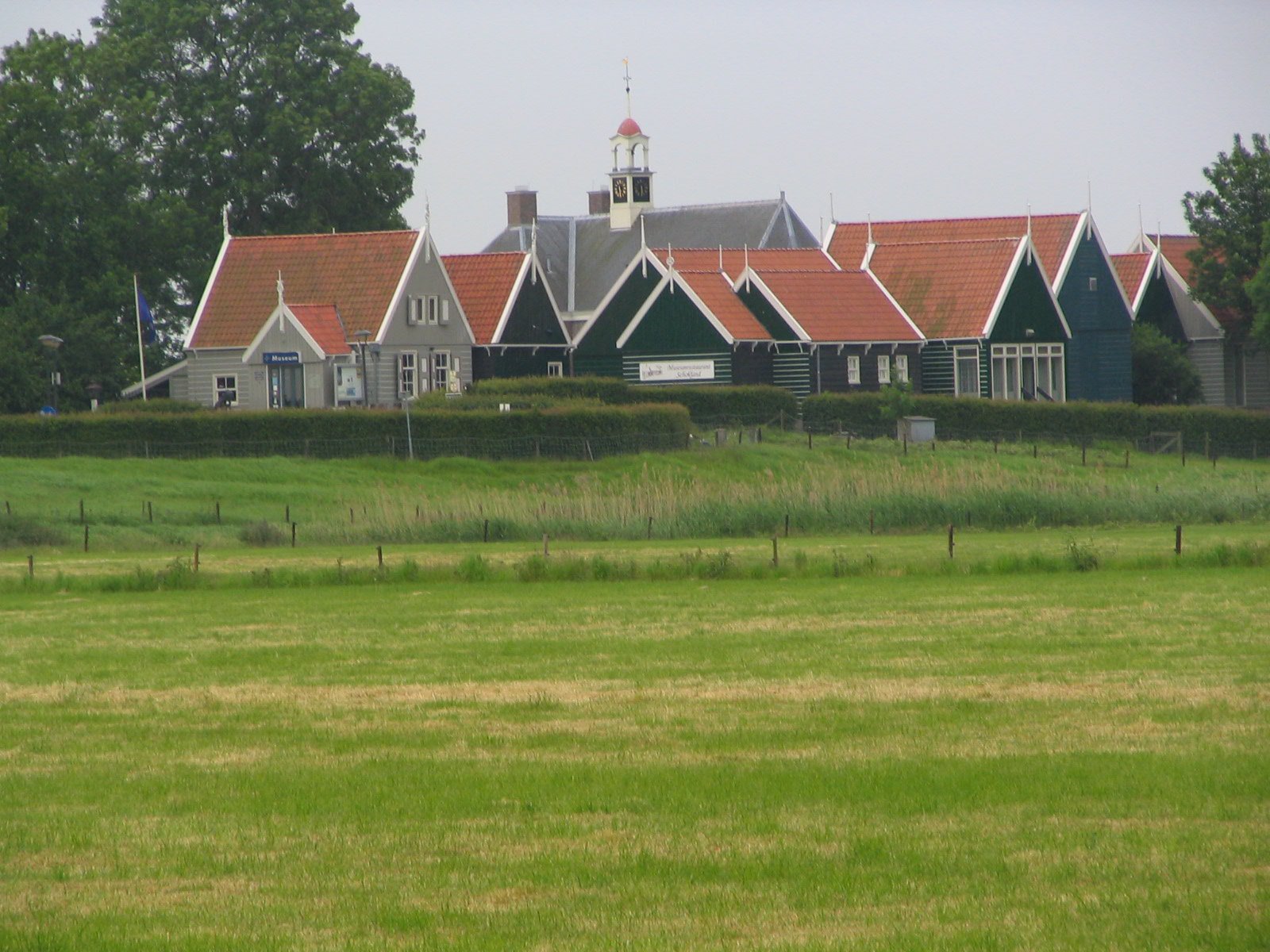
Schokland today is a low, elongated ridge of older clay rising above the flat polder — its topography immediately reveals its former island character. The Schokland Museum occupies the former church and schoolhouse on the Middelbuurt terp, displaying archaeological finds from the site and explaining the island’s history through maps, models and original artefacts. The terpen earthworks are still visible as low mounds around the museum. The former harbour mole at the southern end (Ens) survives. Walking the dyke path around the island perimeter gives a clear sense of the former shoreline. In the surrounding polder farmland — flat to the horizon, criss-crossed by drainage ditches — the transition from seabed to farmland is visible in the soil colours and the occasional emergence of medieval ship timbers from ploughed fields.
Practical information
- Museum: Schokland Museum — open Tuesday to Sunday, April to October; reduced hours November to March
- Admission: Adults approx. EUR 8; children free under 6
- Guided tours: Available on request; cycling routes from Emmeloord (10 km)
- Language: Exhibits in Dutch; English summaries available
- Access: Car or bicycle; no public transport directly to the site
Getting there
Schokland is located 10 km northeast of Emmeloord in the Noordoostpolder, accessible by car via the N50 motorway. The nearest train station is Kampen (25 km by road) or Zwolle (40 km). Cycling from Emmeloord through the flat polder farmland is popular and takes approximately 30-40 minutes. There is a car park at the museum.
Nearby
- Emmeloord: The main town of the Noordoostpolder, built in 1943 — itself a museum of post-war Dutch rationalist urban planning
- Ketelhaven: Scheepsarcheologie museum (shipwreck archaeology from the polder floor), 25 km southwest
- Urk: Another former island turned peninsula, 15 km southwest — medieval fishing village with similar history
Sources
- UNESCO World Heritage List — Schokland and Surroundings (1995)
- Schokland Museum — official site, schokland.nl
- Wikipedia EN — Schokland, Noordoostpolder, Zuiderzee
Find it on the map
See this place and what’s around it →📷 Diventa un fotografo di Cultural Heritage Online
Condividi le tue foto dei luoghi: restano pubblicate con la tua firma come autore. Più vengono viste, più ti fai conoscere — e presto un concorso premierà le foto più apprezzate.
Accedi o registrati gratis per aggiungere una foto