
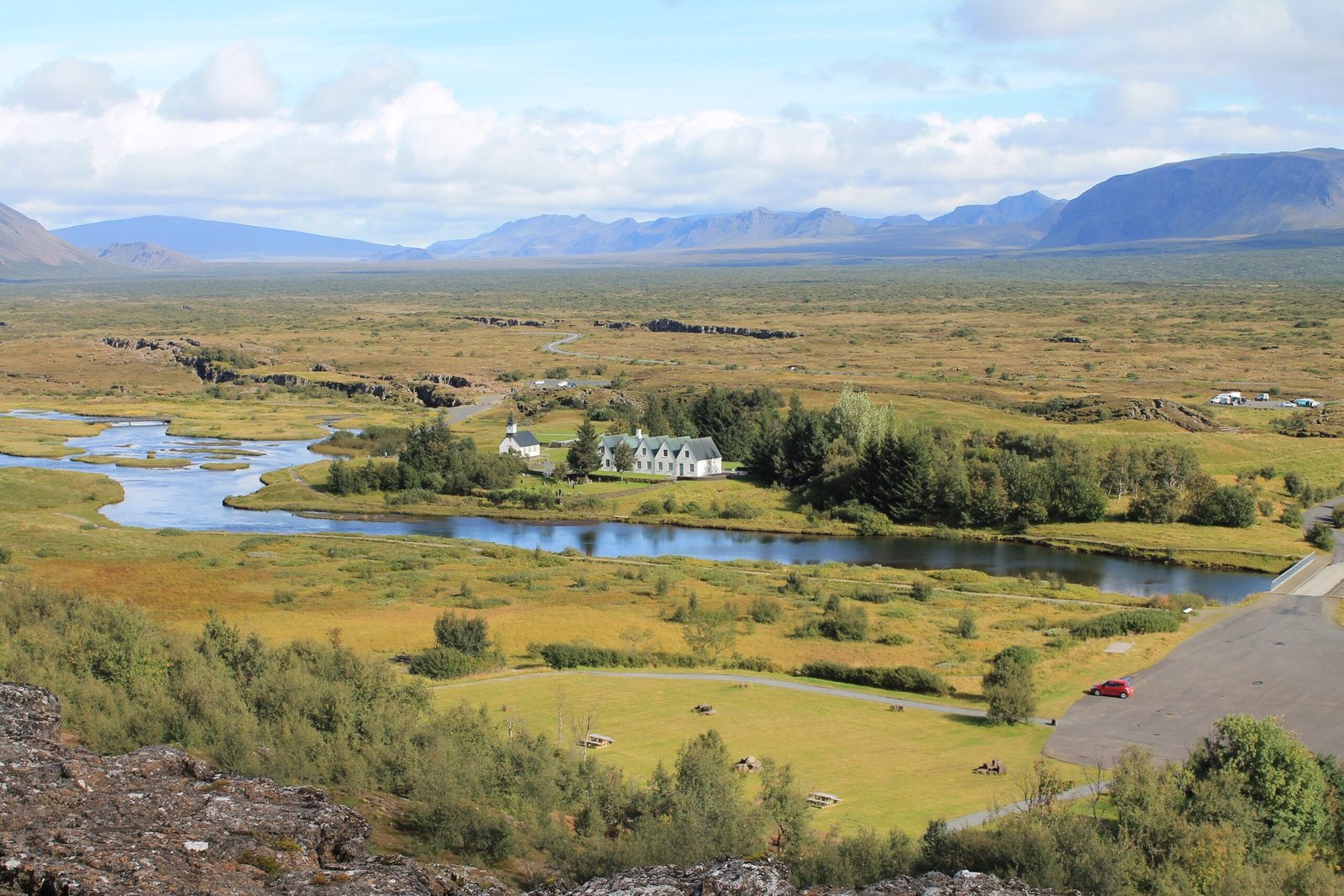
A UNESCO World Heritage rift valley 45km east of Reykjavik where the North American and Eurasian plates slowly drift apart — and where Iceland’s settlers founded the world’s oldest existing parliament in 930 AD.
At a glance
Þingvellir combines geological spectacle with a millennium of living political history. The Almannagjá gorge — a rift fissure up to 30 metres deep and 7km long — marks the visible boundary between two continental plates, while the plains beyond served as Iceland’s annual parliamentary gathering for nearly a thousand years. It is simultaneously one of Earth’s most legible geological features and the birthplace of Icelandic democracy. In 2004 it was inscribed on the UNESCO World Heritage List as a cultural landscape.
Key facts
- UNESCO designation: World Heritage Site since 2004
- Parliament founded: 930 AD — the Althing, world’s oldest existing parliamentary institution
- Geology: Sits directly on the Mid-Atlantic Ridge; the Eurasian and North American plates diverge at approximately 2cm per year
- Almannagjá gorge: approximately 7km long, up to 30m deep; the valley floor sinks at approximately 4mm per year
- Christianity vote: In 1000 AD, the Althing voted democratically to adopt Christianity — preventing civil war through collective religious decision-making
- Drekkingarhylur: “Drowning Pool” in the Oxará River — historical site of capital punishment by drowning
- Film location: Used as “The Vale of Arryn” in Game of Thrones across multiple seasons
History
When Norse settlers arrived in Iceland in the 9th century, they needed a system of governance without a king. Their solution — the Althing, convened for the first time in 930 AD at Þingvellir — became one of the most sophisticated political institutions of the early medieval world. Free male landowners from across Iceland gathered here for two weeks each summer in a natural amphitheatre formed by the Almannagjá cliffs. The Law Speaker stood at the Lögberg — the Law Rock — and recited the entire legal code from memory, audible across the assembled crowd thanks to the cliff’s natural acoustic properties.
The Althing was not a ceremonial body but a functioning legislature. In 999 or 1000 AD, the assembly faced a potential civil war between the growing Christian faction and the traditional pagan majority. The Law Speaker Þorgeirr Ljósvetningagodi, himself a pagan, retired under his cloak for a day and night of deliberation before delivering a binding ruling: Iceland would formally adopt Christianity but allow private pagan practice to continue. This democratic religious decision — made collectively by an assembly, not imposed by a monarch — was centuries ahead of standard medieval European practice.
The Althing continued to meet at Þingvellir until 1798. When Iceland achieved independence from Denmark in 1944, the republic was formally proclaimed here — completing a symbolic circle of nearly a thousand years of Icelandic democratic identity rooted in this rift valley.
What you see
The Almannagjá gorge is the visual centrepiece: a clean-edged rift fissure where the two continental plates have pulled apart, leaving a dramatic slot canyon through which the main access road to the valley passes. The basalt cliffs are formed by ancient lava flows now fractured by continuing plate divergence. The Oxará River, diverted by early Icelanders to run through the assembly site, flows clear and cold through the valley floor.
The site has no surviving Viking Age structures — the annual assembly was held in temporary turf booths erected each summer. The small white church and adjacent farmhouse date to the 18th–19th centuries. Multiple parallel rift fissures, some flooded to form clear-water lakes, make Þingvellir one of the world’s most visually readable demonstrations of plate tectonics. The Silfra fissure offers the only place on Earth where divers can swim between two continental plates in glacially filtered freshwater with visibility exceeding 100 metres.
Practical information
- Location: Þingvellir National Park, 45km east of Reykjavik via Route 36
- Opening hours: National park open year-round; visitor centre seasonal (typically May–October)
- Admission: Free to enter the park; parking fee applies (approximately ISK 750)
- Best season: June–August for accessible conditions; midnight sun May–July for exceptional photography
- Diving Silfra: Requires a guided tour; drysuit mandatory (water approximately 2°C year-round)
- Film tourism: Game of Thrones fans visit the Almannagjá gorge used as “The Vale of Arryn”
Getting there
Þingvellir lies 45km northeast of Reykjavik on Route 36, approximately 45 minutes by car. It forms the western anchor of the classic “Golden Circle” tour route, which continues to the Geysir geothermal area (65km further) and Gullfoss waterfall. Rental cars are the standard approach; no regular public bus connects Reykjavik to Þingvellir, though organised Golden Circle day tours depart from the capital daily.
Nearby
- Geysir Geothermal Area — 65km east, home of the original geyser; Strokkur erupts every 5–10 minutes
- Gullfoss — 80km east, Iceland’s most famous waterfall, a double-tiered cascade dropping 32 metres into a canyon
- Kerid Volcanic Crater — 55km south, a vivid red-walled crater lake formed approximately 6,500 years ago
- Reykjavik — 45km west, Iceland’s capital with Hallgrimskirkja, the National Museum, and the Harpa concert hall
Sources
Find it on the map
See this place and what’s around it →Historical events at this place (1)
📷 Become a Cultural Heritage Online photographer
Share your photos of places: they stay published under your name as the author. The more they're seen, the more you get noticed — and soon a contest will reward the most appreciated photos.
Log in or sign up free to add a photo