Tlacotalpan (XVI sec.): la cittadina coloniale dai portici colorati sul fiume
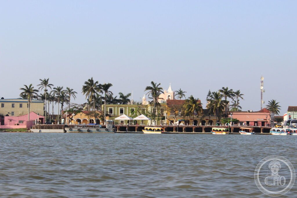
Sulle rive del fiume Papaloapan, Tlacotalpan è una cittadina dove le case basse sfilano dietro lunghi portici dipinti di rosa, azzurro, giallo, all’ombra delle palme. Porto coloniale spagnolo, conserva una rara armonia urbana caraibica, fatta di colore, ariosità e vita tranquilla sul fiume.
At a glance
Tlacotalpan, on the Papaloapan river near the Gulf coast of Mexico, is a Spanish colonial river port of exceptional charm and unity. Founded in the 16th century and flourishing as a trading town, it is laid out on a generous grid of wide streets, its low houses fronted by continuous colonnaded porticoes and painted in vivid colours. Blending Spanish and Caribbean traditions, with abundant greenery and a tranquil riverside life, its historic centre was inscribed by UNESCO in 1998.
Key facts
- UNESCO: World Heritage since 1998 (Historic Monuments Zone of Tlacotalpan)
- Founded: 16th century, a Spanish colonial river port
- Colourful arcades: low houses behind continuous painted porticoes
- Wide grid: spacious tree-lined streets and squares
- Spanish–Caribbean fusion: a distinctive tropical colonial townscape
- On the Papaloapan: a river port near the Gulf of Mexico
History
Tlacotalpan grew on a pre-Hispanic site that the Spanish refounded, prospering as a river port that shipped the produce of the fertile Papaloapan basin toward Veracruz and across the sea. Its wealth in the 18th and 19th centuries built the town of arcaded houses, laid out on a broad, regular plan with plenty of room and greenery, unusual for a colonial town.
Spared the upheavals and rebuilding that changed many Mexican towns, Tlacotalpan kept its airy, colourful fabric and its riverside way of life. Famous for its music and its February fiesta, it remains a vivid, harmonious example of a Caribbean-influenced Spanish colonial town.
What you see
Block after block of single-storey houses run behind continuous colonnaded porches, each painted a different bright colour, shaded by palms and tropical trees, opening onto wide squares and the parish churches. The riverfront looks out over the broad Papaloapan, with boats and the green far bank.
The overall impression is of colour, light and spaciousness, a colonial town built for the tropics.
Practical information
- Old town: freely walkable; the arcaded streets are the attraction
- Time needed: half a day
- Note: the Candelaria fiesta in February is famous
- Setting: on the Papaloapan in Veracruz state
Getting there
Tlacotalpan is in the state of Veracruz, eastern Mexico, about 90 km south-east of the port of Veracruz, near the Gulf coast. It is reached by road. GPS: 18.611° N, 95.661° W.
Nearby
- Veracruz — the historic Gulf port to the north-west
- Papaloapan river — the river and its wetlands
- Santiago Tuxtla — an Olmec-heritage town inland
Sources
- UNESCO World Heritage Centre — “Historic Monuments Zone of Tlacotalpan” (ref. 862)
- Instituto Nacional de Antropología e Historia (INAH) — official body
- Encyclopaedia Britannica — Veracruz (state)
Find it on the map
See this place and what’s around it →📷 Diventa un fotografo di Cultural Heritage Online
Condividi le tue foto dei luoghi: restano pubblicate con la tua firma come autore. Più vengono viste, più ti fai conoscere — e presto un concorso premierà le foto più apprezzate.
Accedi o registrati gratis per aggiungere una foto